[ 3] Name on the Register[ 4]
Image
Date listed[ 5]
Location
City or town
Description
1
Arlington Green Covered Bridge Arlington Green Covered Bridge August 28, 1973 (#73000184 ) Off VT 313 west of Arlington 43°06′16″N 73°13′14″W / 43.104444°N 73.220556°W / 43.104444; -73.220556 (Arlington Green Covered Bridge ) Arlington
2
Arlington Village Historic District Arlington Village Historic District November 2, 1989 (#89001936 ) Roughly Main St., School St., E. Arlington Rd., and Battenkill Dr. 43°04′22″N 73°09′23″W / 43.072778°N 73.156389°W / 43.072778; -73.156389 (Arlington Village Historic District ) Arlington
3
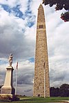
Bennington Battle Monument Bennington Battle Monument March 31, 1971 (#71000054 ) Monument Circle 42°53′20″N 73°13′00″W / 42.888889°N 73.216667°W / 42.888889; -73.216667 (Bennington Battle Monument ) Bennington
4
Bennington College Historic District Bennington College Historic District December 28, 2022 (#100008509 ) 1 College Dr. 42°55′12″N 73°14′07″W / 42.9201°N 73.2353°W / 42.9201; -73.2353 (Bennington College Historic District ) Bennington
5
Bennington Falls Covered Bridge Bennington Falls Covered Bridge August 28, 1973 (#73000185 ) Northwest of Bennington off VT 67A 42°54′46″N 73°14′03″W / 42.912778°N 73.234167°W / 42.912778; -73.234167 (Bennington Falls Covered Bridge ) Bennington Also known as the Paper Mill Bridge
6
Bennington Fish Hatchery Bennington Fish Hatchery April 21, 1994 (#94000376 ) South Stream Rd. 42°51′09″N 73°10′20″W / 42.852582°N 73.172306°W / 42.852582; -73.172306 (Bennington Fish Hatchery ) Bennington
7
Bennington High School Bennington High School August 26, 2005 (#05000948 ) 650 Main St. 42°52′43″N 73°11′24″W / 42.8785°N 73.1899°W / 42.8785; -73.1899 (Bennington High School ) Bennington Bennington's 1913 high school building
8
Bennington Post Office Bennington Post Office December 12, 1976 (#76000137 ) 118 South St. 42°52′39″N 73°11′49″W / 42.877564°N 73.1969°W / 42.877564; -73.1969 (Bennington Post Office ) Bennington Former post office, now houses the police department
9
Bennington Railroad Station Bennington Railroad Station November 9, 1988 (#88001301 ) Depot and River Sts. 42°52′54″N 73°11′58″W / 42.881667°N 73.199444°W / 42.881667; -73.199444 (Bennington Railroad Station ) Bennington
10
W. H. Bradford Hook and Ladder Fire House W. H. Bradford Hook and Ladder Fire House October 28, 1999 (#99001295 ) 212 Safford St. 42°52′52″N 73°11′19″W / 42.881111°N 73.188611°W / 42.881111; -73.188611 (W. H. Bradford Hook and Ladder Fire House ) Bennington
11
William C. Bull House Upload image March 28, 2022 (#100007531 ) 219 Pleasant St. 42°52′45″N 73°11′33″W / 42.8791°N 73.1925°W / 42.8791; -73.1925 (William C. Bull House ) Bennington
12
E. J. Bullock Block Upload image September 21, 2021 (#100007005 ) 7012 Main St. 42°46′20″N 72°56′54″W / 42.7722°N 72.9484°W / 42.7722; -72.9484 (E. J. Bullock Block ) Readsboro
13
Carrigan Lane Historic District Carrigan Lane Historic District September 3, 1998 (#98001152 ) Roughly along Carrigan Ln., from Division St. to Safford St. 42°52′59″N 73°11′19″W / 42.883056°N 73.188611°W / 42.883056; -73.188611 (Carrigan Lane Historic District ) Bennington
14
Center Shaftsbury Historic District Center Shaftsbury Historic District November 9, 1988 (#88002052 ) VT 7A 42°59′05″N 73°12′42″W / 42.984722°N 73.211667°W / 42.984722; -73.211667 (Center Shaftsbury Historic District ) Shaftsbury
15
Dorset Village Historic District Dorset Village Historic District April 18, 1985 (#85000868 ) Roughly bounded by Main and Church Sts. and Dorset Hollow Rd.; also the junction of Church St. and West Rd. 43°15′26″N 73°06′15″W / 43.257222°N 73.104167°W / 43.257222; -73.104167 (Dorset Village Historic District ) Dorset Second set of boundaries represents a boundary increase
16
Downtown Bennington Historic District Downtown Bennington Historic District April 1, 1980 (#80000327 ) U.S. Route 7 and VT 9; also North, Main, and Silver Sts.42°52′43″N 73°11′51″W / 42.878611°N 73.1975°W / 42.878611; -73.1975 (Downtown Bennington Historic District ) Bennington Second set of boundaries represents a boundary increase
17
East Arlington Village Historic District East Arlington Village Historic District July 5, 1996 (#96000689 ) Roughly bounded by Old Mill, Ice Pond, E. Arlington, and Warm Brook Rds., Maple and Pleasnt Sts., and the Lane 43°03′42″N 73°08′40″W / 43.061667°N 73.144444°W / 43.061667; -73.144444 (East Arlington Village Historic District ) Arlington
18
Equinox House Historic District Equinox House Historic District November 21, 1972 (#72000107 ) Main and Union Sts. 43°09′43″N 73°04′25″W / 43.161944°N 73.073611°W / 43.161944; -73.073611 (Equinox House Historic District ) Manchester Boundary increased June 3, 1980
19
First Congregational Church of Bennington First Congregational Church of Bennington April 24, 1973 (#73000186 ) Monument Ave. 42°53′00″N 73°12′48″W / 42.883333°N 73.213333°W / 42.883333; -73.213333 (First Congregational Church of Bennington ) Bennington
20
Robert Frost Farm Robert Frost Farm May 23, 1968 (#68000047 ) 0.25 mi (0.40 km) west of U.S. Route 7 on Buck Hill Rd. 42°56′28″N 73°11′42″W / 42.941111°N 73.195°W / 42.941111; -73.195 (Robert Frost Farm ) South Shaftsbury Residence of poet Robert Frost between 1929 and 1938. Designated a National Historic Landmark in 1968, the Park Service withdrew the landmark designation in 1986.[ 6]
21
Furnace Grove Historic District Furnace Grove Historic District June 27, 1997 (#97000646 ) VT 9, 1 mi (1.6 km) east of the junction of VT 9 and Burgess Rd. 42°53′06″N 73°09′24″W / 42.885°N 73.156667°W / 42.885; -73.156667 (Furnace Grove Historic District ) Bennington
22
Gov. Jonas Galusha Homestead Gov. Jonas Galusha Homestead November 30, 1979 (#79000217 ) 3817 Vermont Route 7A 42°59′17″N 73°12′24″W / 42.988117°N 73.206772°W / 42.988117; -73.206772 (Gov. Jonas Galusha Homestead ) Center Shaftsbury
23
Zera Hard House Zera Hard House November 9, 1988 (#88002230 ) River Rd. 43°07′49″N 73°04′56″W / 43.130278°N 73.082222°W / 43.130278; -73.082222 (Zera Hard House ) Manchester
24
Henry Covered Bridge Henry Covered Bridge August 28, 1973 (#73000187 ) Northwest of Bennington off VT 67A 42°54′45″N 73°15′18″W / 42.9125°N 73.255°W / 42.9125; -73.255 (Henry Covered Bridge ) Bennington
25
William Henry House William Henry House November 9, 1988 (#88001302 ) River Rd. 42°54′30″N 73°15′20″W / 42.9083°N 73.2556°W / 42.9083; -73.2556 (William Henry House ) Bennington
26
Hildene Hildene October 28, 1977 (#77000095 ) 820 Hildene Rd. 43°08′13″N 73°04′25″W / 43.1369°N 73.0736°W / 43.1369; -73.0736 (Hildene ) Manchester
27
Holden-Leonard Mill Complex Holden-Leonard Mill Complex November 14, 1988 (#88002085 ) 160 Benmont Ave. 42°53′06″N 73°12′13″W / 42.885°N 73.2036°W / 42.885; -73.2036 (Holden-Leonard Mill Complex ) Bennington
28
Holden-Leonard Workers Housing Historic District Holden-Leonard Workers Housing Historic District May 19, 2011 (#11000296 ) 121-139, 124-150 Benmont Ave. & 105-115, 117-123 Holden St. 42°53′00″N 73°12′07″W / 42.8833°N 73.2019°W / 42.8833; -73.2019 (Holden-Leonard Workers Housing Historic District ) Bennington
29
Jenks Tavern Jenks Tavern March 17, 1994 (#94000191 ) Junction of Dorset West Rd. and VT 315 43°16′20″N 73°07′35″W / 43.2722°N 73.1264°W / 43.2722; -73.1264 (Jenks Tavern ) Rupert
30
Kent Neighborhood Historic District Kent Neighborhood Historic District July 14, 1978 (#78003203 ) South of Dorset at Dorset West and Nichols Hill Rds. 43°14′22″N 73°05′54″W / 43.2394°N 73.0983°W / 43.2394; -73.0983 (Kent Neighborhood Historic District ) Dorset
31
Amos Lawrence House Amos Lawrence House May 21, 1985 (#85001245 ) Richville Rd. 43°09′55″N 73°03′11″W / 43.1653°N 73.0531°W / 43.1653; -73.0531 (Amos Lawrence House ) Manchester
32
Manchester Village Historic District Manchester Village Historic District January 26, 1984 (#84003438 ) U.S. Route 7A , Union St., and Taconic Ave.43°09′38″N 73°04′22″W / 43.1606°N 73.0728°W / 43.1606; -73.0728 (Manchester Village Historic District ) Manchester
33
Manley-Lefevre House Manley-Lefevre House January 26, 1990 (#89002324 ) Dorset West Rd., Town Highway 1 43°13′36″N 73°05′13″W / 43.2267°N 73.0869°W / 43.2267; -73.0869 (Manley-Lefevre House ) Dorset
34
David Mathews House David Mathews House September 10, 1979 (#79000274 ) VT 67 42°56′27″N 73°16′28″W / 42.9408°N 73.2744°W / 42.9408; -73.2744 (David Mathews House ) Shaftsbury Extends into Rensselaer County, New York ; also known as the State Line House.
35
Munro-Hawkins House Munro-Hawkins House May 17, 1973 (#73000188 ) 0.5 mi (0.80 km) south of Shaftsbury Center on Vermont Route 7A 42°57′24″N 73°12′31″W / 42.9567°N 73.2086°W / 42.9567; -73.2086 (Munro-Hawkins House ) Shaftsbury Center
36
North Bennington Depot North Bennington Depot April 11, 1973 (#73000189 ) Buckley Rd. and Depot St. at the Vermont Railway tracks 42°55′56″N 73°14′32″W / 42.9323°N 73.2422°W / 42.9323; -73.2422 (North Bennington Depot ) North Bennington
37
North Bennington Historic District North Bennington Historic District August 29, 1980 (#80000328 ) VT 67 and VT 67A 42°55′48″N 73°14′35″W / 42.93°N 73.2431°W / 42.93; -73.2431 (North Bennington Historic District ) North Bennington
38
Julius and Sophia Norton House Upload image February 23, 2021 (#100006180 ) 300 Pleasant St. 42°52′44″N 73°11′34″W / 42.879°N 73.1929°W / 42.879; -73.1929 (Julius and Sophia Norton House ) Bennington
39
Old Bennington Historic District Old Bennington Historic District October 4, 1984 (#84000030 ) Roughly bounded by the former Rutland Railway line, Monument Ave. and Circle, West Rd., Seminary Lane, and Elm and Fairview Sts. 42°53′01″N 73°12′45″W / 42.8836°N 73.2125°W / 42.8836; -73.2125 (Old Bennington Historic District ) Bennington
40
The Orchards The Orchards April 24, 2000 (#00000384 ) 982 Mansion Dr. 42°52′08″N 73°13′13″W / 42.8689°N 73.2203°W / 42.8689; -73.2203 (The Orchards ) Bennington Now the campus of Southern Vermont College
41
Park-McCullough House Park-McCullough House October 26, 1972 (#72000090 ) Southwestern corner of West and Park Sts. 42°55′42″N 73°14′49″W / 42.9283°N 73.2469°W / 42.9283; -73.2469 (Park-McCullough House ) North Bennington
42
Pratt-McDaniels-LaFlamme House Pratt-McDaniels-LaFlamme House July 11, 2002 (#02000777 ) 501-507 South St. 42°52′21″N 73°11′50″W / 42.8725°N 73.1972°W / 42.8725; -73.1972 (Pratt-McDaniels-LaFlamme House ) Bennington
43
Ritchie Block Ritchie Block November 6, 1986 (#86003060 ) 465-473 Main St. 42°52′39″N 73°11′44″W / 42.8775°N 73.1956°W / 42.8775; -73.1956 (Ritchie Block ) Bennington
44
Rupert Village Historic District Rupert Village Historic District January 4, 2022 (#100007308 ) VT 153 , Rupert Mountain, West Pawlet, and Youlin Rds.43°15′36″N 73°13′22″W / 43.2599°N 73.2228°W / 43.2599; -73.2228 (Rupert Village Historic District ) Rupert
45
School Street Duplexes School Street Duplexes March 13, 2007 (#07000162 ) 343-345 and 347-349 School St. 42°53′09″N 73°11′40″W / 42.885833°N 73.194444°W / 42.885833; -73.194444 (School Street Duplexes ) Bennington
46
Silk Covered Bridge Silk Covered Bridge August 28, 1973 (#73000190 ) Northwest of Bennington off VT 67A 42°54′34″N 73°13′33″W / 42.909444°N 73.225833°W / 42.909444; -73.225833 (Silk Covered Bridge ) Bennington
47
Frederick Squire House Frederick Squire House July 30, 1992 (#92000964 ) 185 North St. 42°52′53″N 73°11′48″W / 42.881472°N 73.196735°W / 42.881472; -73.196735 (Frederick Squire House ) Bennington
48
Tudor House Tudor House September 10, 1979 (#79000218 ) VT 8 42°45′05″N 73°04′11″W / 42.751389°N 73.069722°W / 42.751389; -73.069722 (Tudor House ) Stamford
49
Wait Block Wait Block November 7, 1996 (#96001327 ) Near the junction of Main and Bonnet Sts. in Manchester Center 43°10′36″N 73°03′24″W / 43.176667°N 73.056667°W / 43.176667; -73.056667 (Wait Block ) Manchester
50
H.C. White Company Mill Complex H.C. White Company Mill Complex January 11, 2017 (#100000515 ) 940 Water St. 42°54′56″N 73°14′48″W / 42.915538°N 73.246614°W / 42.915538; -73.246614 (H.C. White Company Mill Complex ) North Bennington
51
Cora B. Whitney School Cora B. Whitney School November 19, 2001 (#01001237 ) 814 Gage St. 42°52′53″N 73°10′59″W / 42.881389°N 73.183056°W / 42.881389; -73.183056 (Cora B. Whitney School ) Bennington
52
Wilson House Wilson House December 13, 1995 (#95001427 ) Junction of Village St. and Mad Tom Rd. 43°14′22″N 73°00′33″W / 43.239444°N 73.009167°W / 43.239444; -73.009167 (Wilson House ) East Dorset
53
Yester House Yester House November 10, 1988 (#88002051 ) West Rd. 43°10′39″N 73°04′39″W / 43.1775°N 73.0775°W / 43.1775; -73.0775 (Yester House ) Manchester Now the Southern Vermont Arts Center


