Perry County Municipal Airport
Perry County Municipal Airport | |||||||||||
|---|---|---|---|---|---|---|---|---|---|---|---|
| Summary | |||||||||||
| Airport type | Public | ||||||||||
| Owner | Perry County Airport Authority | ||||||||||
| Serves | Tell City, Indiana | ||||||||||
| Elevation AMSL | 659 ft / 201 m | ||||||||||
| Coordinates | 38°01′04″N 086°41′27″W / 38.01778°N 86.69083°W | ||||||||||
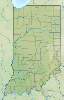
| Map | |||||||||||
| Runways | |||||||||||
| |||||||||||
| Statistics (2006) | |||||||||||
| |||||||||||
Perry County Municipal Airport (ICAO: KTEL, FAA LID: TEL) is seven miles northeast of Tell City, in Perry County, Indiana. It is owned by the Perry County Airport Authority.[1]
Most U.S. airports use the same three-letter location identifier for the FAA and IATA, but this airport is TEL to the FAA and has no IATA code.[2]
Facilities
[edit]The airport covers 76 acres (31 ha) at an elevation of 659 feet (201 m). It is untowered, and has one runway, 13/31, that is 4,400 x 75 ft (1,341 x 23 m) asphalt. In the 12 month period ending in December 2019, 14 aircraft were based out of the field, all being single engine light aircraft. Aircraft operations averaged 62 per week, with 65% local general aviation, 27% transient general aviation, 7% military and <1% air taxi, totaling 3,232 operations.[3]
See also
[edit]References
[edit]- ^ a b FAA Airport Form 5010 for TEL PDF, effective 2008-04-10
- ^ Great Circle Mapper: KTEL - Tell City, Indiana (Perry County Municipal Airport)
- ^ "AirNav: KTEL - Perry County Municipal Airport". www.airnav.com. Retrieved 2023-02-27.
External links
[edit]- Resources for this airport:
- FAA airport information for TEL
- AirNav airport information for TEL
- FlightAware airport information and live flight tracker
- SkyVector aeronautical chart for TEL


