[ 3] Name on the Register[ 4]
Image
Date listed[ 5]
Location
City or town
Description
1
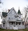
G. W. S. Allen House G. W. S. Allen House April 11, 1985 (#85000721 ) 207 E. Henry St. 40°58′08″N 91°33′00″W / 40.968889°N 91.55°W / 40.968889; -91.55 (G. W. S. Allen House ) Mount Pleasant
2
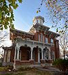
Henry Ambler House Henry Ambler House April 10, 1986 (#86000717 ) 405 Broadway 40°58′13″N 91°33′17″W / 40.970278°N 91.554722°W / 40.970278; -91.554722 (Henry Ambler House ) Mount Pleasant
3
Dr. J.O. and Catherine Ball House Dr. J.O. and Catherine Ball House May 18, 1994 (#94000404 ) 500 W. Monroe St. 40°58′01″N 91°33′31″W / 40.966944°N 91.558611°W / 40.966944; -91.558611 (Dr. J.O. and Catherine Ball House ) Mount Pleasant
4
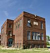
John and Lavina Bangs House John and Lavina Bangs House August 28, 2003 (#03000831 ) 2759 Old Highway 24 40°54′52″N 91°22′46″W / 40.914444°N 91.379444°W / 40.914444; -91.379444 (John and Lavina Bangs House ) New London
5
Benjamin Chapel and Richwoods Cemetery Benjamin Chapel and Richwoods Cemetery October 23, 2015 (#15000746 ) 1936 Franklin Ave. 41°02′07″N 91°37′13″W / 41.0354°N 91.6204°W / 41.0354; -91.6204 (Benjamin Chapel and Richwoods Cemetery ) Trenton
6
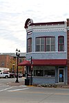
Bicksler Block Bicksler Block May 28, 2010 (#10000291 ) 101-103 West Cherry St. 40°51′17″N 91°37′17″W / 40.854722°N 91.621389°W / 40.854722; -91.621389 (Bicksler Block ) Salem
7
Hugh and Matilda Boyle House and Cemetery Historic District Upload image October 23, 2015 (#15000747 ) 3225 Lexington Ave. 40°50′59″N 91°30′06″W / 40.849662°N 91.501767°W / 40.849662; -91.501767 (Hugh and Matilda Boyle House and Cemetery Historic District ) Lowell
8
Brazelton House Brazelton House January 27, 1983 (#83000366 ) 401 N. Main St. 40°58′12″N 91°33′10″W / 40.97°N 91.552778°W / 40.97; -91.552778 (Brazelton House ) Mount Pleasant
9
Brazelton House Hotel Brazelton House Hotel September 22, 1986 (#86002700 ) 100 N. Main St. 40°57′56″N 91°33′06″W / 40.965556°N 91.551667°W / 40.965556; -91.551667 (Brazelton House Hotel ) Mount Pleasant
10
Budde-Singer Building Budde-Singer Building September 6, 1991 (#91001112 ) 110 N. Main 40°58′01″N 91°33′09″W / 40.966944°N 91.5525°W / 40.966944; -91.5525 (Budde-Singer Building ) Mount Pleasant
11
Camp Harlan-Camp McKean Historic District Camp Harlan-Camp McKean Historic District January 2, 2013 (#12001117 ) 2260 Hickory Ave. 40°58′35″N 91°34′57″W / 40.97634°N 91.58257°W / 40.97634; -91.58257 (Camp Harlan-Camp McKean Historic District ) Mount Pleasant
12
City Hall City Hall September 6, 1991 (#91001120 ) 220 W. Monroe 40°58′00″N 91°33′20″W / 40.966667°N 91.555556°W / 40.966667; -91.555556 (City Hall ) Mount Pleasant
13
Collins-Bond House Collins-Bond House October 28, 2010 (#10000869 ) 402 S. Main St. 40°51′06″N 91°37′17″W / 40.851667°N 91.621389°W / 40.851667; -91.621389 (Collins-Bond House ) Salem
14
Cook-Johnson House Cook-Johnson House May 28, 2010 (#10000292 ) 3091 Franklin Ave. 40°51′28″N 91°37′19″W / 40.857656°N 91.621856°W / 40.857656; -91.621856 (Cook-Johnson House ) Salem
15
George and Margaret Cooper House George and Margaret Cooper House May 2, 1997 (#97000393 ) 400 W. Monroe St. 40°57′46″N 91°33′05″W / 40.962778°N 91.551389°W / 40.962778; -91.551389 (George and Margaret Cooper House ) Mount Pleasant
16
Joseph A. and Lydia A. Edwards House Joseph A. and Lydia A. Edwards House October 23, 2015 (#15000748 ) 1735 Salem Rd. 40°50′48″N 91°34′40″W / 40.8467°N 91.5777°W / 40.8467; -91.5777 (Joseph A. and Lydia A. Edwards House ) Salem
17
Farmers Savings Bank Farmers Savings Bank May 28, 2010 (#10000293 ) 101 S Main St. 40°51′17″N 91°37′17″W / 40.8547°N 91.621425°W / 40.8547; -91.621425 (Farmers Savings Bank ) Salem
18
First National Bank First National Bank September 6, 1991 (#91001118 ) 101 S. Jefferson 40°57′59″N 91°33′17″W / 40.966389°N 91.554722°W / 40.966389; -91.554722 (First National Bank ) Mount Pleasant
19
Fish Creek Bridge Upload image May 15, 1998 (#98000524 ) Hickory Rd. over Fish Creek 40°51′14″N 91°34′51″W / 40.853889°N 91.580833°W / 40.853889; -91.580833 (Fish Creek Bridge ) Salem
20
Owen A. and Emma J. Garretson House Owen A. and Emma J. Garretson House October 23, 2015 (#15000750 ) 1878 335th St. 40°49′15″N 91°33′04″W / 40.8209°N 91.5510°W / 40.8209; -91.5510 (Owen A. and Emma J. Garretson House ) Salem
21
Geode State Park, Civilian Conservation Corps Area Geode State Park, Civilian Conservation Corps Area November 15, 1990 (#90001673 ) County Road X23 east of Lowell 40°49′59″N 91°23′11″W / 40.833056°N 91.386389°W / 40.833056; -91.386389 (Geode State Park, Civilian Conservation Corps Area ) Danville
22
Harlan House Hotel Harlan House Hotel November 16, 1987 (#87002019 ) 122 N. Jefferson St. 40°58′00″N 91°33′15″W / 40.966667°N 91.554167°W / 40.966667; -91.554167 (Harlan House Hotel ) Mount Pleasant
23
Harlan-Lincoln House Harlan-Lincoln House May 25, 1973 (#73000726 ) 101 W. Broad St. 40°58′18″N 91°32′57″W / 40.971667°N 91.549167°W / 40.971667; -91.549167 (Harlan-Lincoln House ) Mount Pleasant
24
Henry County Courthouse Henry County Courthouse July 2, 1981 (#81000244 ) 100 E. Washington St. 40°57′56″N 91°33′12″W / 40.96547°N 91.55343°W / 40.96547; -91.55343 (Henry County Courthouse ) Mount Pleasant
25
Henry County Savings Bank Henry County Savings Bank September 6, 1991 (#91001116 ) 100 S. Main 40°57′59″N 91°33′10″W / 40.966389°N 91.552778°W / 40.966389; -91.552778 (Henry County Savings Bank ) Mount Pleasant
26
Holtkamp Round Barn Holtkamp Round Barn June 30, 1986 (#86001436 ) Off U.S. Route 218 40°49′17″N 91°34′09″W / 40.821389°N 91.569167°W / 40.821389; -91.569167 (Holtkamp Round Barn ) Salem
27
Samuel and Sarah Hulme House Upload image July 3, 2019 (#100004114 ) 1577 Franklin Ave. 41°04′45″N 91°38′24″W / 41.0793°N 91.6400°W / 41.0793; -91.6400 (Samuel and Sarah Hulme House ) Trenton vicinity
28
Charles E. Hult House Summer Kitchen and Wood Shed Charles E. Hult House Summer Kitchen and Wood Shed July 15, 1999 (#99000830 ) 1904 140th St. 41°06′17″N 91°32′39″W / 41.104722°N 91.544167°W / 41.104722; -91.544167 (Charles E. Hult House Summer Kitchen and Wood Shed ) Swedesburg
29
John Hultquist House John Hultquist House July 15, 1999 (#99000828 ) 105 Park St. 41°06′17″N 91°32′39″W / 41.104722°N 91.544167°W / 41.104722; -91.544167 (John Hultquist House ) Swedesburg
30
Henderson Lewelling House Henderson Lewelling House June 21, 1982 (#82002620 ) W. Main St. 40°49′42″N 91°41′17″W / 40.828333°N 91.688056°W / 40.828333; -91.688056 (Henderson Lewelling House ) Salem
31
Lamm-Pollmiller Farmstead District Lamm-Pollmiller Farmstead District May 28, 2010 (#10000294 ) 1584 335th St. 40°49′16″N 91°36′21″W / 40.821111°N 91.605833°W / 40.821111; -91.605833 (Lamm-Pollmiller Farmstead District ) Salem
32
Louisa Building Louisa Building September 6, 1991 (#91001117 ) 120 S. Main 40°57′56″N 91°33′10″W / 40.965556°N 91.552778°W / 40.965556; -91.552778 (Louisa Building ) Mount Pleasant
33
Masonic Temple Theater Masonic Temple Theater September 6, 1991 (#91001119 ) 115 N. Main 40°58′02″N 91°33′11″W / 40.967222°N 91.553056°W / 40.967222; -91.553056 (Masonic Temple Theater ) Mount Pleasant
34
Masters Building Masters Building September 6, 1991 (#91001121 ) 221 W. Monroe 40°58′01″N 91°33′20″W / 40.966944°N 91.555556°W / 40.966944; -91.555556 (Masters Building ) Mount Pleasant
35
McCandless Building McCandless Building September 6, 1991 (#91001111 ) 115 W. Monroe 40°58′01″N 91°33′13″W / 40.966944°N 91.553611°W / 40.966944; -91.553611 (McCandless Building ) Mount Pleasant
36
McClellan's General Store McClellan's General Store August 28, 2003 (#03000828 ) 107 E. Main 40°55′40″N 91°24′04″W / 40.927778°N 91.401111°W / 40.927778; -91.401111 (McClellan's General Store ) New London
37
Mount Pleasant Public Library Mount Pleasant Public Library May 23, 1983 (#83000367 ) 200 N. Main St. 40°56′28″N 91°33′45″W / 40.941111°N 91.5625°W / 40.941111; -91.5625 (Mount Pleasant Public Library ) Mount Pleasant
38
National State Bank National State Bank September 6, 1991 (#91001115 ) 101 W. Monroe 40°58′00″N 91°33′11″W / 40.966667°N 91.553056°W / 40.966667; -91.553056 (National State Bank ) Mount Pleasant
39
Oakland Mills Bridge Oakland Mills Bridge May 15, 1998 (#98000525 ) County Road W55 over the Skunk River 40°56′07″N 91°37′09″W / 40.935278°N 91.619167°W / 40.935278; -91.619167 (Oakland Mills Bridge ) Oakland Mills State Park
40
Old Main Old Main March 26, 1973 (#73000727 ) Iowa Wesleyan College campus40°58′31″N 91°32′34″W / 40.975278°N 91.542778°W / 40.975278; -91.542778 (Old Main ) Mount Pleasant
41
Peterson Manufacturing Building Peterson Manufacturing Building August 29, 1997 (#97000962 ) 213 W. Main St. 40°55′33″N 91°24′13″W / 40.925833°N 91.403611°W / 40.925833; -91.403611 (Peterson Manufacturing Building ) New London
42
Pleasant Lawn School Historic District Pleasant Lawn School Historic District March 25, 1987 (#87000477 ) Off Iowa Highway 218 41°01′01″N 91°29′39″W / 41.016944°N 91.494167°W / 41.016944; -91.494167 (Pleasant Lawn School Historic District ) Mount Pleasant
43
Red Ball Garage Red Ball Garage July 15, 1999 (#99000826 ) 1901 140th St. 41°06′19″N 91°32′39″W / 41.105278°N 91.544167°W / 41.105278; -91.544167 (Red Ball Garage ) Swedesburg
44
Isaac and Agnes (Bells) Reeves House Isaac and Agnes (Bells) Reeves House October 28, 2010 (#10000871 ) 209 S. Main St. 40°51′13″N 91°37′17″W / 40.853611°N 91.621389°W / 40.853611; -91.621389 (Isaac and Agnes (Bells) Reeves House ) Salem
45
Christian K. and Margaret (Rich) Schantz House and Carpentry Shop Christian K. and Margaret (Rich) Schantz House and Carpentry Shop February 19, 2021 (#100006173 ) 116 West 2nd St. 41°08′47″N 91°39′38″W / 41.146341°N 91.660453°W / 41.146341; -91.660453 (Christian K. and Margaret (Rich) Schantz House and Carpentry Shop ) Wayland
46
Second Baptist Church Second Baptist Church November 12, 2014 (#14000906 ) 407 Saunders St. 40°58′13″N 91°33′28″W / 40.9703°N 91.5579°W / 40.9703; -91.5579 (Second Baptist Church ) Mount Pleasant
47
Swedesburg Historic Commercial District Swedesburg Historic Commercial District July 15, 1999 (#99000829 ) 107 Iowa Highway 218 41°06′16″N 91°32′41″W / 41.104444°N 91.544722°W / 41.104444; -91.544722 (Swedesburg Historic Commercial District ) Swedesburg
48
Swedish Evangelical Lutheran Church Swedish Evangelical Lutheran Church July 15, 1999 (#99000827 ) 1897 140th St. 41°06′19″N 91°32′43″W / 41.105278°N 91.545278°W / 41.105278; -91.545278 (Swedish Evangelical Lutheran Church ) Swedesburg
49
Timmerman-Burd Building Timmerman-Burd Building September 6, 1991 (#91001113 ) 118 S. Main 40°57′57″N 91°33′10″W / 40.965833°N 91.552778°W / 40.965833; -91.552778 (Timmerman-Burd Building ) Mount Pleasant
50
Union Block Union Block September 6, 1991 (#91001110 ) 109-113 W. Monroe 40°57′56″N 91°33′13″W / 40.965556°N 91.553611°W / 40.965556; -91.553611 (Union Block ) Mount Pleasant On the Most Endangered list of the Iowa Historic Preservation Alliance [ 6]
51
West Main Street Residential Historic District Upload image October 26, 2023 (#100009485 ) 301-407 and 302-402 W. Main St. 41°08′50″N 91°39′52″W / 41.1471°N 91.6645°W / 41.1471; -91.6645 (West Main Street Residential Historic District ) Wayland
52
Paton and Hannah Wilson House Paton and Hannah Wilson House October 28, 2010 (#10000870 ) 1360 280th St. 40°58′32″N 91°33′04″W / 40.975556°N 91.551111°W / 40.975556; -91.551111 (Paton and Hannah Wilson House ) Salem
53
Zuhn Building Zuhn Building September 6, 1991 (#91001114 ) 201 E. Monroe 40°58′32″N 91°33′04″W / 40.975556°N 91.551111°W / 40.975556; -91.551111 (Zuhn Building ) Mount Pleasant


