Federal District (Brazil)
Federal District | |
|---|---|
| Distrito Federal Federal District | |
| Motto(s): | |
 | |
| Coordinates: 15°47′42″S 47°45′28″W / 15.79500°S 47.75778°W | |
| Country | |
| Seat of government | Brasília |
| Government | |
| • Governor | Ibaneis Rocha (MDB) |
| • Vice Governor | Celina Leão (PP)[a] |
| • Senators | Damares Alves (Republicanos) Izalci Lucas (PSDB) Leila Barros (PDT) |
| • Legislature | Legislative Chamber of the Federal District |
| Area | |
| • Total | 5,802 km2 (2,240 sq mi) |
| • Rank | 27th |
| Population (2022)[2] | |
| • Total | 2,817,381 |
| • Rank | 20th |
| • Density | 490/km2 (1,300/sq mi) |
| • Rank | 1st |
| Demonym | Candango |
| GDP | |
| • Total | R$ 286.944 billion (US$ 53.228 billion) |
| HDI | |
| • Year | 2021 |
| • Category | 0.814[4] – very high (1st) |
| Time zone | UTC−03:00 (BRT) |
| Postal code | 70000-000 to 73690-000 |
| ISO 3166 code | BR-DF |
| Website | df.gov.br |
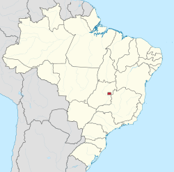
The Federal District (Portuguese: Distrito Federal [dʒisˈtɾitu fedeˈɾaw] ) is one of 27 federative units of Brazil. Located in the Center-West Region, it is the smallest Brazilian federal unit and the only one that has no municipalities, being divided into 35 administrative regions. The federal capital of Brazil, Brasília, which is also the seat of government of the Federal District, is located in its territory. The Federal District is almost completely surrounded by the state of Goiás, but it shares a small border with Minas Gerais.
History
[edit]
From the first republican constitution there was already a device that foresaw the move of the federal capital from Rio de Janeiro, at that time in the former Federal District (1889–1960), to the interior of the country. In 1891 the Exploration Commission of the Central Highlands of Brazil was appointed, led by astronomer Luiz Cruls and composed of doctors, geologists and botanists, who made a study on topography, climate, geology, flora, fauna and other material resources of the region of the Central Highlands The area was known as Quadrilateral Cruls and was presented in 1894 to the Republican Government.
In 1922 a commission of the Federal Government established the location in Goiás, but the project was closed. Only in 1955, during a few elections, the then presidential candidate Juscelino Kubitschek said he would transfer the capital. Elected president, he established the construction of Brasilia as a meta-synthesis of his Plano de Metas.
In 1956, after being elected to the presidency, JK, on his own initiative, sent a message to Congress proposing the creation of the New Capital Urbanization Company (Novacap). After the congress approved the project, in September of the same year, the president signed the law that created the company.[5]
As a result, Novacap, a public company, was given the task of planning and executing the construction of the federal capital in the region delimited by General José Pessoa. After a public competition to select the city's pilot plan, a judging committee chose the urban design by architect Lúcio Costa, which was unanimously approved by the Chamber of Deputies and the Senate.[6][7] This also made the name Brasília official, as well as the choice of Oscar Niemeyer as architect and Joaquim Cardozo as structural engineer.[8][9]
Construction began that same year, under the supervision of Oscar Niemeyer and Israel Pinheiro. The Bandeirante Nucleus was then formed, with candangos (workers who worked on the construction of Brasilia, initially from Goiás, Minas Gerais and mainly the Northeast). Earthworks began in November 1956. Thirty thousand workers built Brasília in 41 months. Israel Pinheiro was appointed the first mayor of the Federal District on April 17, 1960, shortly before its inauguration on April 21, 1960, the date chosen by Juscelino Kubitschek in honor of Tiradentes.[10]
The capital of Brazil was transferred from Rio de Janeiro to Brasília on 21 April 1960 and its new territory, split off from Goiás state on the border with the Minas Gerais state, became the current Federal District. After the transfer the old Federal District, containing the city of Rio de Janeiro, became the state of Guanabara. This state existed from 1960 until 1975, when it merged with the state of Rio de Janeiro. With the merger the capital of Rio de Janeiro state was transferred back from Niterói to Rio de Janeiro itself (as it had been until 1834 when the empire created the Neutral Municipality).
Demographics
[edit]| Year | Pop. | ±% |
|---|---|---|
| 1960 | 141,742 | — |
| 1970 | 546,015 | +285.2% |
| 1980 | 1,203,333 | +120.4% |
| 1991 | 1,598,415 | +32.8% |
| 2000 | 2,051,146 | +28.3% |
| 2010 | 2,570,160 | +25.3% |
| 2022 | 2,817,381 | +9.6% |
| Source:[2] | ||
According to the IBGE census of 2007, there were 2,393,000 people residing in the Federal District. The population density was 410.9 inhabitants per square kilometre (1,064/sq mi).
- Urbanization: 94% (2006).
- Population growth: 2.8% (1991–2000).
- Houses: 697,000 (2006).[11]
Subdivisions
[edit]The Federal District is subdivided into 35 administrative regions.
| Number | Administrative region |
|---|---|
| I | Plano Piloto |
| II | Gama |
| III | Taguatinga |
| IV | Brazlândia |
| V | Sobradinho |
| VI | Planaltina |
| VII | Paranoá |
| VIII | Núcleo Bandeirante |
| IX | Ceilândia |
| X | Guará |
| XI | Cruzeiro |
| XII | Samambaia |
| XIII | Santa Maria |
| XIV | São Sebastião |
| XV | Recanto das Emas |
| XVI | Lago Sul |
| XVII | Riacho Fundo |
| XVIII | Lago Norte |
| XIX | Candangolândia |
| XX | Águas Claras |
| XXI | Riacho Fundo II |
| XXII | Sudoeste/Octogonal |
| XXIII | Varjão |
| XXIV | Park Way |
| XXV | SCIA |
| XXVI | Sobradinho II |
| XXVII | Jardim Botânico |
| XXVIII | Itapoã |
| XXIX | SIA |
| XXX | Vicente Pires |
| XXXI | Fercal |
| XXXII | Sol Nascente/Pôr do Sol[12] |
| XXXIII | Arniqueira[13] |
| XXXIV | Arapoanga |
| XXXV | Água Quente |

Education
[edit]Educational institutions
[edit]- Universidade de Brasília (UnB) (University of Brasília)
- Universidade Católica de Brasília (UCB) (Catholic University of Brasília)
- Centro Universitário de Brasília (UniCEUB)
- Centro Universitário do Distrito Federal (UniDF)
- Centro Universitário Euroamericano (UNIEURO)
- Instituto de Educação Superior de Brasília (IESB)
- Escola Superior de Ciências da Saúde (ESCS)
- União Pioneira da Integração Social (UPIS)
- Universidade Paulista (UniP) (Paulista University)
- Federal Institute of Brasília (IFB)
Geography
[edit]The Federal District is located in the Brazilian Highlands, having an altitude between 600 and 1,100 meters above sea level, with its highest point being the Pico do Roncador, in Serra do Sobradinho.[14][15] In area, the Federal District is more than double the size of Tokyo (Japan) or the island of Maui (Hawaii, United States). Comparing dry land areas, it is slightly larger than French Polynesia, the US State of Rhode Island, or Cape Verde. It is slightly smaller than Bali (Indonesia) or Trinidad and Tobago. The District is surrounded in almost its entirety by Goiás except for a short stretch along the Preto River with Minas Gerais. The District's eastern boundary is marked by the aforementioned Preto River, an eventual tributary of the São Francisco, and its western boundary by the Descoberto, an eventual tributary of the Río de la Plata. The northern and southern boundaries are roughly straight lines.
Climate
[edit]The Federal District has a tropical savanna climate (Aw according to the Köppen system), with a rainy season from October to April, and a dry season from May to September. The altitude moderates temperatures, which throughout the year are very warm rather than uncomfortably hot: maxima range from 25 to 28 °C or 77 to 82 °F throughout the year. During the dry season (winter), the humidity can reach very low level with dangerous fire risks, mainly during the peak hours of the hottest days. The artificial Paranoá Lake, with almost 40 km2 (15 sq mi) and 500 million cubic metres (410,000 acre⋅ft) of water, was built to minimize the severe drought and consequent flammability of the dry season in the cerrado region.
Government and politics
[edit]

The politics and administration of the Federal District are distinguished from the other units of the federation in some particular points, as defined in the Brazilian Constitution of 1988:[16]
- The Federal District is governed by an organic law, typical of municipalities, and not by a state constitution. It builds up the legislative powers reserved to states and municipalities, which are not forbidden by the Constitution.
- The hybrid character of the Federal District is observable by its Legislative Chamber, a mixture of Municipal Chamber and Legislative Assembly.
- The Legislative Power of the Federal District is exercised by the Legislative Chamber, with 24 elected district deputies; being that the head of the Executive Power is the governor.
The Federal District is a legal entity of internal public law, which is part of the political-administrative structure of Brazil, of a nature sui generis, because it is neither a state nor a municipality, but a special entity that accumulates the legislative powers reserved to the states and the municipalities, as provided in art. 32, § 1º of the CF, which gives it a hybrid nature of state and municipality.[16]
Article 32 of the 1988 Brazilian Constitution expressly prohibits the Federal District from being divided into municipalities, being considered one.[16] The executive power of the Federal District was represented by the mayor of the Federal District until 1969, when the position was transformed into governor of the Federal District.[17][18]
The legislative power of the Federal District is represented by the Legislative Chamber of the Federal District, whose nomenclature represents a mixture of legislative assembly (legislative power of the other units of the federation) and municipal chamber (legislative of the municipalities). The Legislative Chamber is made up of 24 district deputies.[19]
The judicial power which serves the Federal District also serves federal territories. Brazil does not have territories currently, therefore, the Court of Justice of the Federal District and of the Territories only serves the Federal District.
Part of the budget of the Federal District Government comes from the Constitutional Fund of the Federal District. In 2012, the fund totaled 9.6 billion reais.[20] By 2015, the forecast was of 12.4 billion Reais, with more than half (6.4% of the total) billion for public security expenditures.[21]
Tourism and recreation
[edit]
- The Parque da Cidade
Located in Brasília, the "Parque da Cidade" ("City Park"), officially the "Parque da Cidade Sarah Kubitschek", is named after the wife of Brazilian president Juscelino Kubitschek, extends over four million square meters. It includes landscape works of Burle Marx, and wall tiles that decorate restrooms in the park designed by Athos Bulcão. Equipped with sports courts, a horse track, a racing kart track, skate tracks, playgrounds for children, bicycle tracks and trails for walks and jogging, the City Park attracts thousands of people everyday, specially on weekends. The park's main entrance is located in the Monumental Axis South, but there are secondary exits that lead to other areas in the city's south wing.
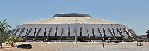
Designed by Oscar Niemeyer, it was inaugurated in 1970. Its shape is circular horizontally and structured around 16 curved pillars, forming a crown filled with futuristic and/or spatial stained-glass works in a triangular shape. The pillars evoke reversed praying hands that deconstruct the gothic traditional church window pattern, but conserves the triangular vaginal shape of the stained-glasses. The curves present in many of Niemeyer's works pay homage to the beautifully built bodies of Brazilian women.

The stained-glasses were designed by Marianne Peretti. Their disposition ensures natural lighting into the aisle, which was built below street level. Around the church, in the outside area, visitors can see Alfredo Ceschiatti's sculptures — the four evangelists — and inside, suspended angels. There are also paintings by Emiliano Di Cavalcanti, representing the stages of the Passion of Christ, and paintings by Athos Bulcão. The cathedral is located in the Eixo Monumental mall, at the entry to the Esplanada dos Ministérios, or Ministries Sector.
- The "Three Powers Square"
Praça dos Três Poderes concentrates some of the most important and significant buildings in the work and career of Oscar Niemeyer — the Planalto Palace, headquarters of Brazilian Presidency; the National Congress, hosting the Chamber of Deputies and the Federal Senate; and the Higher Courts of Justice. The Square also hosts: the Panteão da Pátria (Pantheon of the Fatherland), the Lúcio Costa Space and three important sculptures — "Pombal", by Niemeyer; "Justice", by Alfredo Ceschiatti; and "Os Candangos", by Bruno Giorgi. In the central plaza, a giant Brazilian national flag 286 square meters (3,080 sq ft) is supported by a triangular black 100-meter (330 ft) and high pole. It is located at the end of the Esplanada dos Ministérios.
Infrastructure
[edit]- Vehicles: 910,502 (March/2007)
- Mobile phones: 2.7 million (April/2007)
- Telephones: 884 thousand (April/2007)
- Cities: 31
Economy
[edit]In addition to being the political center, the Federal District is also an important economic center, being the seventh federal unit with the highest gross domestic product (GDP) in Brazil (171.2 billion reais - 2012) and the highest GDP per capita in the country, 64,653 reais (2012).[22]
The service sector is the largest component of GDP at 92.5%, followed by the industrial sector at 7.1%. Agriculture represents 0.4% of GDP (2004). Federal District exports: soybean 77.1% and gold 16.4% (2002). The Federal District's share of the Brazilian economy is 3.7% as of 2005.[citation needed]
Transport
[edit]International Airport
[edit]
Brasília International Airport is the third largest in Brazil in terms of passenger movement. Because of its strategic location it is considered a civil aviation hub for the rest of the country. This makes for a large number of takeoffs and landings and it is not unusual for flights to have to wait in the holding pattern to land. Following the airport's master plan, Infraero built a second runway in 2005. In 2003, the fourth phase of the passenger terminal expansion was completed. It raised its capacity to 7.4 million passengers a year. The third floor of the main building, with 12 thousand square meters, has a panoramic deck, a food court, shops, four movie theaters with total capacity of 500 people, and space for exhibitions. There are a total of 136 shop spots at the Brasília Airport.
Metro
[edit]
There is a rapid transit system, the Federal District Metro, serving some cities. It is operated by Companhia do Metropolitano do Distrito Federal (Metro Company of the Federal District) and was inaugurated in 2001. The system has 29 stations (24 in operation)[23] on two lines, and operates from 06:00 to 23:30, Monday to Friday and from 07:00 to 19:00 on weekends. It serves the southern half of Brasília and the main cities to the west. Its main problem is the large distance between many of the stations caused by the low housing density for such a system. This makes it a small component in the Federal District transit system where a low-efficiency bus network is still predominant. Águas Claras is well served by the metro, making it one of the fastest growing areas and the most dense in the Federal District.
| Trains | 32 |
| Total extension | 42.38 km (26.33 miles)[23] |
| Operational stations | 24 |
| Total stations | 29 |
The non-operational stations include stations under construction and mothballed stations (complete and under construction) awaiting higher density.
Sports
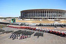
[edit]The Federal District is home to two nationally-recognized football clubs: Brasiliense Futebol Clube (from Taguatinga) and Sociedade Esportiva do Gama (or simply Gama), both of which have played in the first division of the Campeonato Brasileiro Série A, the best result in their history being Brasiliense's runner-up finish in the 2002 edition of the Copa do Brasil.[24] The main soccer stadiums are the Estádio Nacional de Brasília Mané Garrincha, the Estádio Elmo Serejo Farias (Serejão) and the Estádio Walmir Campelo Bezerra (Bezerrão). The Edson Arantes do Nascimento Stadium (Pelezão) was the city's first and main stadium at the time of its inauguration, but was abandoned and demolished in 2009.[25][26]
The Federal District is a departing point for the practice of free flying sports, a sport that may be practiced with hang gliding or paragliding wings. Practitioners of such sports say that because of the district's dry weather it offers strong thermal winds and great "cloud-streets" – which is also the name for a manoeuvre quite appreciated by practitioners. The district hosted the 14th Hang Gliding World Championship – one of the categories of free flying – in 2003. In August 2005, it hosted the 2nd stage of the Brazilian Hang Gliding Championship.
Brasilia was one of the six host cities for the 2013 Confederations Cup matches[27][28] and one of the twelve for the 2014 World Cup, whose matches took place at the Mané Garrincha National Stadium in Brasilia.[29][30] The stadium is located in the Ayrton Senna Multisport Complex (formerly the Sports Sector), which also includes the Nilson Nelson Sports Gymnasium, which has hosted matches for the men's and women's volleyball teams and the 2008 Futsal World Cup.[31]
In the Federal District, the city of Brasília is the site of the Autódromo Internacional Nelson Piquet, which hosted a non-championship round of the 1974 Formula One Grand Prix season. An IndyCar race that was scheduled to occur at the circuit was cancelled at the last minute in 2015 due to financial problems.[32] The track, which has been closed since 2015, is being renovated for the end of 2023 by the state-owned Banco de Brasília.[33]
Domestic sports clubs
[edit]Association football
[edit]Basketball
[edit]Stadiums
[edit]Association football
[edit]Other
[edit]Flag
[edit]
The white background of the flag stands for peace, and gives the idea of infinity, or the vast Brazilian territory. The green and yellow colours in the middle refer to the most commonly used of the four colours of the national flag to represent Brazil. The four yellow arrows symbolize the native nations of Brazil, whereas their pointing into the four cardinal directions of the compass stands for the centralized emanating political power of Brasília, as the capital of the country. The yellow arrows also form a cross, which symbolizes both the Southern Cross, a constellation seen only in the Southern Hemisphere and the Roman Catholic or Christian symbol of redemption brought by Pedro Álvares Cabral and under whose shadow the first Mass in Brazil was celebrated in 1500 in Bahia. With their feathers, the arrows form a lozenge in the middle, a reference to yellow lozenge of the national flag, that stands for Brazil's mineral riches.
The flag was created by the poet and herald Guilherme de Almeida, and was adopted by decree n.o 1090 on August 25, 1969.
Voting rights
[edit]The Federal District has eight seats in the Chamber of Deputies[34] and three in the Federal Senate.[35] Its population also votes its governor and district deputies (which function as both state deputies and aldermen in the municipalities), but not regional administrators, which are appointed by the governor itself, respecting the government centrality of the Federal District.
Gallery
[edit]-
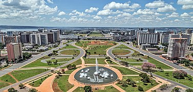
Monumental Axis as seen from the Brasilia TV Tower
-
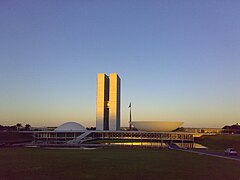
National Congress of Brazil building
-
Praça dos Três Poderes with the Brazilian flag and Os Candangos sculpture
-
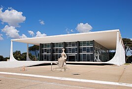
Supreme Federal Court building
-
Statue in Cruzeiro
-
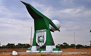
Balão do Periquito, Gama
-
Praça do Relógio, Taguatinga
-
Water reserve in Ceilândia
-
States' Square, Candangolândia
-
Greater rhea sculpture, Recanto das Emas
-
Águas Claras Park
See also
[edit]References
[edit]- ^ Alcântara, Manoela (January 9, 2023). "Celina Leão é a nova governadora do DF com afastamento de Ibaneis" (in Portuguese). Metrópoles. Retrieved January 9, 2023.
- ^ a b "2022 Census Overview" (in Portuguese).
- ^ "PIB por Unidade da Federação, 2021". ibge.gov.br.
- ^ "Atlas do Desenvolvimento Humano no Brasil. Pnud Brasil, Ipea e FJP, 2022". www.atlasbrasil.org.br. Retrieved 2023-06-11.
- ^ "Distrito Federal: História". Enciclopédia Barsa Universal. São Paulo: Barsa Planeta Internacional. 2009. p. 1013.
- ^ "Esboços para a capital desde 1927". www.agenciabrasilia.df.gov.br (in Brazilian Portuguese). Retrieved 2024-06-27.
- ^ Eufrásio*', 'Jéssica (2017-03-16). "Vitória do projeto de Lucio Costa para Brasília completa 60 anos". Acervo (in Brazilian Portuguese). Retrieved 2024-06-27.
- ^ "A importância de Oscar Niemeyer para Brasília e 5 pontos para visitar na capital". CNN Brasil V&G. Retrieved 2024-06-27.
- ^ Curated, Something (2021-11-16). "Oscar Niemeyer & The Birth Of Brasília". Something Curated. Retrieved 2024-06-27.
Along with Costa as planner and Niemeyer as chief architect, Joaquim Cardozo was brought in as the structural engineer, and Roberto Burle Marx was the landscape designer.
- ^ "Nasce Brasília. Sessenta anos de uma ideia feliz". www.agenciabrasilia.df.gov.br (in Brazilian Portuguese). Retrieved 2024-06-27.
- ^ Source: PNAD.
- ^ "Pôr do Sol/Sol Nascente se torna a 32ª região administrativa do DF". G1 (in Brazilian Portuguese). 14 August 2019. Retrieved 2022-04-28.
- ^ "CLDF aprova criação da Região Administrativa de Arniqueira". Agência Brasília (in Brazilian Portuguese). 2019-08-28. Retrieved 2022-04-28.
- ^ Distrito Federal: Geografia [Federal District: Geography] (in Brazilian Portuguese). Barsa Planeta Internacional. 2009. p. 1012.
- ^ Ecloniq (2022-05-13). "Qual é o ponto mais alto do DF | pico do roncador". Ecloniq (in Brazilian Portuguese). Retrieved 2024-01-22.
- ^ a b c Governo do Brasil, ed. (1988). "Constituição da República Federativa do Brasil de 1988 - Título III, Capítulo V: Do Distrito Federal e dos Territórios". Retrieved 4 August 2013.
- ^ "Prefeitos". A História de Brasília (in Portuguese). Info Brasília. Archived from the original on 12 April 2010. Retrieved 17 April 2010.
- ^ Portal Terra, ed. (25 August 2010). "Por que Brasília não tem prefeito?". Retrieved 4 August 2013.
- ^ Câmara Legislativa do Distrito Federal (ed.). "Sobre a Câmara Legislativa". Retrieved 4 August 2013.
- ^ "Portal da Transparência - Fundo Constitucional do Distrito Federal". Archived from the original on 2015-02-21. Retrieved 2019-02-26.
- ^ "Ao todo, o GDF poderá contar com um orçamento de R$ 37,2 bilhões para o próximo ano". Archived from the original on 2015-02-21. Retrieved 2019-02-26.
- ^ "Tabela 4 - Produto Interno Bruto, população residente e Produto Interno Bruto per capita, segundo as Grandes Regiões e as Unidades da Federação" (PDF). IBGE (in Brazilian Portuguese). 2011. Retrieved 2024-06-28.
- ^ a b "Estrutura". www.metro.df.gov.br. Archived from the original on 20 November 2012. Retrieved 6 June 2022.
- ^ "Folha Online - Esporte - Corinthians empata com o Brasiliense e conquista a Copa do Brasil - 15/05/2002". www1.folha.uol.com.br. Retrieved 2024-06-28.
- ^ "Homenagem a Pelé? No Brasil, é raridade e somente três estádios na elite relembram ídolos do passado". ESPN.com (in Portuguese). 2023-01-10. Retrieved 2024-06-28.
- ^ Redação (2016-06-26). "Glória do futebol, Pelezão morre nas mãos da Via e de Paulo Octavio". Notibras (in Brazilian Portuguese). Retrieved 2024-06-28.
- ^ "Brazil to open 2013 Confederations Cup in Brasilia". FOX Sports. Retrieved 2024-06-28.
- ^ "Brazil opens the Confed Cup with convincing win over Japan". ESPN.com. 2014-05-30. Retrieved 2024-06-28.
- ^ "Brazil's Soccer Cities: from Rio to Brasilia". BBC Sport. 2014-05-29. Retrieved 2024-06-28.
- ^ "World Cup 2014 schedule - CBS News". www.cbsnews.com. 2014-04-28. Retrieved 2024-06-28.
- ^ UEFA.com (2008-02-08). "Dates set for Brazilian futsal feast | Futsal World Cup 2008". UEFA.com. Retrieved 2024-06-28.
- ^ "Brasilia government forced IndyCar race cancellation in money worry". www.autosport.com. 2015-01-31. Retrieved 2023-06-23.
- ^ Marson, Leonardo (2022-07-01). "Autódromo de Brasília lança Instagram para acompanhamento das obras na pista". Racing Online (in Brazilian Portuguese). Retrieved 2023-06-23.
- ^ "The Deputies — Portal da Câmara dos Deputados". www2.Camara.leg.br. Retrieved 3 August 2017.
- ^ "The Federal Senate — Portal da Câmara dos Deputados". www2.Camara.leg.br. Retrieved 3 August 2017.
Notes
[edit]- ^ Leão began serving as governor on 9 January 2023 after Rocha was suspended by Alexandre de Moraes for inaction during the 2023 Praça dos Três Poderes attack.[1]
External links
[edit]- (in Portuguese) Government of the Federal District website
- (in Portuguese) Legislative Chamber of the Federal District website
- (in Portuguese) Court of Justice of the Federal District and of the Territories website


