Grand-Popo
Grand-Popo | |
|---|---|
 | |
| Coordinates: 6°17′N 1°50′E / 6.283°N 1.833°E | |
| Country | |
| Department | Mono Department |
| Area | |
| • Total | 112 sq mi (289 km2) |
| Population (2013 Census) | |
| • Total | 57,636 |
| • Density | 520/sq mi (200/km2) |
| Time zone | UTC+1 (WAT) |
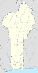
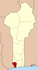
Grand-Popo [gʁɑ̃.pɔ.po] is a town, arrondissement, and commune in the Mono Department of south-western Benin. The commune covers an area of 289 square kilometres and as at the 2013 Census had a population of 57,636 people.[1][2]

The term "Grand-Popo" is a European exonym for the ancient town and kingdom of "Hulagan" (Great Hula). The Hula/Xwla/Phla people that once dominated the Togo-Benin coast traditionally regarded Great Hula as their ancestral town of common origin. [3] It is unclear why Europeans began calling it Popo rather than Hula. It may come from a generic Yoruba term "popo" for peoples to their "west", which was subsequently borrowed by the Portuguese to refer to the Hula/Phla specifically. An alternative theory connects the "Popo" term to an ancient ruler called Kpokpo of Tado (an Aja town in the interior), which the Europeans may have confused with Hulagan.[4]
The town grew around the slave trade, but coastal erosion has now destroyed most of the old town.[5] The town is now a centre for voodoo and home to a Finnish-African cultural centre, Villa Karo. The town's main industry is fishing.
The town inspired the name of the French electronic music duo Grand Popo Football Club, as well as the name of the iPad application creator Grand Popo LLC.[6]
History
[edit]This section needs expansion. You can help by adding to it. (May 2021) |
Grand popo is located in south western Benin. This land is composed by Pedah,kotafon, pla and Ewe people. In Kotafon land, Ga kome ( Djanglanmey) which means district of the king was the famous in the colonial time cause the leader busness was the slave trade. they are living from agriculture and fishing. from 1960 Kotafon people are celebrating their traditional festival also called kotafon. Pla people were great fisherman cause their grandfathers were living along the rivers or mono. the traditional leader of Xwla land is Ahoussan heleketche alifa.

References
[edit]- ^ "Grand-Popo". Atlas Monographique des Communes du Benin. Retrieved January 5, 2010.[permanent dead link]
- ^ L’Institut National de la Statistique et de l’Analyse Economique (INSAE), Benin, 2013.
- ^ Robin Law (1991) Slave Coast of West Africa, 1550-1750. Clarendon Press, p.15.
- ^ Law (1991: p.16)
- ^ Butler, Stuart (2019) Bradt Travel Guide - Benin, pgs. 115-120
- ^ "Ordo Abchao". iTunes. Retrieved April 21, 2012.
External links
[edit] Grand Popo travel guide from Wikivoyage
 History of Grand-Popo at Wikibooks


