
Custer County, Montana
Custer County | |
|---|---|
 Custer County Courthouse in Miles City | |
 Location within the U.S. state of Montana | |
 Montana's location within the U.S. | |
| Coordinates: 46°16′N 105°35′W / 46.27°N 105.58°W | |
| Country | |
| State | |
| Founded | June 2, 1865 |
| Named for | George Armstrong Custer |
| Seat | Miles City |
| Largest city | Miles City |
| Area | |
| • Total | 3,793 sq mi (9,820 km2) |
| • Land | 3,783 sq mi (9,800 km2) |
| • Water | 9.9 sq mi (26 km2) 0.3% |
| Population (2020) | |
| • Total | 11,867 |
| • Estimate (2022) | 12,032 |
| • Density | 3.1/sq mi (1.2/km2) |
| Time zone | UTC−7 (Mountain) |
| • Summer (DST) | UTC−6 (MDT) |
| Congressional district | 2nd |
| Website | https://custercountymt.com/ |
| |
Custer County is a county located in the U.S. state of Montana. As of the 2020 census, the population was 11,867.[1] Its county seat is Miles City.[2] The county was established on June 2, 1865, as one of the nine original counties of the Territory of Montana named Big Horn County,[3] and was renamed on February 16, 1877, in honor of Lieutenant Colonel George Armstrong Custer.[4]
Geography
[edit]According to the United States Census Bureau, the county has a total area of 3,793 square miles (9,820 km2), of which 3,783 square miles (9,800 km2) is land and 9.9 square miles (26 km2) (0.3%) is water.[5]
Climate
[edit]According to the Köppen Climate Classification system, Custer County has a mostly cold semi-arid climate, abbreviated "BSk" on climate maps.
| Climate data for Mizpah, Montana, 1991—2020 normals, extremes 1960—present | |||||||||||||
|---|---|---|---|---|---|---|---|---|---|---|---|---|---|
| Month | Jan | Feb | Mar | Apr | May | Jun | Jul | Aug | Sep | Oct | Nov | Dec | Year |
| Record high °F (°C) | 69 (21) |
73 (23) |
85 (29) |
92 (33) |
101 (38) |
111 (44) |
112 (44) |
110 (43) |
106 (41) |
96 (36) |
80 (27) |
70 (21) |
112 (44) |
| Mean maximum °F (°C) | 51.6 (10.9) |
56.3 (13.5) |
71.9 (22.2) |
81.3 (27.4) |
87.2 (30.7) |
95.8 (35.4) |
102.5 (39.2) |
101.5 (38.6) |
97.1 (36.2) |
84.2 (29.0) |
67.9 (19.9) |
54.2 (12.3) |
104.4 (40.2) |
| Mean daily maximum °F (°C) | 32.6 (0.3) |
36.9 (2.7) |
49.7 (9.8) |
61.2 (16.2) |
70.9 (21.6) |
81.1 (27.3) |
91.3 (32.9) |
90.9 (32.7) |
79.4 (26.3) |
62.1 (16.7) |
46.4 (8.0) |
35.2 (1.8) |
61.5 (16.4) |
| Daily mean °F (°C) | 19.4 (−7.0) |
23.7 (−4.6) |
35.4 (1.9) |
46.1 (7.8) |
55.8 (13.2) |
65.6 (18.7) |
73.5 (23.1) |
72.0 (22.2) |
61.0 (16.1) |
46.2 (7.9) |
32.3 (0.2) |
21.9 (−5.6) |
46.1 (7.8) |
| Mean daily minimum °F (°C) | 6.3 (−14.3) |
10.6 (−11.9) |
21.0 (−6.1) |
31.0 (−0.6) |
40.8 (4.9) |
50.1 (10.1) |
55.6 (13.1) |
53.0 (11.7) |
42.6 (5.9) |
30.4 (−0.9) |
18.3 (−7.6) |
8.6 (−13.0) |
30.7 (−0.7) |
| Mean minimum °F (°C) | −23.5 (−30.8) |
−15.4 (−26.3) |
−4.1 (−20.1) |
13.1 (−10.5) |
24.3 (−4.3) |
36.1 (2.3) |
43.2 (6.2) |
37.6 (3.1) |
25.5 (−3.6) |
12.3 (−10.9) |
−6.3 (−21.3) |
−17.2 (−27.3) |
−32.0 (−35.6) |
| Record low °F (°C) | −45 (−43) |
−45 (−43) |
−40 (−40) |
−5 (−21) |
13 (−11) |
21 (−6) |
33 (1) |
31 (−1) |
16 (−9) |
−11 (−24) |
−29 (−34) |
−49 (−45) |
−49 (−45) |
| Average precipitation inches (mm) | 0.44 (11) |
0.48 (12) |
0.70 (18) |
1.65 (42) |
2.92 (74) |
2.31 (59) |
1.78 (45) |
1.02 (26) |
1.26 (32) |
1.04 (26) |
0.50 (13) |
0.41 (10) |
14.51 (368) |
| Average snowfall inches (cm) | 5.6 (14) |
5.0 (13) |
5.4 (14) |
2.2 (5.6) |
0.8 (2.0) |
0.0 (0.0) |
0.0 (0.0) |
0.0 (0.0) |
0.1 (0.25) |
1.6 (4.1) |
3.7 (9.4) |
5.5 (14) |
29.9 (76.35) |
| Average precipitation days (≥ 0.01 in) | 6.2 | 6.3 | 6.3 | 8.4 | 10.5 | 10.4 | 8.0 | 5.8 | 6.3 | 7.2 | 5.7 | 5.9 | 87.0 |
| Average snowy days (≥ 0.1 in) | 4.7 | 4.4 | 3.2 | 1.3 | 0.3 | 0.0 | 0.0 | 0.0 | 0.0 | 1.0 | 3.2 | 4.8 | 22.9 |
| Source 1: NOAA[6] | |||||||||||||
| Source 2: National Weather Service[7] | |||||||||||||
Major highways
[edit]Transit
[edit]Adjacent counties
[edit]- Prairie County - north
- Fallon County - east
- Carter County - southeast
- Powder River County - south
- Rosebud County - west
- Garfield County - northwest
Demographics
[edit]| Census | Pop. | Note | %± |
|---|---|---|---|
| 1870 | 38 | — | |
| 1880 | 2,510 | 6,505.3% | |
| 1890 | 5,308 | 111.5% | |
| 1900 | 7,891 | 48.7% | |
| 1910 | 14,123 | 79.0% | |
| 1920 | 12,194 | −13.7% | |
| 1930 | 11,242 | −7.8% | |
| 1940 | 10,422 | −7.3% | |
| 1950 | 12,661 | 21.5% | |
| 1960 | 13,227 | 4.5% | |
| 1970 | 12,174 | −8.0% | |
| 1980 | 13,109 | 7.7% | |
| 1990 | 11,697 | −10.8% | |
| 2000 | 11,696 | 0.0% | |
| 2010 | 11,699 | 0.0% | |
| 2020 | 11,867 | 1.4% | |
| 2022 (est.) | 12,032 | [8] | 1.4% |
| U.S. Decennial Census[9] 1790–1960,[10] 1900–1990,[11] 1990–2000,[12] 2010–2020[1] | |||
2020 census
[edit]As of the 2020 census, there were 11,867 people living in the county.[citation needed]
2010 census
[edit]As of the 2010 census, there were 11,699 people, 5,031 households, and 3,014 families living in the county. The population density was 3.1 inhabitants per square mile (1.2/km2). There were 5,560 housing units at an average density of 1.5 per square mile (0.58/km2). The racial makeup of the county was 95.5% white, 1.7% American Indian, 0.3% black or African American, 0.3% Asian, 0.1% Pacific islander, 0.5% from other races, and 1.6% from two or more races. Those of Hispanic or Latino origin made up 2.2% of the population. In terms of ancestry, 33.6% were German, 18.3% were Irish, 14.3% were American, 14.1% were Norwegian, and 10.6% were English.
Of the 5,031 households, 27.3% had children under the age of 18 living with them, 46.6% were married couples living together, 9.0% had a female householder with no husband present, 40.1% were non-families, and 34.3% of all households were made up of individuals. The average household size was 2.24 and the average family size was 2.88. The median age was 42.1 years.
The median income for a household in the county was $38,913 and the median income for a family was $49,011. Males had a median income of $37,535 versus $26,576 for females. The per capita income for the county was $21,676. About 12.4% of families and 15.7% of the population were below the poverty line, including 19.8% of those under age 18 and 14.6% of those age 65 or over.
Politics
[edit]| Year | Republican | Democratic | Third party(ies) | |||
|---|---|---|---|---|---|---|
| No. | % | No. | % | No. | % | |
| 2020 | 4,205 | 71.76% | 1,514 | 25.84% | 141 | 2.41% |
| 2016 | 3,657 | 70.53% | 1,176 | 22.68% | 352 | 6.79% |
| 2012 | 3,373 | 62.87% | 1,833 | 34.17% | 159 | 2.96% |
| 2008 | 3,047 | 55.89% | 2,267 | 41.58% | 138 | 2.53% |
| 2004 | 3,297 | 65.31% | 1,630 | 32.29% | 121 | 2.40% |
| 2000 | 3,156 | 64.34% | 1,501 | 30.60% | 248 | 5.06% |
| 1996 | 2,467 | 46.29% | 2,115 | 39.69% | 747 | 14.02% |
| 1992 | 2,105 | 37.52% | 1,968 | 35.07% | 1,538 | 27.41% |
| 1988 | 3,007 | 55.05% | 2,343 | 42.90% | 112 | 2.05% |
| 1984 | 3,879 | 65.53% | 1,982 | 33.49% | 58 | 0.98% |
| 1980 | 3,533 | 60.75% | 1,822 | 31.33% | 461 | 7.93% |
| 1976 | 3,120 | 55.25% | 2,425 | 42.94% | 102 | 1.81% |
| 1972 | 3,486 | 63.31% | 1,875 | 34.05% | 145 | 2.63% |
| 1968 | 2,831 | 58.06% | 1,760 | 36.10% | 285 | 5.84% |
| 1964 | 2,302 | 45.13% | 2,790 | 54.70% | 9 | 0.18% |
| 1960 | 2,943 | 55.00% | 2,393 | 44.72% | 15 | 0.28% |
| 1956 | 3,240 | 58.30% | 2,317 | 41.70% | 0 | 0.00% |
| 1952 | 3,461 | 62.53% | 2,050 | 37.04% | 24 | 0.43% |
| 1948 | 1,845 | 43.28% | 2,359 | 55.34% | 59 | 1.38% |
| 1944 | 1,830 | 46.96% | 2,038 | 52.30% | 29 | 0.74% |
| 1940 | 2,017 | 41.73% | 2,782 | 57.55% | 35 | 0.72% |
| 1936 | 1,381 | 29.30% | 3,196 | 67.81% | 136 | 2.89% |
| 1932 | 1,675 | 36.99% | 2,729 | 60.27% | 124 | 2.74% |
| 1928 | 2,503 | 64.08% | 1,386 | 35.48% | 17 | 0.44% |
| 1924 | 1,654 | 43.78% | 412 | 10.91% | 1,712 | 45.31% |
| 1920 | 2,347 | 64.53% | 1,127 | 30.99% | 163 | 4.48% |
| 1916 | 1,615 | 37.05% | 2,602 | 59.69% | 142 | 3.26% |
| 1912 | 695 | 21.70% | 1,068 | 33.34% | 1,440 | 44.96% |
| 1908 | 967 | 60.66% | 531 | 33.31% | 96 | 6.02% |
| 1904 | 824 | 72.22% | 285 | 24.98% | 32 | 2.80% |
| 1900 | 980 | 66.94% | 477 | 32.58% | 7 | 0.48% |
| 1896 | 723 | 51.50% | 676 | 48.15% | 5 | 0.36% |
| 1892 | 680 | 52.67% | 537 | 41.60% | 74 | 5.73% |
Economy
[edit]Agriculture (dryland farming) and cattle raising provide the bulk of Custer County economy.[14] Miles City serves as the center of commerce in an area extending for 100 miles in every direction.[15] As of 2009 the county's largest employers were Holy Rosary Healthcare, Sanjel USA, Stockman Bank, and Walmart.[15]
Communities
[edit]
City
[edit]- Miles City (county seat)
Town
[edit]Unincorporated communities
[edit]See also
[edit]- List of lakes in Custer County, Montana
- List of mountains in Custer County, Montana
- National Register of Historic Places listings in Custer County, Montana
References
[edit]- ^ a b "State & County QuickFacts". United States Census Bureau. Retrieved April 5, 2023.
- ^ "Find a County". National Association of Counties. Archived from the original on May 31, 2011. Retrieved June 7, 2011.
- ^ Big Horn County, Montana Territory was not the same county as present day Big Horn County, Montana.
- ^ "A Brief Custer County History". Custer County Montana. Archived from the original on October 28, 2014. Retrieved December 1, 2014.
- ^ "2010 Census Gazetteer Files". United States Census Bureau. August 22, 2012. Archived from the original on December 5, 2014. Retrieved November 27, 2014.
- ^ "U.S. Climate Normals Quick Access". National Oceanic and Atmospheric Administration. Retrieved August 6, 2022.
- ^ "NOAA Online Weather Data". National Weather Service. Retrieved August 6, 2022.
- ^ "Annual Estimates of the Resident Population for Counties: April 1, 2020 to July 1, 2022". United States Census Bureau. Retrieved April 5, 2023.
- ^ "U.S. Decennial Census". United States Census Bureau. Retrieved November 27, 2014.
- ^ "Historical Census Browser". University of Virginia Library. Archived from the original on August 11, 2012. Retrieved November 27, 2014.
- ^ "Population of Counties by Decennial Census: 1900 to 1990". United States Census Bureau. Retrieved November 27, 2014.
- ^ "Census 2000 PHC-T-4. Ranking Tables for Counties: 1990 and 2000" (PDF). United States Census Bureau. Archived (PDF) from the original on March 27, 2010. Retrieved November 27, 2014.
- ^ Leip, David. "Atlas of US Presidential Elections". uselectionatlas.org. Retrieved April 2, 2018.
- ^ Merrill, Andrea; Judy Jacobson (1997). Montana almanac. Helena MT: Falcon Publishing. ISBN 1-56044-493-2.
- ^ a b Montana Dept. of Labor and Industry (September 2010). "Demographic & Economic Information for Custer County" (PDF). Archived from the original (PDF) on September 6, 2011. Retrieved July 23, 2011.
- ^ U.S. Geological Survey Geographic Names Information System: Garland
- ^ U.S. Geological Survey Geographic Names Information System: Garland
- ^ U.S. Geological Survey Geographic Names Information System: Garland
- ^ U.S. Geological Survey Geographic Names Information System: Tusler
Places adjacent to Custer County, Montana | ||||||||||||||||
|---|---|---|---|---|---|---|---|---|---|---|---|---|---|---|---|---|
| ||||||||||||||||
Municipalities and communities of Custer County, Montana, United States | ||
|---|---|---|
| City | 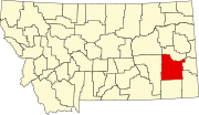 | |
| Town | ||
| Unincorporated communities | ||
| International | |
|---|---|
| National | |