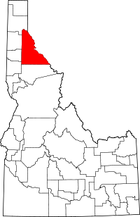
[ 4] Name on the Register[ 5]
Image
Date listed[ 6]
Location
City or town
Description
1
Avery Depot Avery Depot September 20, 1984 (#84001142 ) St. Joe River Rd. 47°15′03″N 115°48′26″W / 47.250797°N 115.807348°W / 47.250797; -115.807348 (Avery Depot ) Avery
2
Avery Ranger Station Avery Ranger Station June 27, 1974 (#74000748 ) Near the St. Joe National Forest 47°15′04″N 115°48′20″W / 47.251063°N 115.805636°W / 47.251063; -115.805636 (Avery Ranger Station ) Avery
3
Bullion Tunnel Upload image September 20, 1984 (#84001160 ) East of Avery 47°24′04″N 115°42′04″W / 47.401111°N 115.701111°W / 47.401111; -115.701111 (Bullion Tunnel ) Avery
4
Cedar Snags Cedar Snags September 20, 1984 (#84001174 ) North of Avery 47°22′30″N 115°45′42″W / 47.374888°N 115.761651°W / 47.374888; -115.761651 (Cedar Snags ) Avery
5
Chicago, Milwaukee, St. Paul and Pacific Railroad Company Historic District Chicago, Milwaukee, St. Paul and Pacific Railroad Company Historic District October 26, 2000 (#00001269 ) Idaho Panhandle National Forest 47°21′37″N 115°38′43″W / 47.360167°N 115.645222°W / 47.360167; -115.645222 (Chicago, Milwaukee, St. Paul and Pacific Railroad Company Historic District ) Avery Extends into Mineral County, Montana
6
John C. Feehan House Upload image August 27, 1980 (#80001334 ) Main St. 47°37′36″N 115°51′05″W / 47.626667°N 115.851389°W / 47.626667; -115.851389 (John C. Feehan House ) Murray
7
Grand Forks Upload image September 20, 1984 (#84001175 ) East of Avery 47°21′12″N 115°40′25″W / 47.353227°N 115.673701°W / 47.353227; -115.673701 (Grand Forks ) Avery
8
Halm Creek, Bean Creek Fire Upload image September 20, 1984 (#84001177 ) South of Red Ives 47°00′27″N 115°21′13″W / 47.0075°N 115.353611°W / 47.0075; -115.353611 (Halm Creek, Bean Creek Fire ) Red Ives
9
Kellogg Boy Scout Cabin Kellogg Boy Scout Cabin September 22, 2021 (#100007006 ) 2 South Hill St. 47°32′13″N 116°07′40″W / 47.5369°N 116.1277°W / 47.5369; -116.1277 (Kellogg Boy Scout Cabin ) Kellogg
10
Magee Ranger Station Magee Ranger Station February 18, 1981 (#81000208 ) West of Pritchard 47°50′39″N 116°15′09″W / 47.844054°N 116.252468°W / 47.844054; -116.252468 (Magee Ranger Station ) Pritchard
11
Mallard Peak Lookout Upload image April 12, 1984 (#84001178 ) Southeast of Avery 46°56′17″N 115°31′30″W / 46.938093°N 115.524903°W / 46.938093; -115.524903 (Mallard Peak Lookout ) Avery
12
Miner's Hat Miner's Hat September 23, 2021 (#100007007 ) 300 East Cameron Ave. 47°32′10″N 116°06′48″W / 47.5362°N 116.1134°W / 47.5362; -116.1134 (Miner's Hat ) Kellogg
13
Murray Courthouse Murray Courthouse November 14, 1978 (#78001098 ) Main St. 47°37′36″N 115°51′15″W / 47.626578°N 115.854172°W / 47.626578; -115.854172 (Murray Courthouse ) Murray Collapsed due to snow load in 1997; subsequently rebuilt in replica.[ 7]
14
Murray Masonic Hall Murray Masonic Hall May 19, 1987 (#87000774 ) Main St. between 2nd and 3rd 47°37′37″N 115°51′29″W / 47.626832°N 115.858062°W / 47.626832; -115.858062 (Murray Masonic Hall ) Murray
15
Northern Pacific Railway Depot Northern Pacific Railway Depot April 2, 1976 (#76000681 ) 219 6th St. 47°28′24″N 115°55′25″W / 47.473247°N 115.923603°W / 47.473247; -115.923603 (Northern Pacific Railway Depot ) Wallace Built in 1906, relocated in 1986 due to Interstate 90 construction.[ 8]
16
Pine Creek Baptist Church Pine Creek Baptist Church November 17, 1982 (#82000361 ) Main and S. 3rd Sts. 47°32′19″N 116°14′13″W / 47.53871°N 116.23684°W / 47.53871; -116.23684 (Pine Creek Baptist Church ) Pinehurst Designed by Tourtellotte & Hummel , built in 1932
17
Edward Pulaski Tunnel and Placer Creek Escape Route Edward Pulaski Tunnel and Placer Creek Escape Route September 20, 1984 (#84001179 ) Southwest of Wallace 47°26′58″N 115°57′24″W / 47.449444°N 115.956667°W / 47.449444; -115.956667 (Edward Pulaski Tunnel and Placer Creek Escape Route ) Wallace
18
Red Ives Ranger Station Red Ives Ranger Station September 13, 1986 (#86002151 ) Southeast of Avery on Forest Service Rd. 218 47°03′22″N 115°21′08″W / 47.056145°N 115.352316°W / 47.056145; -115.352316 (Red Ives Ranger Station ) Avery
19
St. Andrew's Episcopal Church St. Andrew's Episcopal Church April 1, 1999 (#99000419 ) 104 Hunter St. 47°28′12″N 115°48′11″W / 47.470095°N 115.802944°W / 47.470095; -115.802944 (St. Andrew's Episcopal Church ) Mullan
20
U.S. Post Office – Kellogg Main U.S. Post Office – Kellogg Main May 30, 1990 (#89002118 ) 302 S. Division St. 47°32′04″N 116°07′18″W / 47.534526°N 116.121742°W / 47.534526; -116.121742 (U.S. Post Office – Kellogg Main ) Kellogg
21
U.S. Post Office – Wallace Main U.S. Post Office – Wallace Main March 16, 1989 (#89000137 ) 403 Cedar St. 47°28′21″N 115°55′36″W / 47.472617°N 115.926711°W / 47.472617; -115.926711 (U.S. Post Office – Wallace Main ) Wallace
22
Wallace 1910 Fire Memorial Wallace 1910 Fire Memorial September 20, 1984 (#84001180 ) North of Wallace 47°29′16″N 115°54′56″W / 47.487704°N 115.915564°W / 47.487704; -115.915564 (Wallace 1910 Fire Memorial ) Wallace
23
Wallace Carnegie Library Wallace Carnegie Library February 3, 1981 (#81000209 ) 415 River St. 47°28′27″N 115°55′34″W / 47.474189°N 115.926149°W / 47.474189; -115.926149 (Wallace Carnegie Library ) Wallace
24
Wallace Historic District Wallace Historic District August 10, 1979 (#79000809 ) Roughly bounded by Oak, Silver, C, Mullan, Canyon, Fir, and 1st Sts. 47°28′20″N 115°55′34″W / 47.4723°N 115.9262°W / 47.4723; -115.9262 (Wallace Historic District ) Wallace


