[ 3] Name on the Register[ 4]
Image
Date listed[ 5]
Location
City or town
Description
1
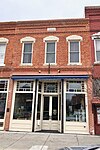
Berquist & Nelson Drugstore Building Berquist & Nelson Drugstore Building April 22, 2009 (#09000228 ) 105 N. Main St. 38°34′25″N 97°40′33″W / 38.5736°N 97.6759°W / 38.5736; -97.6759 (Berquist & Nelson Drugstore Building ) Lindsborg
2
Bethany Lutheran Church and Parsonage Bethany Lutheran Church and Parsonage May 11, 2023 (#100008966 ) 320-340 North Main St. 38°34′38″N 97°40′33″W / 38.5773°N 97.6759°W / 38.5773; -97.6759 (Bethany Lutheran Church and Parsonage ) Lindsborg
3
Canton Township Carnegie Library Canton Township Carnegie Library June 25, 1987 (#87000960 ) 300 N. Main 38°23′17″N 97°25′35″W / 38.3881°N 97.4264°W / 38.3881; -97.4264 (Canton Township Carnegie Library ) Canton
4
Farmers State Bank Farmers State Bank October 16, 2008 (#08000985 ) 101 S. Main St. 38°34′24″N 97°40′33″W / 38.5733°N 97.6758°W / 38.5733; -97.6758 (Farmers State Bank ) Lindsborg
5
Hans Hanson House Hans Hanson House February 19, 1982 (#82002665 ) 211 E. 5th St. 38°33′24″N 97°49′54″W / 38.5567°N 97.8317°W / 38.5567; -97.8317 (Hans Hanson House ) Marquette
6
Hjerpe Grocery Hjerpe Grocery July 11, 2010 (#10000447 ) 110 & 112 N. Main St. 38°34′26″N 97°40′31″W / 38.5739°N 97.6753°W / 38.5739; -97.6753 (Hjerpe Grocery ) Lindsborg
7
Holmberg and Johnson Blacksmith Shop Holmberg and Johnson Blacksmith Shop April 22, 2009 (#09000230 ) 122 N. Main St. 38°34′26″N 97°40′33″W / 38.5739°N 97.6758°W / 38.5739; -97.6758 (Holmberg and Johnson Blacksmith Shop ) Lindsborg
8
Inman I.O.O.F. Hall Inman I.O.O.F. Hall April 15, 2011 (#11000195 ) 100 N. Main. 38°13′55″N 97°46′32″W / 38.2319°N 97.7756°W / 38.2319; -97.7756 (Inman I.O.O.F. Hall ) Inman
9
Johnson House Johnson House March 19, 1998 (#98000251 ) 226 W. Lincoln 38°34′51″N 97°40′43″W / 38.5808°N 97.6786°W / 38.5808; -97.6786 (Johnson House ) Lindsborg
10
Kuns-Collier House Kuns-Collier House March 8, 2006 (#06000114 ) 302 S. Walnut St. 38°22′01″N 97°40′10″W / 38.3669°N 97.6694°W / 38.3669; -97.6694 (Kuns-Collier House ) McPherson
11
P.J. Lindquist Building P.J. Lindquist Building June 8, 2015 (#15000318 ) 116 S. Main St. 38°34′22″N 97°40′33″W / 38.5727°N 97.6759°W / 38.5727; -97.6759 (P.J. Lindquist Building ) Lindsborg
12
McPherson Community Building McPherson Community Building June 29, 2018 (#100002628 ) 122 E. Marlin St. 38°22′13″N 97°39′57″W / 38.3704°N 97.6659°W / 38.3704; -97.6659 (McPherson Community Building ) McPherson
13
McPherson County Courthouse McPherson County Courthouse November 21, 1976 (#76002264 ) Maple and Kansas Aves. 38°22′12″N 97°40′07″W / 38.37°N 97.6686°W / 38.37; -97.6686 (McPherson County Courthouse ) McPherson
14
McPherson Opera House McPherson Opera House March 16, 1972 (#72001452 ) 221 S. Main St. 38°22′02″N 97°39′59″W / 38.3672°N 97.6664°W / 38.3672; -97.6664 (McPherson Opera House ) McPherson
15
North Gypsum Creek Truss Leg Bedstead Bridge North Gypsum Creek Truss Leg Bedstead Bridge May 9, 2003 (#03000367 ) Sioux Rd., 0.2 miles east of intersection with 24th Ave., 1.0 mile south and 2.8 miles west of Roxbury 38°32′12″N 97°28′39″W / 38.5367°N 97.4775°W / 38.5367; -97.4775 (North Gypsum Creek Truss Leg Bedstead Bridge ) Roxbury
16
Paint Creek Archeological Site Upload image June 20, 1972 (#72001449 ) Western bank of Paint Creek, 1.5 miles (2.4 km) south of its confluence with the Smoky Hill River [ 6] 38°30′05″N 97°42′55″W / 38.5014°N 97.7153°W / 38.5014; -97.7153 (Paint Creek Archeological Site ) Lindsborg Formerly known as the Salina 1 Site[ 7]
17
Anton Pearson House and Studio Anton Pearson House and Studio April 2, 2021 (#100006324 ) 505 South Main St. 38°34′03″N 97°40′33″W / 38.5675°N 97.6758°W / 38.5675; -97.6758 (Anton Pearson House and Studio ) Lindsborg
18
Power Plant No. 1 Power Plant No. 1 October 10, 2007 (#07001067 ) 414 W. Elizabeth St. 38°22′06″N 97°40′16″W / 38.3683°N 97.6711°W / 38.3683; -97.6711 (Power Plant No. 1 ) McPherson
19
Rosberg-Holmgren-Clareen Block Rosberg-Holmgren-Clareen Block April 22, 2009 (#09000229 ) 109-111-113 N. Main St. 38°34′25″N 97°40′33″W / 38.5737°N 97.6759°W / 38.5737; -97.6759 (Rosberg-Holmgren-Clareen Block ) Lindsborg Formerly listed as the Clareen-Peterson Restaurant Building; expanded and renamed October 11, 2016
20
Heinrich H. Schroeder Barn Upload image September 21, 2005 (#05001051 ) 632 29th Ave. 38°16′03″N 97°23′18″W / 38.2675°N 97.3883°W / 38.2675; -97.3883 (Heinrich H. Schroeder Barn ) Canton
21
Sharps Creek Archeological Site Upload image June 22, 1972 (#72001450 ) Eastern side of Sharps Creek, 1.5 miles (2.4 km) above its confluence with the Smoky Hill River [ 8] 38°30′25″N 97°45′42″W / 38.5069°N 97.7616°W / 38.5069; -97.7616 (Sharps Creek Archeological Site ) Lindsborg
22
Smoky Valley Roller Mill Smoky Valley Roller Mill February 23, 1972 (#72001451 ) Mill St. 38°34′39″N 97°40′39″W / 38.5775°N 97.6775°W / 38.5775; -97.6775 (Smoky Valley Roller Mill ) Lindsborg
23
Swedish Pavilion Swedish Pavilion March 20, 1973 (#73002129 ) Mill St. 38°34′02″N 97°40′27″W / 38.5672°N 97.6742°W / 38.5672; -97.6742 (Swedish Pavilion ) Lindsborg
24
Teichgraeber-Runbeck House Teichgraeber-Runbeck House November 15, 2005 (#05001239 ) 116 Mill St. 38°33′57″N 97°40′29″W / 38.5658°N 97.6747°W / 38.5658; -97.6747 (Teichgraeber-Runbeck House ) Lindsborg
25
US Post Office-Lindsborg US Post Office-Lindsborg October 17, 1989 (#89001646 ) 125 E. Lincoln St. 38°34′27″N 97°39′50″W / 38.5742°N 97.6639°W / 38.5742; -97.6639 (US Post Office-Lindsborg ) Lindsborg
26
John R. Wright House John R. Wright House May 2, 2002 (#02000427 ) 322 W. Marlin St. 38°22′14″N 97°40′13″W / 38.3706°N 97.6703°W / 38.3706; -97.6703 (John R. Wright House ) McPherson


