Gerona, Tarlac
Gerona | |
|---|---|
| Municipality of Gerona | |
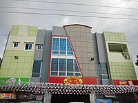
 Downtown area | |
 Map of Tarlac with Gerona highlighted | |
Location within the Philippines | |
| Coordinates: 15°36′25″N 120°35′55″E / 15.6069°N 120.5986°E | |
| Country | Philippines |
| Region | Central Luzon |
| Province | Tarlac |
| District | 2nd district |
| Barangays | 44 (see Barangays) |
| Government | |
| • Type | Sangguniang Bayan |
| • Mayor | Eloy C. Eclar[1] |
| • Vice Mayor | Ronald T. Go[1] |
| • Representative | Victor A. Yap |
| • Electorate | 57,320 voters (2022) |
| Area | |
| • Total | 128.89 km2 (49.76 sq mi) |
| Elevation | 29 m (95 ft) |
| Highest elevation | 50 m (160 ft) |
| Lowest elevation | 19 m (62 ft) |
| Population (2020 census)[4] | |
| • Total | 94,485 |
| • Density | 730/km2 (1,900/sq mi) |
| • Households | 23,696 |
| Demonym | Geronian |
| Economy | |
| • Income class | 1st municipal income class |
| • Poverty incidence | 10.66 |
| • Revenue | 260,703,176.70 (2020)[6] |
| • Assets | ₱ 623.5 million (2020) |
| • Expenditure | ₱ 241.9 million (2020) |
| • Liabilities | ₱ 126.7 million (2020) |
| Service provider | |
| • Electricity | Tarlac 1 Electric Cooperative (TARELCO 1) |
| Time zone | UTC+8 (PST) |
| ZIP code | 2302 |
| PSGC | |
| IDD : area code | +63 (0)45 |
| Native languages | Kapampangan Tagalog Ilocano |
| Website | geronatarlac |
Gerona, officially the Municipality of Gerona (Ilocano: Ili ti Gerona; Kapampangan: Balen ning Gerona, Tagalog: Bayan ng Gerona), is a 1st class municipality in the province of Tarlac, Philippines. According to the 2020 census, it has a population of 94,485 people.[4]
The MacArthur Highway goes through the center of the town.
Geography
[edit]Gerona is one of the 17 towns of the province of Tarlac. It is bounded on the north by Paniqui; on the east by the Pura; on the south by the provincial capital Tarlac City; and on the west by Santa Ignacia. The town is 14 kilometres (8.7 mi) from Tarlac City the provincial capital, 72 kilometres (45 mi) from the regional center San Fernando, and 138 kilometres (86 mi) north of Metro Manila.
Gerona has a land area of 141.47 square kilometres (54.62 sq mi) of plain and rugged agricultural land representing 4.63% of the province total area. The Tarlac River, which originates from the eastern slopes of the Zambales Mountains, cuts across the west central areas, dividing the town into two parts.
The eastern area consists of 31 barangays with total land area of 90.50 square kilometres (34.94 sq mi) representing 63.9% of the total area. It is characterized as plain, low-lying agricultural land.
The second part is the Western Area consisting of 13 barangays with total area of 50.97 square kilometres (19.68 sq mi) representing 36.03% of the total land area. It is characterized by hilly and rugged agricultural land and is also forested.
Barangays
[edit]Gerona is politically subdivided into 44 barangays. [7] Each barangay consists of puroks and some have sitios.
- Abagon
- Amacalan
- Apsayan
- Ayson
- Bawa
- Buenlag
- Bularit
- Calayaan
- Carbonel
- Cardona
- Caturay
- Danzo
- Dicolor
- Don Basilio
- Luna
- Mabini
- Magaspac
- Malayep
- Matapitap
- Matayuncab
- New Salem
- Oloybuaya
- Padapada
- Parsolingan
- Pinasling (Pinasung)
- Plastado
- Poblacion 1
- Poblacion 2
- Poblacion 3
- Quezon
- Rizal
- Salapungan
- San Agustin
- San Antonio
- San Bartolome
- San Jose
- Santa Lucia
- Santiago
- Sembrano
- Singat
- Sulipa
- Tagumbao
- Tangcaran
- Villa Paz
Climate
[edit]| Climate data for Gerona, Tarlac | |||||||||||||
|---|---|---|---|---|---|---|---|---|---|---|---|---|---|
| Month | Jan | Feb | Mar | Apr | May | Jun | Jul | Aug | Sep | Oct | Nov | Dec | Year |
| Mean daily maximum °C (°F) | 30 (86) |
31 (88) |
33 (91) |
35 (95) |
33 (91) |
31 (88) |
30 (86) |
29 (84) |
29 (84) |
30 (86) |
31 (88) |
30 (86) |
31 (88) |
| Mean daily minimum °C (°F) | 19 (66) |
19 (66) |
20 (68) |
22 (72) |
24 (75) |
24 (75) |
24 (75) |
24 (75) |
23 (73) |
22 (72) |
21 (70) |
20 (68) |
22 (71) |
| Average precipitation mm (inches) | 3 (0.1) |
2 (0.1) |
5 (0.2) |
10 (0.4) |
80 (3.1) |
107 (4.2) |
138 (5.4) |
147 (5.8) |
119 (4.7) |
70 (2.8) |
26 (1.0) |
8 (0.3) |
715 (28.1) |
| Average rainy days | 2.0 | 1.7 | 2.7 | 4.6 | 16.1 | 20.8 | 24.0 | 23.0 | 21.4 | 15.5 | 8.0 | 3.2 | 143 |
| Source: Meteoblue[8] | |||||||||||||
Demographics
[edit]
|
| |||||||||||||||||||||||||||||||||||||||||||||||||||
| Source: Philippine Statistics Authority[9][10][11][12] | ||||||||||||||||||||||||||||||||||||||||||||||||||||
In the 2020 census, the population of Gerona, Tarlac, was 94,485 people,[4] with a density of 730 inhabitants per square kilometre or 1,900 inhabitants per square mile.
Economy
[edit]Poverty incidence of Gerona
5
10
15
20
2006
13.90 2009
17.59 2012
10.94 2015
12.82 2018
6.13 2021
10.66 Source: Philippine Statistics Authority[13][14][15][16][17][18][19][20] |
Points of interest
[edit]- 1894 Saint Catherine of Alexandria Church of Gerona[21][22] (Vicariate of St. Catherine of Alexandria, Vicar Forane: Father Alfredo Dizon, Titular: Saint Catherine of Alexandria, Feast day, November 24 Parish Priest: Father Alfredo Dizon, succeeded by Fr. Ramon Capuno[23][24] Parochial Vicar: Rev. Fr. Paulo Dela Cruz[23] - Don Federico Bartolome Street, McArthur Highway, Gerona, Tarlac 2302, Philippines[25][26][27][28] under the Roman Catholic Diocese of Tarlac Roman Catholic Diocese of Tarlac[29] led by Most Rev. Florentino F. Cinense, D.D., PhD, STL.
Gallery
[edit]-
Town hall
-
Public market
-
Chuzon Supermarket
-
Auditorium
-
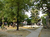
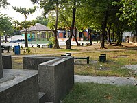
Park
-
Plaza and park
References
[edit]- ^ a b "Elected Officials - Official Website of Municipality of Gerona, Province of Tarlac - Home".
- ^ Municipality of Gerona | (DILG)
- ^ "2015 Census of Population, Report No. 3 – Population, Land Area, and Population Density" (PDF). Philippine Statistics Authority. Quezon City, Philippines. August 2016. ISSN 0117-1453. Archived (PDF) from the original on May 25, 2021. Retrieved July 16, 2021.
{{cite web}}: CS1 maint: year (link) - ^ a b c Census of Population (2020). "Region III (Central Luzon)". Total Population by Province, City, Municipality and Barangay. Philippine Statistics Authority. Retrieved 8 July 2021.
- ^ "PSA Releases the 2021 City and Municipal Level Poverty Estimates". Philippine Statistics Authority. 2 April 2024. Retrieved 28 April 2024.
- ^ "Cities and Municipalities Competitiveness Index". Retrieved 5 March 2020.
- ^ "Province: Tarlac". PSGC Interactive. Quezon City, Philippines: Philippine Statistics Authority. Retrieved 12 November 2016.
- ^ "Gerona: Average Temperatures and Rainfall". Meteoblue. Retrieved 5 May 2020.
- ^ Census of Population (2015). "Region III (Central Luzon)". Total Population by Province, City, Municipality and Barangay. Philippine Statistics Authority. Retrieved 20 June 2016.
- ^ Census of Population and Housing (2010). "Region III (Central Luzon)" (PDF). Total Population by Province, City, Municipality and Barangay. National Statistics Office. Retrieved 29 June 2016.
- ^ Censuses of Population (1903–2007). "Region III (Central Luzon)". Table 1. Population Enumerated in Various Censuses by Province/Highly Urbanized City: 1903 to 2007. National Statistics Office.
{{cite encyclopedia}}: CS1 maint: numeric names: authors list (link) - ^ "Province of Tarlac". Municipality Population Data. Local Water Utilities Administration Research Division. Retrieved 17 December 2016.
- ^ "Poverty incidence (PI):". Philippine Statistics Authority. Retrieved December 28, 2020.
- ^ "Estimation of Local Poverty in the Philippines" (PDF). Philippine Statistics Authority. 29 November 2005.
- ^ "2003 City and Municipal Level Poverty Estimates" (PDF). Philippine Statistics Authority. 23 March 2009.
- ^ "City and Municipal Level Poverty Estimates; 2006 and 2009" (PDF). Philippine Statistics Authority. 3 August 2012.
- ^ "2012 Municipal and City Level Poverty Estimates" (PDF). Philippine Statistics Authority. 31 May 2016.
- ^ "Municipal and City Level Small Area Poverty Estimates; 2009, 2012 and 2015". Philippine Statistics Authority. 10 July 2019.
- ^ "PSA Releases the 2018 Municipal and City Level Poverty Estimates". Philippine Statistics Authority. 15 December 2021. Retrieved 22 January 2022.
- ^ "PSA Releases the 2021 City and Municipal Level Poverty Estimates". Philippine Statistics Authority. 2 April 2024. Retrieved 28 April 2024.
- ^ "List of Parishes of the Roman Catholic Diocese of Tarlac | Philippine Churches". Archived from the original on 2012-09-03. Retrieved 2013-05-01.
- ^ "diocese of tarlac - vicariates - Wix.com".
- ^ a b "St. Catherine of Alexandria Church of Gerona". Foursquare.
- ^ "diocese of tarlac - vicariates - Wix.com".
- ^ "St. Catherine of Alexandria Parish Church Gerona, Tarlac Philippines". www.fotothing.com.
- ^ "Saint Catherine of Alexandria Parish - Tungkol - Google+". Archived from the original on 14 November 2013.
- ^ "Feast of St. Catherine de Alexandria- Gerona - Visit Tarlac". Archived from the original on 2013-06-30. Retrieved 2013-05-01.
- ^ "History of Tarlac Towns". 20 August 2011.
- ^ "Diocese of Tarlac". www.cbcponline.net. Archived from the original on 2010-06-17. Retrieved 2013-05-01.


