Rakovica, Croatia
Rakovica | |
|---|---|
| Municipality of Rakovica Općina Rakovica | |
 Rakovica centre | |
| Coordinates: 45°01′00″N 15°39′00″E / 45.01667°N 15.65000°E | |
| Country | |
| Region | Continental Croatia |
| County | |
| Municipality | Rakovica, Croatia |
| Area | |
| • Municipality | 256.4 km2 (99.0 sq mi) |
| • Urban | 2.1 km2 (0.8 sq mi) |
| Elevation | 350 m (1,150 ft) |
| Population (2021)[2] | |
| • Municipality | 2,230 |
| • Density | 8.7/km2 (23/sq mi) |
| • Urban | 247 |
| • Urban density | 120/km2 (300/sq mi) |
| Time zone | UTC+1 (CET) |
| • Summer (DST) | UTC+2 (CEST) |
| Postal codes | 47245 |
| Area code | (+385) 47 |
| Website | rakovica |


Rakovica is a village and a municipality in south-central Croatia, in the region of Kordun south of Karlovac and Slunj, and north of the Plitvice Lakes. Rakovica is an underdeveloped municipality which is statistically classified as the First Category Area of Special State Concern by the Government of Croatia.[3]
History
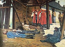
[edit]Rakovica achieved some prominence in Croatian history in October 1871, when several members of the Croatian Party of Rights led by Eugen Kvaternik disavowed the official party position advocating a political solution to the issue of Croatia within the Habsburg monarchy and instead launched a revolt in the village.
Demographics
[edit]The total municipality population is 2,387 (2011), while the village itself has 310 residents.[4] According to that census, 94.8% (2,262) are Croats and 3.2% (77) are ethnic Serbs.[5]
Settlements
[edit]According to the 2011 census,[4] the municipality or Rakovica consists of the following settlements:
- Basara, population 4
- Brajdić Selo, population 79
- Brezovac, population 8
- Broćanac, population 25
- Čatrnja, population 228
- Ćuić Brdo, population 1
- Drage, population 17
- Drežnik Grad, population 323
- Gornja Močila, population 4
- Grabovac, population 338
- Irinovac, population 137
- Jamarje, population 0
- Jelov Klanac, population 79
- Koranski Lug, population 0
- Kordunski Ljeskovac, population 9
- Korita, population 46
- Lipovac, population 15
- Lipovača, population 133
- Mašvina, population 5
- Nova Kršlja, population 70
- Oštarski Stanovi, population 132
- Rakovica, population 246
- Rakovičko Selište, population 88
- Sadilovac, population 1
- Selište Drežničko, population 290
- Stara Kršlja, population 6
Sights
[edit]Due to proximity of Plitvice Lakes, one of the main fields of income is tourism. One of its sights are the Caves of Barać which were reopened for visitors in 2004.
See also
[edit]References
[edit]- ^ Register of spatial units of the State Geodetic Administration of the Republic of Croatia. Wikidata Q119585703.
- ^ "Population by Age and Sex, by Settlements" (xlsx). Census of Population, Households and Dwellings in 2021. Zagreb: Croatian Bureau of Statistics. 2022.
- ^ Lovrinčević, Željko; Davor, Mikulić; Budak, Jelena (June 2004). "AREAS OF SPECIAL STATE CONCERN IN CROATIA- REGIONAL DEVELOPMENT DIFFERENCES AND THE DEMOGRAPHIC AND EDUCATIONAL CHARACTERISTICS". Ekonomski pregled, Vol.55 No.5-6. Archived from the original on 18 August 2018. Retrieved 25 August 2018.
- ^ a b "Population by Age and Sex, by Settlements, 2011 Census: Rakovica". Census of Population, Households and Dwellings 2011. Zagreb: Croatian Bureau of Statistics. December 2012.
- ^ "Population by Ethnicity, by Towns/Municipalities, 2011 Census: County of Karlovac". Census of Population, Households and Dwellings 2011. Zagreb: Croatian Bureau of Statistics. December 2012.
External links
[edit]- Official website (in Croatian)
45°01′00″N 15°39′00″E / 45.01667°N 15.65000°E


