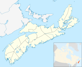
Baccaro, Nova Scotia
Appearance
Baccaro | |
|---|---|
Community | |
 Baccaro Light | |
| Coordinates: 43°28′45″N 65°28′26″W / 43.479167°N 65.473889°W[1] | |
| Country | |
| Province | |
| County | Shelburne |
| Municipal district | Barrington |
| Time zone | UTC-4 (AST) |
| • Summer (DST) | UTC-3 (ADT) |
| Postal code(s) | |
| Area code | 902 |
Baccaro (/ˈbækəroʊ/ BAK-ə-roh)[3] is a community in the Canadian province of Nova Scotia, located in the Barrington Municipal District.[4]
Baccaro Point has a weather station (Station ID WCP). It is mainland Nova Scotia's southernmost point. However, there are a few islands, such as Cape Sable Island, that are further south.[5]
See also
[edit]References
[edit]- ^ Nova Scotia Geographical Names: Baccaro[permanent dead link]
- ^ a b 2006 Statistics Canada Community Profile: Barrington Municipal District, Nova Scotia
- ^ The Canadian Press (2017), The Canadian Press Stylebook (18th ed.), Toronto: The Canadian Press
- ^ Government of Nova Scotia website: Community Counts
- ^ "Baccaro Point Lighthouse".
External links
[edit]Wikimedia Commons has media related to Baccaro, Nova Scotia.
43°28′45″N 65°28′26″W / 43.47917°N 65.47389°W

