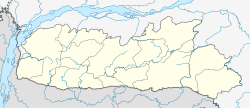
Madanrting
Appearance
Madanryting | |
|---|---|
suburb | |
| Coordinates: 25°33′44″N 91°53′36″E / 25.5623500°N 91.8934200°E | |
| Under Community Development Block | |
| State | Meghalaya |
| District | East Khasi Hills |
| Government | |
| • Type | Traditional Chief called Headman elected in the General Meeting of adult citizens |
| • Body | Village Durbar |
| Population (2001) | |
| • Total | 16,700 |
| Languages | |
| • Official | Khasi, English |
| Time zone | UTC+5:30 (IST) |
| Vehicle registration | ML |
Madanrting is a census town in East Khasi Hills district in the Indian state of Meghalaya.
Demographics
[edit]As of 2001[update] India census,[1] Madanrting had a population of 16,700. Males constitute 51% of the population and females 49%. Madanrting has an average literacy rate of 76%, higher than the national average of 59.5%: male literacy is 80%, and female literacy is 72%. In Madanrting, 13% of the population is under 6 years of age.
References
[edit]- ^ "Census of India 2001: Data from the 2001 Census, including cities, villages and towns (Provisional)". Census Commission of India. Archived from the original on 16 June 2004. Retrieved 1 November 2008.


