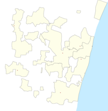
Pondicherry Airport
Pondicherry Airport | |||||||||||
|---|---|---|---|---|---|---|---|---|---|---|---|
 | |||||||||||
| Summary | |||||||||||
| Airport type | Public | ||||||||||
| Owner | Airports Authority of India | ||||||||||
| Operator | Airports Authority of India | ||||||||||
| Serves | Puducherry | ||||||||||
| Location | Lawspet, Puducherry, India | ||||||||||
| Opened | 1989 | ||||||||||
| Elevation AMSL | 41 m / 134 ft | ||||||||||
| Coordinates | 11°58′00″N 79°48′52″E / 11.96667°N 79.81444°E | ||||||||||
| Website | Puducherry Airport | ||||||||||
| Map | |||||||||||
| Runways | |||||||||||
| |||||||||||
| Statistics (April 2023 - March 2024) | |||||||||||
| |||||||||||
Pondicherry Airport (IATA: PNY, ICAO: VOPC) is a domestic airport serving the union territory of Puducherry, India. It is located at Lawspet, situated 8.1 km (5.0 mi) from the international community of Auroville. The airport has scheduled flights and operations of the local flying training school. In 2007, the Government of Puducherry decided to expand the airport to accommodate larger aircraft and commissioned a new terminal building.[4] The new terminal was inaugurated on 18 January 2013, with the arrival of a SpiceJet flight from Bengaluru.[5] After a gap of three years, the airport was operationalised again under the UDAN scheme in August 2017, with daily flights to Hyderabad and Bengaluru.[6]
History
[edit]The airport was constructed in 1989. Between that year and 1991, regional airline Vayudoot flew to Madras, Neyveli, and Bangalore, however the flights were not successful and all were ended. The airport remained in disuse for the following two decades.[7]
In June 2007, a memorandum of understanding (MoU) was signed between the local government and the Airports Authority of India (AAI) for expansion of the airport. For the first phase, 19.92 hectares of land were acquired at ₹ 18.95 crore. Then the new terminal was constructed and the runway extended by 260 m (853 ft), allowing for the landing of ATR aircraft. This phase was completed in late 2012. The second phase of expansion involves acquiring 200 more acres of land to extend the runway by an additional 1,100 m (3,609 ft), allowing larger jet aircraft to land at the airport.[8] The new terminal was inaugurated with the arrival of a SpiceJet Bombardier Dash 8 Q400 aircraft on 17 January 2013 from Bangalore. However, this daily service lasted for only a little over one year as the airline withdrew the flight citing low number of passengers.[7][9] The following year, the airport once again was brought back into operation when Alliance Air commenced flights from Bangalore on 14 April 2015, subsidised by the Pondicherry Government. These flights were suspended six months later due to "payment issues".[10]
In October 2016, the Pondicherry government signed a Tripartite MoU with the Ministry of Civil Aviation (MoCA) and AAI in New Delhi to operationalise the airport under the Regional Connectivity Scheme.[11] Subsequently, SpiceJet was awarded the Hyderabad-Pondicherry route under the scheme in March 2017[12] and the airline commenced operations from 16 August 2017.[13] SpiceJet later resumed its flight to Bangalore from Pondicherry in February 2018.[14]
Structure
[edit]Puducherry Airport has one asphalt runway, oriented 07/25, 1500 m long and 30 m wide. It has a 100 m by 150 m apron and its new terminal building can handle 300 passengers during peak hours. Navigational aids at Puducherry include an aerodrome beacon.[15] Currently land is being acquired to extend the runway and accommodate larger aircraft to increase flight services and open the airport for international flights.[16]
Airlines and destinations
[edit]| Airlines | Destinations | Refs. |
|---|---|---|
| SpiceJet | Bangalore, Hyderabad | [17] |
Demands
[edit]There are also demands to operate direct flight services between Puducherry to Delhi and Goa.
Statistics
[edit]Graphs are unavailable due to technical issues. There is more info on Phabricator and on MediaWiki.org. |
References
[edit]- ^ "Annexure III – Passenger Data" (PDF). aai.aero. Retrieved 24 April 2024.
- ^ "Annexure II – Aircraft Movement Data" (PDF). aai.aero. Retrieved 24 April 2024.
- ^ "Annexure IV – Freight Movement Data" (PDF). aai.aero. Retrieved 24 April 2024.
- ^ "Flight operations await new terminal". IBN Live. 10 May 2012. Archived from the original on 13 May 2012. Retrieved 3 July 2012.
- ^ "First flight to Pondicherry from Bangalore on January 17". The Hindu. 5 January 2013. Retrieved 6 January 2013.
- ^ "SpiceJet to operate daily flights between Hyderabad and Puducherry starting August 16". The Times of India. Retrieved 31 October 2017.
- ^ a b SpiceJet announces Pondy flight schedule. The New Indian Express. 3 January 2013. Retrieved 7 December 2015.
- ^ "Pondicherry airport to go on stream in October". The Economic Times. 3 September 2011. Retrieved 3 January 2012.
- ^ Jaisankar, C. (31 January 2014). "With last flight, Pondicherry airport runs out of steam". The Hindu. Retrieved 7 December 2015.
- ^ Philip, Annie (19 October 2015). "Puducherry's flight services suspended temporarily". The Hindu.
- ^ "Puducherry Airport To Be Operational From January 2017". NDTV. 1 October 2016. Retrieved 4 September 2018.
- ^ "SpiceJet awarded six routes under regional connectivity scheme". Ultra News. 30 March 2017. Retrieved 4 September 2018.
- ^ "Puducherry back on aviation map; services to Hyderabad launched". The Indian Express. 16 August 2017. Retrieved 4 September 2018.
- ^ "Bangalore-UT flight service resumes". The Hindu. 16 February 2018. Retrieved 4 September 2018.
- ^ "Airport website". Archived from the original on 2 January 2012. Retrieved 3 January 2012.
- ^ "Efforts on to expand Puducherry airport runway: CM Narayanasamy". The Indian Express. 3 August 2017. Retrieved 31 October 2017.
- ^ "SpiceJet Flight Schedule". SpiceJet. Retrieved 2 October 2023.
External links
[edit]![]() Media related to Puducherry Airport at Wikimedia Commons
Media related to Puducherry Airport at Wikimedia Commons
- Airport information for PNY at Great Circle Mapper.
- Accident history for PNY at Aviation Safety Network
- Pondicherry Airport at the Airports Authority of India


