From Wikipedia, the free encyclopedia
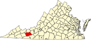
Location of Wythe County in Virginia This is a list of the National Register of Historic Places listings in Wythe County, Virginia .
This is intended to be a complete list of the properties and districts on the National Register of Historic Places in Wythe County , Virginia , United States . The locations of National Register properties and districts for which the latitude and longitude coordinates are included below, may be seen in an online map.[1]
There are 22 properties and districts listed on the National Register in the county.
This National Park Service list is complete through NPS recent listings posted July 26, 2024. [2]
[3] Name on the Register[4]
Image
Date listed[5]
Location
City or town
Description
1
Cornett Archeological Site (44WY1) Cornett Archeological Site (44WY1) September 29, 1983 (#83003320 ) New River below Austinville[6] : 202 36°51′32″N 80°54′44″W / 36.858889°N 80.912222°W / 36.858889; -80.912222 (Cornett Archeological Site (44WY1) ) Austinville
2
Crockett's Cove Presbyterian Church Crockett's Cove Presbyterian Church October 15, 1992 (#92001373 ) Crockett's Cove Rd., east of its junction with Smith Hollow Rd. 37°01′35″N 81°02′14″W / 37.026250°N 81.037222°W / 37.026250; -81.037222 (Crockett's Cove Presbyterian Church ) Wytheville
3
Fort Chiswell Mansion Fort Chiswell Mansion May 6, 1971 (#71000992 ) 325 Factory Outlet Drive; Interstate 81 near its junction with U.S. Route 52 and State Route 121 36°56′46″N 80°56′12″W / 36.946111°N 80.936667°W / 36.946111; -80.936667 (Fort Chiswell Mansion ) Fort Chiswell
4
Fort Chiswell Site Fort Chiswell Site August 29, 1978 (#78003046 ) E Lee Highway 36°56′54″N 80°56′04″W / 36.948406°N 80.934319°W / 36.948406; -80.934319 (Fort Chiswell Site ) Fort Chiswell
5
Foster Falls Historic District Foster Falls Historic District November 12, 2009 (#09000925 ) New River Trail State Park , 176 Orphanage Dr.36°53′03″N 80°51′19″W / 36.884167°N 80.855278°W / 36.884167; -80.855278 (Foster Falls Historic District ) Max Meadows
6
Andrew and Sarah Fulton Farm Upload image May 26, 2022 (#100007782 ) 531 Kohler Ave. 36°51′42″N 80°54′17″W / 36.8618°N 80.9046°W / 36.8618; -80.9046 (Andrew and Sarah Fulton Farm ) Austinville vicinity
7
Graham's Forge Mill Graham's Forge Mill May 26, 2005 (#05000481 ) Major Graham Rd. 36°56′27″N 80°53′12″W / 36.940833°N 80.886667°W / 36.940833; -80.886667 (Graham's Forge Mill ) Max Meadows
8
Maj. David Graham House Maj. David Graham House February 14, 1985 (#85000300 ) Junction of Major Grahams and Carters Ferry Rds. 36°54′58″N 80°52′18″W / 36.916111°N 80.871667°W / 36.916111; -80.871667 (Maj. David Graham House ) Fosters Falls
9
Haller-Gibboney Rock House Haller-Gibboney Rock House November 9, 1972 (#72001419 ) Monroe and Tazewell Sts. 36°57′02″N 81°05′04″W / 36.950556°N 81.084444°W / 36.950556; -81.084444 (Haller-Gibboney Rock House ) Wytheville
10
Kimberling Lutheran Cemetery Kimberling Lutheran Cemetery March 26, 1980 (#80004231 ) Northwest of Rural Retreat 36°55′05″N 81°18′17″W / 36.918056°N 81.304722°W / 36.918056; -81.304722 (Kimberling Lutheran Cemetery ) Rural Retreat
11
Loretto Loretto September 8, 1994 (#94001093 ) 190 Peppers Ferry Rd. 36°57′27″N 81°04′49″W / 36.95750°N 81.080278°W / 36.95750; -81.080278 (Loretto ) Wytheville
12
Martin Site Martin Site August 13, 1974 (#74002152 ) Bounded by Reed Creek Rd., the New River , and Reed Creek[6] : 172 36°55′24″N 80°49′33″W / 36.923333°N 80.825833°W / 36.923333; -80.825833 (Martin Site ) Fosters Falls
13
McGavock Family Cemetery McGavock Family Cemetery June 22, 1979 (#79003098 ) East of Fort Chiswell off Interstate 81 36°56′52″N 80°55′29″W / 36.947778°N 80.924722°W / 36.947778; -80.924722 (McGavock Family Cemetery ) Fort Chiswell
14
Reed Creek Mill Reed Creek Mill November 22, 2016 (#16000802 ) 1565 S. Church St. 36°56′09″N 81°04′28″W / 36.935833°N 81.074444°W / 36.935833; -81.074444 (Reed Creek Mill ) Wytheville
15
Rural Retreat Depot Rural Retreat Depot August 25, 2014 (#14000531 ) 105 Railroad Ave. 36°53′38″N 81°16′35″W / 36.893889°N 81.276389°W / 36.893889; -81.276389 (Rural Retreat Depot ) Rural Retreat
16
Sanders Farm Sanders Farm May 22, 2003 (#03000454 ) 3908 Fort Chiswell Rd. 36°52′26″N 80°52′16″W / 36.873750°N 80.871111°W / 36.873750; -80.871111 (Sanders Farm ) Max Meadows
17
Shot Tower Shot Tower October 1, 1969 (#69000286 ) West of the junction of U.S. Route 52 with Foster Falls Rd. 36°52′13″N 80°52′13″W / 36.870194°N 80.870278°W / 36.870194; -80.870278 (Shot Tower ) Max Meadows
18
St. John's Episcopal Church St. John's Episcopal Church September 9, 2008 (#08000894 ) 275 E. Main St. 36°57′03″N 81°04′55″W / 36.950833°N 81.081944°W / 36.950833; -81.081944 (St. John's Episcopal Church ) Wytheville
19
St. John's Lutheran Church and Cemetery St. John's Lutheran Church and Cemetery January 26, 1978 (#78003047 ) Northwest of Wytheville at the junction of U.S. Routes 21 /52 with Interstate 81 36°57′42″N 81°06′03″W / 36.961667°N 81.100833°W / 36.961667; -81.100833 (St. John's Lutheran Church and Cemetery ) Wytheville
20
Wythe County Poorhouse Farm Wythe County Poorhouse Farm May 26, 2000 (#00000557 ) Peppers Ferry Rd. 36°58′56″N 81°01′42″W / 36.982222°N 81.028333°W / 36.982222; -81.028333 (Wythe County Poorhouse Farm ) Wytheville
21
Wytheville Historic District Wytheville Historic District September 30, 1994 (#94001179 ) Roughly bounded by Monroe, 11th, Jefferson, and 12th Sts., and W. Railroad Ave. 36°56′50″N 81°05′04″W / 36.947222°N 81.084444°W / 36.947222; -81.084444 (Wytheville Historic District ) Wytheville
22
Zion Evangelical Lutheran Church Cemetery Zion Evangelical Lutheran Church Cemetery February 1, 1979 (#79003099 ) Northwest of Speedwell 36°50′28″N 81°13′21″W / 36.841111°N 81.2225°W / 36.841111; -81.2225 (Zion Evangelical Lutheran Church Cemetery ) Speedwell
^ The latitude and longitude information provided in this table was derived originally from the National Register Information System, which has been found to be fairly accurate for about 99% of listings. Some locations in this table may have been corrected to current GPS standards.
^ National Park Service, United States Department of the Interior , "National Register of Historic Places: Weekly List Actions" , retrieved July 26, 2024.
^ Numbers represent an alphabetical ordering by significant words. Various colorings, defined here , differentiate National Historic Landmarks and historic districts from other NRHP buildings, structures, sites or objects.
^ "National Register Information System" . National Register of Historic Places National Park Service . April 24, 2008.^ The eight-digit number below each date is the number assigned to each location in the National Register Information System database, which can be viewed by clicking the number.
^ a b MacCord, Howard A. "The Martin Site (44WY13), Wythe County, Virginia". Quarterly bulletin of the Archeological Society of Virginia 53.4 (1998): 171-203.
Lists Lists Other lists