From Wikipedia, the free encyclopedia
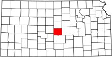
Location of Rice County in Kansas This is a list of the National Register of Historic Places listings in Rice County, Kansas .
This is intended to be a complete list of the properties and districts on the National Register of Historic Places in Rice County , Kansas , United States . The locations of National Register properties and districts for which the latitude and longitude coordinates are included below may be seen on a map.[ 1] National Historic Landmark and two former listings.
This National Park Service list is complete through NPS recent listings posted August 16, 2024. [ 2]
[ 3] Name on the Register[ 4]
Image
Date listed[ 5]
Location
City or town
Description
1
Archeological Site Number 14RC10 Upload image July 9, 1982 (#82004887 ) 9 miles (14 km) northeast of Lyons[ 6] Little River A petroglyph site located near the Tobias-Thompson Complex and perhaps related to it[ 6]
2
Archeological Site Number 14RC11 Upload image July 9, 1982 (#82004866 ) Address restricted Little River
3
Cooper Hall Upload image May 3, 1974 (#74000845 ) N. Broadway Ave. 38°13′18″N 98°12′27″W / 38.221667°N 98.2075°W / 38.221667; -98.2075 (Cooper Hall ) Sterling
4
Little Arkansas River Crossing Upload image April 5, 2014 (#14000122 ) Northeast of the junction of Ave. P and 30th Rd. 38°18′15″N 97°56′36″W / 38.304203°N 97.943345°W / 38.304203; -97.943345 (Little Arkansas River Crossing ) Windom Santa Fe Trail Multiple Property Submission
5
Malone Archeological Site Upload image June 26, 1972 (#72000523 ) Eastern side of Cow Creek , west of Lyons[ 7] : 188 38°21′00″N 98°17′24″W / 38.350000°N 98.290000°W / 38.350000; -98.290000 (Malone Archeological Site ) Lyons
6
Rice County Courthouse Rice County Courthouse April 26, 2002 (#02000401 ) 101 W. Commercial St. 38°20′50″N 98°12′13″W / 38.347222°N 98.203611°W / 38.347222; -98.203611 (Rice County Courthouse ) Lyons
7
Rice County Jail and Sheriff's Residence Upload image September 30, 2021 (#100007026 ) 120 East Main St. 38°20′52″N 98°12′11″W / 38.3477°N 98.2030°W / 38.3477; -98.2030 (Rice County Jail and Sheriff's Residence ) Lyons
8
Santa Fe Trail-Rice County Trail Segments Upload image May 11, 1995 (#95000582 ) Bushton Blacktop (FAS Highway 570), ¾ mile north of U.S. Route 56 ; also 4th Rd. at Av. L, ¾ mile north of U.S. Route 56 38°21′34″N 98°25′20″W / 38.359444°N 98.422222°W / 38.359444; -98.422222 (Santa Fe Trail-Rice County Trail Segments ) Chase 4th and L represents a boundary increase of July 17, 2013
9
Santa Fe Trail-Rice County Segment 2 Upload image August 6, 2013 (#13000580 ) Ave. P, ¾ mile west of 30th Rd. 38°18′15″N 97°57′26″W / 38.304251°N 97.957180°W / 38.304251; -97.957180 (Santa Fe Trail-Rice County Segment 2 ) Little River Santa Fe Trail Multiple Property Submission
10
Santa Fe Trail-Rice County Segment 3 Upload image August 6, 2013 (#13000581 ) Address Restricted Windom Santa Fe Trail Multiple Property Submission
11
Saxman Site Upload image May 3, 1976 (#76000837 ) 0.5 miles (0.80 km) south of Saxman on Cow Creek[ 7] : 192 38°16′26″N 98°07′26″W / 38.273889°N 98.123889°W / 38.273889; -98.123889 (Saxman Site ) Saxman
12
Shay Building Upload image April 12, 2010 (#10000179 ) 202 S. Broadway Ave. 38°12′31″N 98°12′24″W / 38.208481°N 98.206794°W / 38.208481; -98.206794 (Shay Building ) Sterling
13
Station Little Arkansas Upload image May 11, 1995 (#95000583 ) 5 miles south of U.S. Route 56 on FAS Highway 443, ¾ miles west on gravel road 38°18′10″N 97°56′11″W / 38.302778°N 97.936389°W / 38.302778; -97.936389 (Station Little Arkansas ) Windom
14
Sterling Free Public Carnegie Library Upload image June 25, 1987 (#87000969 ) 132 N. Broadway 38°12′38″N 98°12′25″W / 38.210486°N 98.206825°W / 38.210486; -98.206825 (Sterling Free Public Carnegie Library ) Sterling Red brick Carnegie library built in 1916, funded by a $10,000 grant
15
Tobias-Thompson Complex Tobias-Thompson Complex October 15, 1966 (#66000349 ) 4 miles southeast of Geneseo 38°27′24″N 98°05′31″W / 38.456667°N 98.091944°W / 38.456667; -98.091944 (Tobias-Thompson Complex ) Geneseo
^ The latitude and longitude information provided in this table was derived originally from the National Register Information System, which has been found to be fairly accurate for about 99% of listings. Some locations in this table may have been corrected to current GPS standards.
^ National Park Service, United States Department of the Interior , "National Register of Historic Places: Weekly List Actions" , retrieved August 16, 2024.
^ a b Numbers represent an alphabetical ordering by significant words. Various colorings, defined here , differentiate National Historic Landmarks and historic districts from other NRHP buildings, structures, sites or objects.
^ "National Register Information System" . National Register of Historic Places National Park Service . March 13, 2009.^ The eight-digit number below each date is the number assigned to each location in the National Register Information System database, which can be viewed by clicking the number.
^ a b Wedel, Waldo . "A Shield and Spear Petroglyph from Central Kansas: Some Possible Implications ". Plains Anthropologist 14.44 (1969): 125-129: 125.^ a b Wedel, Waldo . "Chain Mail in Plains Archeology ". Plains Anthropologist 20.69 (1975): 187-196.
Topics Lists by county Other lists


