Camp Garcia Vieques
This article needs additional citations for verification. (March 2021) |
Camp Garcia Vieques Airport | |||||||||||
|---|---|---|---|---|---|---|---|---|---|---|---|
 | |||||||||||
| Summary | |||||||||||
| Location | Vieques, Puerto Rico | ||||||||||
| Coordinates | 18°06′57″N 065°25′22″W / 18.11583°N 65.42278°W | ||||||||||
| Map | |||||||||||
| Runways | |||||||||||
| |||||||||||
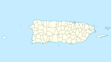
MCAS Vieques Airport was a Marine Corps Air Station (MCAS) at MCB Camp Garcia on the island-municipality of Vieques in Puerto Rico. It was built in 1960 by USMC engineers and consisted of a single 5,000 ft east–west runway.[1] It was used to fly in troops, equipment and supplies to support amphibious landing training missions.[1]
MCB Camp Garcia was a U.S. Marine Corps base, Camp Garcia Gate.[2]
The base was used for amphibious landing training purposes.[1] Camp Garcia hosted the Atlantic Fleet's Composite Training Unit Exercises and served as the premiere training area for the Atlantic Fleet for more than 60 years.
It also housed a MARS (Military Auxiliary Radio System) radio relay station.
Camp Garcia was named after Marine Corps Private 1st Class Fernando Garcia, a Medal of Honor recipient during the Korean War and a native of Puerto Rico. It was located on the island of Vieques (part of the Puerto Rico Commonwealth). The base closed in 2003.[1]
References
[edit]- ^ a b c d "Abandoned & Little-Known Airfields: Eastern Puerto Rico". www.airfields-freeman.com. Retrieved 2021-03-25.
- ^ "Photograph of Frank Haussmann". 2019-02-05. Archived from the original on 2019-02-05. Retrieved 2021-03-25.
External links
[edit]

