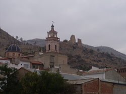
Gestalgar
Appearance
This article needs additional citations for verification. (April 2024) |
Gestalgar | |
|---|---|
 | |
| Coordinates: 39°36′18″N 0°50′4″W / 39.60500°N 0.83444°W | |
| Country | |
| Autonomous community | |
| Province | Valencia |
| Comarca | Los Serranos |
| Judicial district | Llíria |
| Government | |
| • Alcalde | Rafael Pardos Peiró |
| Area | |
| • Total | 69.7 km2 (26.9 sq mi) |
| Elevation | 200 m (700 ft) |
| Population (2018)[1] | |
| • Total | 554 |
| • Density | 7.9/km2 (21/sq mi) |
| Demonym | Gestalguino/a |
| Time zone | UTC+1 (CET) |
| • Summer (DST) | UTC+2 (CEST) |
| Postal code | 46166 |
| Official language(s) | Spanish |
| Website | Official website |
Gestalgar is a municipality of the comarca of Los Serranos in the Valencian Community, Spain. The name in Valencian is Xestalgar, but the local language is Spanish, not Valencian.
References
[edit]- ^ Municipal Register of Spain 2018. National Statistics Institute.
Wikimedia Commons has media related to Gestalgar.


