Ksani
Appearance
| Ksani | |
|---|---|
 Ravine of Ksani | |
| Native name | |
| Location | |
| Country | Georgia (South Ossetia)[1] |
| Physical characteristics | |
| Source | Greater Caucasus |
| Mouth | Kura |
• coordinates | 41°51′17″N 44°33′45″E / 41.8546°N 44.5626°E |
| Length | 84 km (52 mi) |
| Basin size | 885 km2 (342 sq mi) |
| Basin features | |
| Progression | Kura→ Caspian Sea |
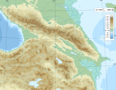
The Ksani (Georgian: ქსანი, Ossetian: Чысандон, Ĉysandon) is a river in central Georgia, which rises on the southern slopes of the Greater Caucasus Mountain Range in South Ossetia and flows into the Kura (Mtkvari). It is a left tributary of the Kura. The Ksani is 84 km (52 mi) long, and has a drainage basin of 885 km2 (342 sq mi).[2] Ksani (both the river and the name) is often associated with the Medieval Georgian Ksani fortress which lies near the confluence of the Ksani and the Mtkvari.
See also
[edit]References
[edit]- ^ South Ossetia's status is disputed. It considers itself to be an independent state, but this is recognised by only a few other countries. The Georgian government and most of the world's other states consider South Ossetia de jure a part of Georgia's territory.
- ^ Statistical Yearbook of Georgia: 2020, National Statistics Office of Georgia, Tbilisi, 2020, p. 12.


