Kremenchuk Airport
Appearance
Kremenchuk (Velyka Kokhnivka) Airport Аеропорт «Кременчук» Аэропорт «Кременчуг» | |
|---|---|
| Summary | |
| Airport type | Public/military |
| Serves | Kremenchuk, Poltava Oblast, Ukraine |
| Coordinates | 49°07′51″N 033°28′31″E / 49.13083°N 33.47528°E |
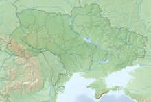
| Map | |
 | |
Kremenchuk (Velyka Kokhnivka) Airport (Ukrainian: Аеропорт «Кременчук», Russian: Аэропорт «Кременчуг») (IATA: KHU, ICAO: UKHK) is an airport in the Poltava Oblast, Ukraine. It is located at 5 km in the North-East of the Kremenchuk city.
In the 1990s, part of the airfield was transferred to a private company. Now it is used as a fuel and lubricants warehouse. Today, the airfield in Velyka Kokhnivka accepts helicopters and small airplanes An-24 and Yak-40."
References
[edit]- ^ Airport information for KHU at Great Circle Mapper. Source: DAFIF (effective October 2006).
- ^ Accident history for KHU at Aviation Safety Network
- ^ Airport information for Kremenchuk Airport at Transport Search website.


