From Wikipedia, the free encyclopedia
North Ayrshire shown within Scotland This is a list of Category A listed buildings in the North Ayrshire council area in Scotland .
In Scotland, the term listed building refers to a building or other structure officially designated as being of "special architectural or historic interest".[1] [2] [3] Historic Scotland , an executive agency of the Scottish Government , which inherited this role from the Scottish Development Department in 1991. Once listed, severe restrictions are imposed on the modifications allowed to a building's structure or its fittings. Listed building consent must be obtained from local authorities prior to any alteration to such a structure.[3] [4]
The council area of North Ayrshire covers 885 square kilometres (342 sq mi), including the Isle of Arran , and has a population of around 135,200. There are 41 Category A listed buildings in the area.
Name
Location
Date Listed
Grid Ref. [note 1] Geo-coordinates
Notes
LB Number [note 2]
Image
Annick Lodge
Irvine
NS3586341846 55°38′33″N 4°36′34″W / 55.642363°N 4.60954°W / 55.642363; -4.60954 (Annick Lodge ) [5] 836
Upload Photo
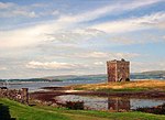
Little Cumbrae Castle
Little Cumbrae , Castle Island
NS1524851348 55°43′13″N 4°56′35″W / 55.720229°N 4.943037°W / 55.720229; -4.943037 (Little Cumbrae Castle ) [6] 853
Upload another image See more images
Woodside House
Beith
NS3475255411 55°45′49″N 4°38′07″W / 55.763741°N 4.635359°W / 55.763741; -4.635359 (Woodside House ) [7] 943
Upload another image See more images
Blair House
Dalry
NS3045348034 55°41′46″N 4°41′57″W / 55.696044°N 4.699218°W / 55.696044; -4.699218 (Blair House ) [8] 1196
Upload Photo
Swindridgemuir
Dalry
NS3195849842 55°42′46″N 4°40′35″W / 55.712795°N 4.676411°W / 55.712795; -4.676411 (Swindridgemuir ) [9] 1254
Upload Photo
Lamp near main door of Skelmorlie Parish Church
Skelmorlie
NS1928668130 55°52′20″N 4°53′24″W / 55.872346°N 4.889981°W / 55.872346; -4.889981 (Lamp near main door of Skelmorlie Parish Church ) [10] 7270
Upload another image
Kelburn Castle
Fairlie
NS2171056704 55°46′15″N 4°50′38″W / 55.770714°N 4.843796°W / 55.770714; -4.843796 (Kelburn Castle ) [11] 7294
Upload another image See more images
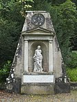
Kelburn Castle , monument to John, 3rd Earl of Glasgow
Fairlie
NS2189056714 55°46′15″N 4°50′27″W / 55.77087°N 4.840937°W / 55.77087; -4.840937 (Kelburn Castle, monument to John, 3rd Earl of Glasgow ) [12] 7295
Upload another image See more images
Kelburn Castle , sundial to west of house
Fairlie
NS2169556706 55°46′15″N 4°50′39″W / 55.770726°N 4.844036°W / 55.770726; -4.844036 (Kelburn Castle, sundial to west of house ) [13] 7298
Upload another image See more images
Knock Castle
Largs
NS1940462998 55°49′35″N 4°53′05″W / 55.826338°N 4.884681°W / 55.826338; -4.884681 (Knock Castle ) [14] 7306
Upload another image See more images
Kilbirnie Auld Kirk
Kilbirnie
NS3147353647 55°44′48″N 4°41′11″W / 55.746777°N 4.686468°W / 55.746777; -4.686468 (Kilbirnie Auld Kirk ) [15] 7492
Upload another image See more images
Ladyland House Sundial
Kilbirnie
NS3220957877 55°47′06″N 4°40′38″W / 55.784998°N 4.677359°W / 55.784998; -4.677359 (Ladyland House Sundial ) [16] 7499
Upload another image
Brodick Castle
Arran
NS0155837866 55°35′38″N 5°09′03″W / 55.593863°N 5.1509°W / 55.593863; -5.1509 (Brodick Castle ) [17] 7507
Upload another image See more images
Brodick Castle Walled Garden
Arran
NS0167137876 55°35′38″N 5°08′57″W / 55.593998°N 5.149117°W / 55.593998; -5.149117 (Brodick Castle Walled Garden ) [18] 7508
Upload another image See more images
Ladyland House
Kilbirnie
NS3219657840 55°47′05″N 4°40′39″W / 55.784661°N 4.677543°W / 55.784661; -4.677543 (Ladyland House ) [19] 7532
Upload another image See more images
Montgreenan
Kilwinning
NS3432344519 55°39′57″N 4°38′08″W / 55.665832°N 4.635593°W / 55.665832; -4.635593 (Montgreenan ) [20] 7577
Upload another image See more images
St. Molio's Church
Arran , Shiskine
NR9099629419 55°30′49″N 5°18′43″W / 55.513672°N 5.31183°W / 55.513672; -5.31183 (St. Molio's Church ) [21] 7635
Upload another image See more images
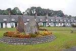
1–27 (inclusive nos) Hamilton Terrace
Arran , Lamlash
NS0269431133 55°32′02″N 5°07′41″W / 55.533916°N 5.128093°W / 55.533916; -5.128093 (1–27 (inclusive nos) Hamilton Terrace ) [22] 13234
Upload another image
Lamlash and Kilbride Parish Church
Arran , Lamlash
NS0256930939 55°31′56″N 5°07′48″W / 55.532125°N 5.129932°W / 55.532125; -5.129932 (Lamlash and Kilbride Parish Church ) [23] 13441
Upload another image See more images
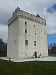
Law Castle
West Kilbride
NS2109448416 55°41′46″N 4°50′53″W / 55.69611°N 4.848177°W / 55.69611; -4.848177 (Law Castle ) [24] 14279
Upload another image See more images
Sundial, Kirktonhall
West Kilbride , Glen Road
NS2052148272 55°41′41″N 4°51′26″W / 55.694606°N 4.857187°W / 55.694606; -4.857187 (Sundial, Kirktonhall ) [25] 14309
Upload another image
Hunterston Castle
Hunterston
NS1928551471 55°43′22″N 4°52′44″W / 55.722855°N 4.878937°W / 55.722855; -4.878937 (Hunterston Castle ) [26] 14313
Upload another image See more images
St Peter-in-Chains RC Church
Ardrossan , South Crescent Road
NS2329242155 55°38′27″N 4°48′33″W / 55.640728°N 4.80922°W / 55.640728; -4.80922 (St Peter-in-Chains RC Church ) [27] 21335
Upload another image
Irvine Old Parish Church and Graveyard
Irvine , Kirkgate
NS3220538672 55°36′45″N 4°39′56″W / 55.612625°N 4.665657°W / 55.612625; -4.665657 (Irvine Old Parish Church and Graveyard ) [28] 35409
Upload another image See more images
Trinity Church
Irvine , Bridgegate
NS3203038801 55°36′49″N 4°40′07″W / 55.613723°N 4.66851°W / 55.613723; -4.66851 (Trinity Church ) [29] 35410
Upload another image See more images
Linthouse Building, Scottish Maritime Museum
Irvine , Montgomery Street
NS3135438542 55°36′40″N 4°40′45″W / 55.611164°N 4.679072°W / 55.611164; -4.679072 (Linthouse Building, Scottish Maritime Museum ) [30] 35450
Upload another image
SV Carrick , Scottish Maritime Museum
Irvine , Montgomery Street
NS3135038630 55°36′43″N 4°40′45″W / 55.611953°N 4.679189°W / 55.611953; -4.679189 (SV Carrick , Scottish Maritime Museum ) [31] 35451
Upload Photo
Kilwinning Abbey
Kilwinning
NS3032443274 55°39′12″N 4°41′54″W / 55.653277°N 4.698324°W / 55.653277; -4.698324 (Kilwinning Abbey ) [32] 36237
Upload another image See more images
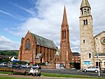
Clark Memorial Church
Largs , Bath Street
NS2016659316 55°47′37″N 4°52′12″W / 55.793582°N 4.870099°W / 55.793582; -4.870099 (Clark Memorial Church ) [33] 37152
Upload another image See more images
Brooksby Convalescent Home
Largs , Greenock Road
NS2032859792 55°47′52″N 4°52′04″W / 55.797913°N 4.867833°W / 55.797913; -4.867833 (Brooksby Convalescent Home ) [34] 37165
Upload another image See more images
Skelmorlie Aisle
Largs
NS2026559441 55°47′41″N 4°52′07″W / 55.79474°N 4.868605°W / 55.79474; -4.868605 (Skelmorlie Aisle ) [35] 37198
Upload another image See more images
Brisbane Aisle
Largs
NS2024759447 55°47′41″N 4°52′08″W / 55.794787°N 4.868896°W / 55.794787; -4.868896 (Brisbane Aisle ) [36] 37199
Upload another image See more images
Cathedral of The Isles and Collegiate Church of the Holy Spirit
Great Cumbrae , Millport
NS1657755240 55°45′20″N 4°55′28″W / 55.755658°N 4.924522°W / 55.755658; -4.924522 (Cathedral of The Isles and Collegiate Church of the Holy Spirit ) [37] 37824
Upload another image See more images
Seamill Centre, formerly Seamill House
Seamill
NS2044847223 55°41′07″N 4°51′28″W / 55.685166°N 4.85766°W / 55.685166; -4.85766 (Seamill Centre, formerly Seamill House ) [38] 43209
Upload Photo
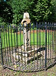
Mercat Cross
Kilwinning
NS3045343352 55°39′14″N 4°41′47″W / 55.654022°N 4.696324°W / 55.654022; -4.696324 (Mercat Cross ) [39] 47598
Upload another image See more images
Brodick Castle , Bavarian Summerhouse
Arran
NS0168337725 55°35′34″N 5°08′56″W / 55.592648°N 5.148818°W / 55.592648; -5.148818 (Brodick Castle, Bavarian Summerhouse ) [40] 47599
Upload another image
^ Guide to the Protection of Scotland’s Listed Buildings (PDF) . Historic Scotland. 2009. p. 4. ISBN 978-1-84917-013-0 . Retrieved 5 May 2010 .^ "What is Listing?" . Historic Scotland. Retrieved 5 May 2010 .^ a b Scottish Historic Environment Policy (PDF) . Historic Scotland. October 2008. pp. 24–25. ISBN 978-1-84917-002-4 . Retrieved 5 May 2010 .^ Guide to the Protection of Scotland’s Listed Buildings , p. 17.^ "Annick Lodge: Listed Building Report" . Historic Scotland.^ "Little Cumbrae Castle: Listed Building Report" . Historic Scotland.^ "Woodside House, Including Boundary Walls And Gatepiers: Listed Building Report" . Historic Scotland.^ "Blair House: Listed Building Report" . Historic Scotland.^ "Swindridgemuir: Listed Building Report" . Historic Scotland.^ "Skelmorlie Village Skelmorlie Parish Church Lamp Near Main Door: Listed Building Report" . Historic Scotland.^ "Kelburn Castle Walled Courtyard To North And Gatepiers: Listed Building Report" . Historic Scotland.^ "Kelburn Monument To John, 3rd Earl Of Glasgow: Listed Building Report" . Historic Scotland.^ "Kelburn Sundial To West Of House: Listed Building Report" . Historic Scotland.^ "Knock Castle And Garden Pavilion Block And Gatepiers To East: Listed Building Report" . Historic Scotland.^ "Kilbirnie Auld Kirk And Cemetery Walls: Listed Building Report" . Historic Scotland.^ "Ladyland House Sundial: Listed Building Report" . Historic Scotland.^ "Brodick Castle: Listed Building Report" . Historic Scotland.^ "Walled Garden And Formal Layout With Centre Sundial: Listed Building Report" . Historic Scotland.^ "Ladyland House And Gatepiers: Listed Building Report" . Historic Scotland.^ "Montgreenan: Listed Building Report" . Historic Scotland.^ "St. Molio's Church Shiskine: Listed Building Report" . Historic Scotland.^ "Lamlash 1-27 (Inclusive Nos) Hamilton Terrace Including Garden Enclosures: Listed Building Report" . Historic Scotland.^ "Lamlash, Lamlash And Kilbride Parish Church, Including Cross And Baptismal Font, Former Closet, Boundary Wall, Piers And Railings: Listed Building Report" . Historic Scotland.^ "Law Castle: Listed Building Report" . Historic Scotland.^ "Sundial, Kirktonhall: Listed Building Report" . Historic Scotland.^ "Hunterston Castle: Listed Building Report" . Historic Scotland.^ "St Peter-In-Chains RC Church Pavilion Place And South Crescent: Listed Building Report" . Historic Scotland.^ "Kirkgate, Irvine Old Parish Church And Graveyard, Including Boundary Walls And Gatepiers: Listed Building Report" . Historic Scotland.^ "Bridgegate, Trinity Church, Latterly Community Centre, With Hall, Approach Wall, Piers And Railings: Listed Building Report" . Historic Scotland.^ "Gottries Road, Linthouse Building, Scottish Maritime Museum: Listed Building Report" . Historic Scotland.^ "Harbour Street, Scottish Maritime Museum, Sv Carrick: Listed Building Report" . Historic Scotland.^ "Kilwinning Abbey: Listed Building Report" . Historic Scotland.^ "Bath Street, Clark Memorial Church And Gatepiers: Listed Building Report" . Historic Scotland.^ "Greenock Road Brooksby Convalescent Home And Gatepiers: Listed Building Report" . Historic Scotland.^ "Skelmorlie Aisle And Cemetery Wall And Gate Piers: Listed Building Report" . Historic Scotland.^ "Skelmorlie Aisle, Brisbane Aisle: Listed Building Report" . Historic Scotland.^ "Episcopal Cathedral With Collegiate Buildings And Cloister: Listed Building Report" . Historic Scotland.^ "Seamill Centre, Formerly Seamill House, With Lodge, Boundary Walls And Gatepiers: Listed Building Report" . Historic Scotland.^ "Mercat Cross: Listed Building Report" . Historic Scotland.^ "Bavarian Summerhouse: Listed Building Report" . Historic Scotland.
Category A listed buildings in North Ayrshire at Wikimedia Commons

![]() Media related to Category A listed buildings in North Ayrshire at Wikimedia Commons
Media related to Category A listed buildings in North Ayrshire at Wikimedia Commons


