Three Rivers District
Three Rivers
Three Rivers District | |
|---|---|
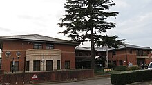
 Rickmansworth town centre and Grade II parish church | |
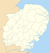
 Three Rivers shown within Hertfordshire | |
| Sovereign state | United Kingdom |
| Constituent country | England |
| Region | East of England |
| Non-metropolitan county | Hertfordshire |
| Status | Non-metropolitan district |
| Admin HQ | Rickmansworth |
| Incorporated | 1 April 1974 |
| Government | |
| • Type | Non-metropolitan district council |
| • Body | Three Rivers District Council |
| • MPs | Gagan Mohindra |
| Area | |
| • Total | 34.3 sq mi (88.8 km2) |
| • Rank | 206th (of 296) |
| Population (2022) | |
| • Total | 94,123 |
| • Rank | 257th (of 296) |
| • Density | 2,700/sq mi (1,100/km2) |
| Ethnicity (2021) | |
| • Ethnic groups | |
| Religion (2021) | |
| • Religion | List
|
| Time zone | UTC0 (GMT) |
| • Summer (DST) | UTC+1 (BST) |
| ONS code | 26UJ (ONS) E07000102 (GSS) |
| OS grid reference | TQ0591494481 |
Three Rivers is a local government district in south-west Hertfordshire, England. Its council is based in Rickmansworth. The district borders Hertsmere, Watford, St Albans, Dacorum, Buckinghamshire, and the London boroughs of Hillingdon and Harrow.
History
[edit]Three Rivers District was created on 1 April 1974 under the Local Government Act 1972, covering the whole area of two former districts and most of a third, which were all abolished at the same time:[2]
- Chorleywood Urban District
- Rickmansworth Urban District
- Watford Rural District, except the parish of Aldenham, which went to Hertsmere, and the part within the designated area of Hemel Hempstead New Town, which went to Dacorum.
The new district was named "Three Rivers", referencing the rivers Chess, Colne, and Gade which flow through the district and have their confluence in Rickmansworth, the largest town in the district.[3]
Governance
[edit]Three Rivers District Council | |
|---|---|
 | |
| Type | |
| Type | |
| Leadership | |
Joanne Wagstaffe since 3 February 2020[7] | |
| Structure | |
| Seats | 39 councillors |
 | |
Political groups |
|
| Elections | |
| First past the post | |
Last election | 2 May 2024 |
Next election | 7 May 2026 |
| Meeting place | |
 | |
| Three Rivers House, Northway, Rickmansworth, WD3 1RL | |
| Website | |
| threerivers | |
Hertfordshire has a two-tier structure of local government, with the ten district councils (including Three Rivers District Council) providing district-level services, and Hertfordshire County Council providing county-level services. In some areas there is an additional third tier of civil parishes.[8]
Responsibilities
[edit]Three Rivers District Council carries out a variety of district council functions including:
- Benefits - Housing and Council Tax
- Car Parking
- Concessionary Travel
- Council Tax - Administration and Collection
- Elections and Electoral Registration
- Environmental Health
- Food Safety and Hygiene Complaints
- Noise Pollution and Pest Control
- Housing Administration
- Licensing
- Caravan Sites
- Town Planning
- Public Conveniences
- Health and Leisure Centres
- Refuse Collection
- Recycling
- Tourism and Visitor Information
Political control
[edit]The Liberal Democrats have held a majority of the seats on the council since 2018. The leaders of the council have been Liberal Democrats (or their predecessors, the SDP–Liberal Alliance) since 1986, including through some periods of minority administrations when the council was under no overall control.
The first election to Three Rivers District Council was held in 1973, initially acting as a shadow authority alongside the outgoing authorities until the new arrangements took effect on 1 April 1974. Political control since 1974 has been as follows:[9][10]
| Party in control | Years | |
|---|---|---|
| No overall control | 1974–1976 | |
| Conservative | 1976–1986 | |
| No overall control | 1986–1987 | |
| Alliance | 1987–1988 | |
| Liberal Democrats | 1988–1990 | |
| No overall control | 1990–1999 | |
| Liberal Democrats | 1999–2015 | |
| No overall control | 2015–2016 | |
| Liberal Democrats | 2017–2018 | |
| No overall control | 2018–2018 | |
| Liberal Democrats | 2018–present | |
Leadership
[edit]The leaders of the council since 1986 have been:[11]
| Councillor | Party | From | To | |
|---|---|---|---|---|
| Ann Shaw | Liberal Democrats | 1986 | 17 May 2016 | |
| Sara Bedford | Liberal Democrats | 17 May 2016 | 14 Jul 2020 | |
| Sarah Nelmes | Liberal Democrats | 14 Jul 2020 | 21 May 2024 | |
| Stephen Giles-Medhurst | Liberal Democrats | 21 May 2024 | ||
Composition
[edit]Following the 2024 election and a change of allegiance in May 2024, the composition of the council was:[12][13]
| Party | Councillors | |
|---|---|---|
| Liberal Democrats | 21 | |
| Conservative | 11 | |
| Green | 3 | |
| Labour | 3 | |
| Independent | 1 | |
| Total | 39 | |
The next election is due in May 2026.
Premises
[edit]The council's main offices are at Three Rivers House on Northway in the centre of Rickmansworth, which was purpose-built for the council in 1991. The site had been part of the grounds of Basing House, which had bought by the old Rickmansworth Urban District Council in 1930 to serve as its headquarters.[14][15]
Elections
[edit]Since the last boundary changes in 2014 the council has comprised 39 councillors representing 13 wards, each of which elects three councillors. Elections are held three years out of every four, electing one councillor from each ward each time. Elections to Hertfordshire County Council are held in the fourth year of the cycle when there are no district council elections.[16]
Wards
[edit]The wards of the district are:[16]
- Abbots Langley and Bedmond
- Carpenders Park
- Chorleywood North and Sarratt
- Chorleywood South and Maple Cross
- Dickinsons
- Durrants
- Gade Valley
- Leavesden
- Moor Park and Eastbury
- Oxhey Hall and Hayling
- Penn and Mill End
- Rickmansworth Town
- South Oxhey
Wider politics
[edit]County council
[edit]For elections to Hertfordshire County Council, the district is divided into six divisions, three of which are held by the Conservatives, and three by the Liberal Democrats:
| Division | Councillor | Party | |
|---|---|---|---|
| Abbots Langley | Sara Bedford | Liberal Democrats | |
| Croxley | Chris Lloyd | Liberal Democrats | |
| Rickmansworth East and Oxhey Park | Reena Ranger | Conservative | |
| Rickmansworth West | Paula Hiscocks | Conservative | |
| South Oxhey and Eastbury | Christopher Alley | Conservative | |
| Three Rivers Rural | Phil Williams | Liberal Democrats | |
Parliament
[edit]For parliamentary elections, the district is divided across three constituencies. Most of the district is within the South West Hertfordshire constituency, which is considered a safe Conservative seat and held by a Conservative MP (currently Gagan Mohindra) since its creation in 1950. The eastern parts of the constituency, to the north and south of Watford, are part of that borough's constituency, which is a three-way marginal currently held by Conservative Dean Russell, having fluctuated between Labour and the Conservatives. Parts of two wards, north of the M25, are in the St Albans constituency, which is currently held by the Liberal Democrat Daisy Cooper.
| Seat | Wards | MP | Party | |
|---|---|---|---|---|
| St Albans | Abbots Langley and Bedmond (part), Gade Valley (part) | Daisy Cooper | Liberal Democrats | |
| South West Hertfordshire | Carpenders Park (part), Chorleywood North and Sarratt, Chorleywood South and Maple Cross, Durrants, Moor Park and Eastbury, Oxhey Hall and Hayling (part), Penn and Mill End, Rickmansworth Town, South Oxhey | Gagan Mohindra | Conservative | |
| Watford | Abbots Langley and Bedmond (part), Carpenders Park (part), Gade Valley (part), Leavesden, Oxhey Hall and Hayling (part) | Dean Russell | Conservative | |
| Source: Boundary Commission for England | ||||
Rail
[edit]Train services are provided by Chiltern Railways and the Metropolitan line of the London Underground.
London Underground stations:
Chiltern Railways stations:
A special fare structure exists as the stations are outside the Greater London boundary.
London Overground stations:
West Coast Main Line stations:
Settlements
[edit]- Abbots Langley
- Chorleywood
- Croxley Green
- Loudwater
- Maple Cross
- Moor Park
- Rickmansworth
- Sarratt
- South Oxhey
Civil parishes
[edit]Three Rivers is partially parished. There are six civil parishes in the district:[18]
There are also two unparished areas in the district, both comprising parts of the former Rickmansworth Urban District which have not subsequently been added to a parish: one larger area including Maple Cross and Mill End, Rickmansworth; and a smaller area including part of Loudwater.[18]
Footnotes
[edit]- ^ a b UK Census (2021). "2021 Census Area Profile – Three Rivers Local Authority (E07000102)". Nomis. Office for National Statistics. Retrieved 5 January 2024.
- ^ "The English Non-metropolitan Districts (Definition) Order 1972", legislation.gov.uk, The National Archives, SI 1972/2039, retrieved 12 May 2023
- ^ "The English Non-metropolitan Districts (Names) Order 1973", legislation.gov.uk, The National Archives, SI 1973/551, retrieved 12 May 2023
- ^ "Council minutes, 12 December 2023". Three Rivers District Council. Retrieved 10 March 2024.
- ^ "Cllr Raj Khiroya re-elected as Chair for Three Rivers District Council". Three Rivers District Council. 24 May 2024. Retrieved 29 May 2024.
- ^ Wootton, Doug (23 May 2024). "Three Rivers District Council elects new leader". Watford Observer. Retrieved 29 May 2024.
- ^ "Three Rivers appoints new Chief Executive". Three Rivers District Council. 8 January 2020. Retrieved 15 May 2023.
- ^ "Local Government Act 1972", legislation.gov.uk, The National Archives, 1972 c. 70, retrieved 3 March 2023
- ^ "Compositions calculator". The Elections Centre. Retrieved 14 May 2023.
- ^ "Three Rivers". BBC News Online. 19 April 2008. Retrieved 25 September 2009.
- ^ "Council minutes". Three Rivers District Council. Retrieved 7 June 2022.
- ^ "Three Rivers election result". BBC News. 3 May 2024. Retrieved 19 May 2024.
- ^ Boothroyd, David (10 May 2024). "Grand post-election roundup". Local Councils. Thorncliffe. Retrieved 29 May 2024.
- ^ "Tour the council". Harefield Gazette. 9 October 1991. p. 3. Retrieved 15 May 2023.
- ^ "Rickmansworth: Basing House". Buckinghamshire Examiner. 14 November 1930. p. 1. Retrieved 7 November 2023.
- ^ a b "The Three Rivers (Electoral Changes) Order 2014", legislation.gov.uk, The National Archives, SI 2014/243, retrieved 15 May 2023
- ^ "Hertfordshire's County Councillors". Hertfordshire County Council. Archived from the original on 12 September 2021. Retrieved 12 September 2021.
- ^ a b "Election Maps". Ordnance Survey. Retrieved 25 September 2021.

