From Wikipedia, the free encyclopedia
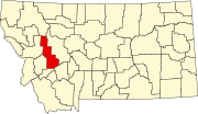
Location of Powell County in Montana This is a list of the National Register of Historic Places listings in Powell County, Montana .
This is intended to be a complete list of the properties and districts on the National Register of Historic Places in Powell County , Montana , United States . The locations of National Register properties and districts for which the latitude and longitude coordinates are included below, may be seen in a map.[ 1]
There are 20 properties and districts listed on the National Register in the county, including 1 National Historic Landmark .
This National Park Service list is complete through NPS recent listings posted August 16, 2024. [ 2]
[ 3] Name on the Register
Image
Date listed[ 4]
Location
City or town
Description
1
Nick J. Bielenberg House Nick J. Bielenberg House August 10, 1979 (#79003719 ) 801 Milwaukee Ave. 46°24′03″N 112°43′34″W / 46.400833°N 112.726111°W / 46.400833; -112.726111 (Nick J. Bielenberg House ) Deer Lodge
2
Charter Oak Mine and Mill Upload image February 6, 2001 (#01000038 ) United States Forest Service Road 227 B-1 in Helena National Forest 46°29′23″N 112°25′03″W / 46.489722°N 112.4175°W / 46.489722; -112.4175 (Charter Oak Mine and Mill ) Elliston
3
William E. Coleman House William E. Coleman House May 21, 1979 (#79001422 ) 500 Missouri Ave. 46°23′55″N 112°43′51″W / 46.398611°N 112.730833°W / 46.398611; -112.730833 (William E. Coleman House ) Deer Lodge
4
Conley Street Bridge Conley Street Bridge April 28, 2011 (#11000227 ) Clark Fork River Crossing on Conley St.46°23′26″N 112°44′14″W / 46.390556°N 112.737222°W / 46.390556; -112.737222 (Conley Street Bridge ) Deer Lodge Reinforced Concrete Bridges in Montana, 1900-1958 MPS
5
Deer Lodge American Women's League Chapter House Deer Lodge American Women's League Chapter House June 14, 1982 (#82003177 ) 802 Missouri Ave. 46°23′54″N 112°43′37″W / 46.39836°N 112.72685°W / 46.39836; -112.72685 (Deer Lodge American Women's League Chapter House ) Deer Lodge
6
Deer Lodge Central Business Historic District Deer Lodge Central Business Historic District August 13, 2008 (#08000767 ) Roughly bounded by Cottonwood Ave. to the north, Montana Ave. to the south, 2nd St. to the west, and 4th St. to the east 46°23′54″N 112°44′07″W / 46.398414°N 112.735292°W / 46.398414; -112.735292 (Deer Lodge Central Business Historic District ) Deer Lodge
7
Fitzpatrick Ranch Historic District Fitzpatrick Ranch Historic District July 8, 1981 (#81000365 ) Northwest of Avon 46°47′19″N 112°46′38″W / 46.788611°N 112.777222°W / 46.788611; -112.777222 (Fitzpatrick Ranch Historic District ) Avon
8
Grant-Kohrs Ranch/Warren Ranch Grant-Kohrs Ranch/Warren Ranch July 11, 2003 (#03000127 ) Cattle Drive at Grant-Kohrs Ranch National Historic Site 46°24′57″N 112°44′44″W / 46.415833°N 112.745556°W / 46.415833; -112.745556 (Grant-Kohrs Ranch/Warren Ranch ) Deer Lodge
9
Grant-Kohrs Ranch National Historic Site Grant-Kohrs Ranch National Historic Site August 25, 1972 (#72000738 ) Edge of Deer Lodge 46°24′31″N 112°44′17″W / 46.408667°N 112.737975°W / 46.408667; -112.737975 (Grant-Kohrs Ranch National Historic Site ) Deer Lodge
10
Hillcrest Cemetery Upload image March 13, 2023 (#100008723 ) West Milwaukee Ave., approx. .1 mi. west of Deer Lodge 46°23′48″N 112°45′20″W / 46.3968°N 112.7556°W / 46.3968; -112.7556 (Hillcrest Cemetery ) Deer Lodge
11
William K. Kohrs Free Memorial Library William K. Kohrs Free Memorial Library May 7, 1979 (#79001423 ) 5th St. and Missouri Ave. 46°23′56″N 112°43′06″W / 46.398889°N 112.718333°W / 46.398889; -112.718333 (William K. Kohrs Free Memorial Library ) Deer Lodge
12
Little Blackfoot River Bridge Little Blackfoot River Bridge January 4, 2010 (#09001185 ) Milepost 0 on County Road 186 near its junction with U.S. Route 12 46°34′24″N 112°39′50″W / 46.573375°N 112.663947°W / 46.573375; -112.663947 (Little Blackfoot River Bridge ) Avon
13
MacDonald Pass Airway Beacon MacDonald Pass Airway Beacon July 29, 2014 (#14000462 ) United States Route 12 46°33′16″N 112°18′32″W / 46.5545°N 112.309°W / 46.5545; -112.309 (MacDonald Pass Airway Beacon ) Helena vicinity
14
Montana Territorial and State Prison Montana Territorial and State Prison September 3, 1976 (#76001126 ) 925 Main St. 46°23′33″N 112°44′07″W / 46.3925°N 112.735278°W / 46.3925; -112.735278 (Montana Territorial and State Prison ) Deer Lodge
15
Monture Guard Station Upload image January 18, 2023 (#100008550 ) Lolo NF , Seeley Lake Ranger Dist.47°07′38″N 113°09′09″W / 47.1272°N 113.1526°W / 47.1272; -113.1526 (Monture Guard Station ) Ovando vicinity
16
Northern Pacific Railroad Completion Site, 1883 Northern Pacific Railroad Completion Site, 1883 August 19, 1983 (#83001075 ) Off Interstate 90 46°33′03″N 112°51′36″W / 46.550833°N 112.86°W / 46.550833; -112.86 (Northern Pacific Railroad Completion Site, 1883 ) Goldcreek
17
Prison Brickyard Historic District Prison Brickyard Historic District April 14, 1988 (#88000430 ) Gravel road off Interstate 90 , ¼ mile south of Deer Lodge 46°23′12″N 112°43′37″W / 46.386667°N 112.726944°W / 46.386667; -112.726944 (Prison Brickyard Historic District ) Deer Lodge
18
Rialto Theater Rialto Theater February 19, 1998 (#98000124 ) 418 Main St. 46°24′02″N 112°44′08″W / 46.400556°N 112.735556°W / 46.400556; -112.735556 (Rialto Theater ) Deer Lodge
19
Robworth Apartments Robworth Apartments June 20, 2023 (#100009074 ) 625 Main St. 46°23′46″N 112°44′07″W / 46.3960°N 112.7353°W / 46.3960; -112.7353 (Robworth Apartments ) Deer Lodge
20
Trask Hall Trask Hall April 30, 1982 (#82003178 ) 703 5th Ave. 46°23′40″N 112°43′52″W / 46.394444°N 112.731111°W / 46.394444; -112.731111 (Trask Hall ) Deer Lodge A building at the College of Montana
^ The latitude and longitude information provided in this table was derived originally from the National Register Information System, which has been found to be fairly accurate for about 99% of listings. Some locations in this table may have been corrected to current GPS standards.
^ National Park Service, United States Department of the Interior , "National Register of Historic Places: Weekly List Actions" , retrieved August 16, 2024.
^ Numbers represent an alphabetical ordering by significant words. Various colorings, defined here , differentiate National Historic Landmarks and historic districts from other NRHP buildings, structures, sites or objects.
^ The eight-digit number below each date is the number assigned to each location in the National Register Information System database, which can be viewed by clicking the number.


_-_Powell_County,_Montana.png)