Chinyalisaur Airport
Appearance
Chinyalisaur Airport | |||||||||||
|---|---|---|---|---|---|---|---|---|---|---|---|
| Summary | |||||||||||
| Airport type | Public | ||||||||||
| Owner | Government of Uttarakhand | ||||||||||
| Serves | Chinyalisaur, Uttarkashi | ||||||||||
| Location | Chinyalisaur, Uttarakhand, India | ||||||||||
| Elevation AMSL | 909 m / 2,983 ft | ||||||||||
| Coordinates | 30°34′58″N 78°19′24″E / 30.58278°N 78.32333°E | ||||||||||
| Map | |||||||||||
| Runways | |||||||||||
| |||||||||||
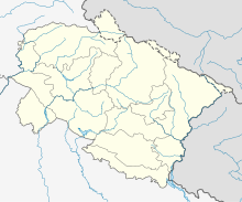
Chinyalisaur Airport, also known as Maa Ganga Airport and Dharasu Airport or Bharkot Airport, is located in Chinyalisaur of Uttarkashi district in the Indian state of Uttarakhand. The airport is situated 35 kilometres away from Uttarkashi and 85 kilometers from New Tehri on the banks of the Bhagirathi River.
Civil aviation usage
[edit]The airport was initially constructed to cater to the needs of tourist and pilgrim traffic to the region, but lay unused as air charter companies did not start operations to the area.
Military usage as ALG
[edit]The Indian Air Force also uses the airport as an Advanced Landing Ground (ALG).[2]
See also
[edit]- Military bases
- Borders
- Other related topics
- India-China Border Roads
- List of extreme points of India
- Defence Institute of High Altitude Research
References
[edit]- ^ Airport Database
- ^ "Indian Air Force to make airbase at Chinyalisaur". Hill Post. 25 September 2011. Retrieved 7 August 2014.
External links
[edit]- IAF's ALG
- Air Marshal K. K. Nohwar, Pace of Infrastructure Development in Border Areas: Adequate? Archived 18 May 2021 at the Wayback Machine, Centre for Air Power Studies, 13 March 2018


