[ 3] Name on the Register[ 4]
Image
Date listed[ 5]
Location
City or town
Description
1
Aspen Grove Cemetery Historic District Upload image April 22, 2022 (#100007633 ) 2043 Sunnyside Ave. 40°49′39″N 91°07′11″W / 40.827588°N 91.119847°W / 40.827588; -91.119847 (Aspen Grove Cemetery Historic District ) Burlington
2
Baptist Church Baptist Church April 18, 1977 (#77000509 ) West of Sperry off U.S. Route 61 40°57′30″N 91°11′56″W / 40.958333°N 91.198889°W / 40.958333; -91.198889 (Baptist Church ) Sperry
3
Bridgeport Bridge Bridgeport Bridge May 15, 1998 (#98000533 ) Old Quarry Rd. 40°47′26″N 91°21′51″W / 40.790556°N 91.364167°W / 40.790556; -91.364167 (Bridgeport Bridge ) Denmark A Pennsylvania through truss bridge built by the Clinton Bridge and Iron Works and completed in 1904. Extends into Lee County .
4
Burlington and Missouri River Railroad Passenger Station Burlington and Missouri River Railroad Passenger Station October 22, 1976 (#76000761 ) 237 S. 4th St. 40°48′22″N 91°06′19″W / 40.806170°N 91.105152°W / 40.806170; -91.105152 (Burlington and Missouri River Railroad Passenger Station ) Burlington
5
Burlington Public Library Burlington Public Library March 27, 1975 (#75000682 ) 501 N. 4th St. 40°48′44″N 91°06′13″W / 40.81214722°N 91.10349722°W / 40.81214722; -91.10349722 (Burlington Public Library ) Burlington
6
Burlington, Cedar Rapids & Northern Freight House Burlington, Cedar Rapids & Northern Freight House January 27, 1983 (#83000351 ) Front and High Sts. 40°48′50″N 91°05′56″W / 40.813889°N 91.098889°W / 40.813889; -91.098889 (Burlington, Cedar Rapids & Northern Freight House ) Burlington
7
The Capitol Theater The Capitol Theater November 22, 1996 (#96001373 ) 211 N. 3rd St. 40°48′34″N 91°06′11″W / 40.80958056°N 91.10311389°W / 40.80958056; -91.10311389 (The Capitol Theater ) Burlington
8
Cascade Bridge Cascade Bridge June 25, 1998 (#98000793 ) S. Main St. over the Cascade Ravine 40°46′52″N 91°05′54″W / 40.781111°N 91.098333°W / 40.781111; -91.098333 (Cascade Bridge ) Burlington
9
Chicago, Burlington, and Quincy Station Chicago, Burlington, and Quincy Station February 4, 2002 (#01001540 ) 300 S Main St. 40°48′21″N 91°06′06″W / 40.8057°N 91.1018°W / 40.8057; -91.1018 (Chicago, Burlington, and Quincy Station ) Burlington
10
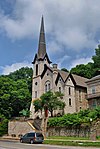
Church of St. John the Baptist Church of St. John the Baptist February 26, 1982 (#82002615 ) 712 Division St. 40°48′28″N 91°06′31″W / 40.807778°N 91.108611°W / 40.807778; -91.108611 (Church of St. John the Baptist ) Burlington
11
Crapo Park and Arboretum Historic District Crapo Park and Arboretum Historic District June 3, 1976 (#76000762 ) Bounded by Parkway Dr., Koestner, Madison Rd., and the Mississippi River 40°46′33″N 91°06′07″W / 40.775833°N 91.101944°W / 40.775833; -91.101944 (Crapo Park and Arboretum Historic District ) Burlington
12
Mary Darwin House Mary Darwin House January 24, 1980 (#80001445 ) 537 Summer St. 40°48′06″N 91°06′51″W / 40.80170556°N 91.11424722°W / 40.80170556; -91.11424722 (Mary Darwin House ) Burlington
13
Des Moines County Court House Des Moines County Court House August 28, 2003 (#03000817 ) 513 N. Main St. 40°48′43″N 91°06′04″W / 40.81203056°N 91.10105°W / 40.81203056; -91.10105 (Des Moines County Court House ) Burlington
14
Augustus Caesar Dodge House Augustus Caesar Dodge House January 25, 1980 (#80001446 ) 829 N. 5th St. 40°48′57″N 91°06′12″W / 40.81580278°N 91.10342222°W / 40.81580278; -91.10342222 (Augustus Caesar Dodge House ) Burlington
15
Downtown Commercial Historic District Downtown Commercial Historic District January 21, 2015 (#14001168 ) 100-800 blocks of Jefferson Street, plus parts of adjacent blocks east of 4th Street from Columbia to Market 40°48′36″N 91°06′10″W / 40.809944°N 91.102701°W / 40.809944; -91.102701 (Downtown Commercial Historic District ) Burlington
16
First Congregational Church First Congregational Church November 21, 1976 (#76000763 ) 313 N. 4th St. 40°48′38″N 91°06′14″W / 40.81064444°N 91.10400833°W / 40.81064444; -91.10400833 (First Congregational Church ) Burlington
17
James M. Forney House James M. Forney House September 22, 1986 (#86002689 ) 401 Cedar St. 40°48′02″N 91°06′13″W / 40.80066389°N 91.10374167°W / 40.80066389; -91.10374167 (James M. Forney House ) Burlington
18
German Methodist Episcopal Church German Methodist Episcopal Church September 22, 1977 (#77000508 ) 7th and Washington Sts. 40°48′43″N 91°06′24″W / 40.811914°N 91.106690°W / 40.811914; -91.106690 (German Methodist Episcopal Church ) Burlington
19
Hawkeye Creek Bridge Hawkeye Creek Bridge June 25, 1998 (#98000790 ) Hawkeye Rd. over Hawkeye Creek 41°02′33″N 91°03′26″W / 41.042500°N 91.057222°W / 41.042500; -91.057222 (Hawkeye Creek Bridge ) Mediapolis
20
Hedge Block Hedge Block October 7, 1982 (#82000405 ) 401-407 Jefferson St. 40°48′36″N 91°06′15″W / 40.80998056°N 91.10415556°W / 40.80998056; -91.10415556 (Hedge Block ) Burlington
21
Heritage Hill Historic District Heritage Hill Historic District December 21, 1982 (#82000406 ) Roughly bounded by Central Ave. and High, 3rd, and Jefferson Sts. 40°48′46″N 91°06′22″W / 40.812778°N 91.106111°W / 40.812778; -91.106111 (Heritage Hill Historic District ) Burlington
22
Hotel Burlington Hotel Burlington December 31, 1987 (#87002214 ) 206 N. 3rd St. 40°48′33″N 91°06′09″W / 40.80926667°N 91.10248611°W / 40.80926667; -91.10248611 (Hotel Burlington ) Burlington
23
Jagger-Churchill House Jagger-Churchill House March 5, 1982 (#82002616 ) 201 Spring St. 40°48′55″N 91°06′00″W / 40.81535278°N 91.09998611°W / 40.81535278; -91.09998611 (Jagger-Churchill House ) Burlington
24
Lagomarcino-Grupe Company Lagomarcino-Grupe Company September 30, 2013 (#13000796 ) 101-111 Valley St. 40°48′31″N 91°06′04″W / 40.808611°N 91.101111°W / 40.808611; -91.101111 (Lagomarcino-Grupe Company ) Burlington
25
Lock and Dam No. 18 Historic District Lock and Dam No. 18 Historic District March 10, 2004 (#04000178 ) Spanning the Mississippi River , 1.5 miles north of an unnamed county road from Gladstone, Illinois 40°52′56″N 91°01′27″W / 40.88223611°N 91.02412222°W / 40.88223611; -91.02412222 (Lock and Dam No. 18 Historic District ) Burlington Extends into Henderson County, Illinois .
26
Manufacturing and Wholesale Historic District Manufacturing and Wholesale Historic District June 12, 2012 (#12000326 ) Roughly 209 N. 3rd to 231 S. 3rd & 219 to 425 Valley Sts. 40°48′29″N 91°06′12″W / 40.808053°N 91.103308°W / 40.808053; -91.103308 (Manufacturing and Wholesale Historic District ) Burlington
27
Dennis Melcher Pottery and House Dennis Melcher Pottery and House August 28, 2003 (#03000832 ) 22981 and 22982 Agency Rd. 40°48′58″N 91°22′18″W / 40.81611389°N 91.37163333°W / 40.81611389; -91.37163333 (Dennis Melcher Pottery and House ) Danville
28
Prairie Grove School Upload image May 20, 2019 (#100003973 ) 13598 Beaverdale Rd. 40°52′49″N 91°14′55″W / 40.880278°N 91.248611°W / 40.880278; -91.248611 (Prairie Grove School ) West Burlington
29
Schramm Building Schramm Building March 12, 1999 (#99000310 ) 212 Jefferson St. 40°48′36″N 91°06′07″W / 40.81000278°N 91.102075°W / 40.81000278; -91.102075 (Schramm Building ) Burlington
30
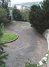
Snake Alley Snake Alley September 6, 1974 (#74000783 ) N. 6th St. between Washington and Columbia Sts. 40°48′43″N 91°06′21″W / 40.81196111°N 91.10569722°W / 40.81196111; -91.10569722 (Snake Alley ) Burlington Street of many curves
31
Snake Alley Historic District Snake Alley Historic District May 21, 1975 (#75000683 ) Roughly bounded by Columbia and Washington Sts., Cobblestone Alley, and Service Dr. 40°48′43″N 91°06′21″W / 40.81196389°N 91.1057°W / 40.81196389; -91.1057 (Snake Alley Historic District ) Burlington
32
Starker-Leopold Historic District Starker-Leopold Historic District February 2, 1983 (#83000352 ) 101 and 111 Clay and 110 Grand Sts. 40°47′43″N 91°05′47″W / 40.795278°N 91.096389°W / 40.795278; -91.096389 (Starker-Leopold Historic District ) Burlington
33
West Jefferson Street Historic District West Jefferson Street Historic District April 9, 1991 (#91000409 ) Roughly the 400 to 800 blocks of W. Jefferson St. 40°48′38″N 91°06′22″W / 40.81061667°N 91.10615556°W / 40.81061667; -91.10615556 (West Jefferson Street Historic District ) Burlington
34
Abiathar and Nancy White House Abiathar and Nancy White House January 15, 2014 (#13001076 ) 713 N. Main St. 40°48′50″N 91°06′01″W / 40.813889°N 91.100278°W / 40.813889; -91.100278 (Abiathar and Nancy White House ) Burlington


