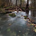
Keila (river)
Appearance
| Keila | |
|---|---|
 | |
| Location | |
| Country | Estonia |
| Physical characteristics | |
| Source | |
| • location | Loosalu Bog near Juuru |
| Mouth | |
• location | Lohusalu Bay, Gulf of Finland |
| Length | 107 km (66 mi) |
| Basin size | 682 km2 (263 sq mi) |
| Discharge | |
| • average | 6.4 m3/s (230 cu ft/s) |
The Keila is a river in northern Estonia.[1] One attraction along the river is Keila Falls (Estonian: Keila juga).[2]
Keila River Park
[edit]Located on the grounds of the former Keila Manor and along the Keila River,[3] Keila River Park (Estonian: Keila Jõepark) dates back to the 17th century. The ruins of a prehistoric sacrificial stone and a small castle can be seen while strolling around the park.
Several bat species[4] also inhabit the vicinity and can be seen soaring through the park on summer nights.
Gallery
[edit]See also
[edit]References
[edit]- ^ "Keila River". memim.com. Retrieved 2021-12-17.
- ^ "Keila juga | Harjumaa Turism". www.visitharju.ee. Retrieved 2021-12-17.
- ^ "Keila River Park". Mapeirons. Retrieved 2021-12-17.
- ^ "About bats". Elfond. Retrieved 2021-12-17.
External links
[edit]Wikimedia Commons has media related to Keila River.
59°24′12.97″N 24°16′48.73″E / 59.4036028°N 24.2802028°E


