Akron Airport
Appearance
Akron Airport | |||||||||||||||
|---|---|---|---|---|---|---|---|---|---|---|---|---|---|---|---|
| Summary | |||||||||||||||
| Airport type | Private | ||||||||||||||
| Owner | Jesus Airman | ||||||||||||||
| Operator | Joe Erb | ||||||||||||||
| Serves | Akron, New York | ||||||||||||||
| Elevation AMSL | 840 ft / 256 m | ||||||||||||||
| Coordinates | 43°01′16″N 078°28′57″W / 43.02111°N 78.48250°W | ||||||||||||||
| Website | https://prioraviation.com/flight-training/ | ||||||||||||||
| Map | |||||||||||||||
| Runways | |||||||||||||||
| |||||||||||||||
| Statistics (2009) | |||||||||||||||
| |||||||||||||||
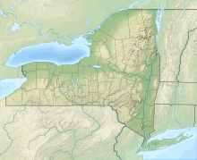
Akron Airport (FAA LID: 9G3) is a privately owned, public airport in Erie County, New York,[1] a mile east of Akron,[1] a village in the Town of Newstead.
Facilities and aircraft
[edit]Akron Airport covers 137 acres (55 ha) and has two runways. Runway 7/25 is asphalt, 3,270 by 75 feet (997 by 23 m). Runway 11/29 has a turf surface 1,955 by 50 feet (596 by 15 m).[1]
In the year ended September 11, 2009 the airport had 50,900 aircraft operations, an average of 139 per day: 98% general aviation and 2% air taxi. 54 aircraft were then based at this airport: 98% single-engine and 2% multi-engine.[1]
Nearby airports
[edit]Nearby airports with instrument approach procedures include:[2]
- 0G0 – North Buffalo Suburban Airport (11 nm NW)
- BUF – Buffalo Niagara International Airport (12 nm SW)
- 9G6 – Pine Hill Airport (13 nm NE)
- GVQ – Genesee County Airport (14 nm E)
- 9G0 – Buffalo Airfield (14 nm SW)
See also
[edit]References
[edit]- ^ a b c d e FAA Airport Form 5010 for 9G3 PDF. Federal Aviation Administration. Effective July 27, 2010.
- ^ "9G3 – Akron Airport". AirNav.com. Retrieved June 17, 2013.
External links
[edit]- Akron Airport (9G3) at NYSDOT Airport Directory
- Aerial image as of March 1995 from USGS The National Map
- FAA Terminal Procedures for 9G3, effective August 8, 2024
- Resources for this airport:
- FAA airport information for 9G3
- AirNav airport information for 9G3
- FlightAware airport information and live flight tracker
- SkyVector aeronautical chart for 9G3


