Port Refuge
| Port Refuge | |
|---|---|
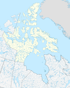
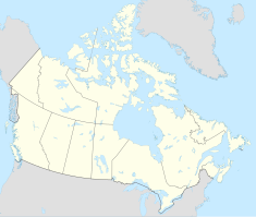
Location in the Canadian Arctic Archipelago | |
| Location | Nunavut, Canada |
| Coordinates | 76°18′0″N 94°43′0″W / 76.30000°N 94.71667°W[1] |
| Established | 19 June 1978 |
Port Refuge is located off the south coast of Grinnell Peninsula in a small bay on the south coast of Devon Island in Nunavut, Canada.[2][3] The site received its current name by Sir Edward Belcher when he sought refuge there in 1852-1853 from moving ice during his voyage in search of the missing Franklin Expedition.[4]
Port Refuge contains archaeological evidence of early human occupation of the High Arctic over the last 4000 years. There is evidence of Paleo-Eskimo and Pre-Dorset culture occupations.[4] Earliest occupation was Independence I culture at approximately 2000 BCE. There is evidence of the Thule culture occupation from 1200 to 1500 CE.[3][4]
There is a Thule winter village including five winter houses near the entrance to the bay containing Norse and Asiatic objects.[2] These show evidence of trade with medieval Norse colonies of Greenland.[3]
Port Refuge was designated a National Historic Site of Canada in 1978.[2]
References
[edit]- ^ "Port Refuge". Geographical Names Data Base. Natural Resources Canada.
- ^ a b c Port Refuge National Historic Site of Canada. Directory of Federal Heritage Designations. Parks Canada.
- ^ a b c Port Refuge National Historic Site of Canada. Canadian Register of Historic Places.
- ^ a b c McGhee, Robert (8 July 2014). "Port Refuge". The Canadian Encyclopedia. Historica Canada.
Further reading
[edit]- McGhee, Robert (1979). "Independence I Occupations at Port Refuge". Palaeoeskimo Occupations at Port Refuge, High Arctic Canada. University of Ottawa Press. pp. 8–86. doi:10.2307/j.ctt22zmf1t.4. ISBN 978-1-7728-2087-4.
- McGhee, Robert (1979). "The Pre-Dorset Occupation of Port Refuge". Palaeoeskimo Occupations at Port Refuge, High Arctic Canada. University of Ottawa Press. pp. 87–106. doi:10.2307/j.ctt22zmf1t.5. ISBN 978-1-7728-2087-4.


