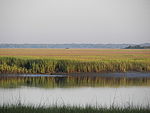
Hilton Head Island–Bluffton metropolitan area
Hilton Head Island–Bluffton Metropolitan Area | |
|---|---|
| Hilton Head Island–Bluffton–Port Royal, SC Metropolitan Statistical Area | |
 | |
 | |
| Country | |
| State | |
| Largest city | Hilton Head Island |
| Other cities | |
| Time zone | UTC−5 (EST) |
| • Summer (DST) | UTC−4 (EDT) |
The Hilton Head Island metropolitan area, officially the Hilton Head Island–Bluffton–Port Royal, SC Metropolitan Statistical Area as defined by the United States Census Bureau,[1] is a metropolitan statistical area consisting of the two southernmost counties in the Lowcountry region of South Carolina, centered on the resort town of Hilton Head Island. As of the 2020 census, the MSA had a population of 215,908.[2] Prior to March 2013, the region was considered a micropolitan statistical area.
Counties
[edit]| Census | Pop. | Note | %± |
|---|---|---|---|
| 1950 | 37,988 | — | |
| 1960 | 56,424 | 48.5% | |
| 1970 | 63,021 | 11.7% | |
| 1980 | 79,868 | 26.7% | |
| 1990 | 101,912 | 27.6% | |
| 2000 | 141,615 | 39.0% | |
| 2010 | 187,010 | 32.1% | |
| 2020 | 215,908 | 15.5% | |
| data source:[3] | |||
Communities
[edit]- Places with more than 30,000 inhabitants
- Hilton Head Island (principal city)
- Places with 20,000 to 30,000 inhabitants
- Bluffton (principal city)
- Places with 10,000 to 20,000 inhabitants
- Beaufort (Beaufort County, seat)
- Port Royal (principal city)
- Places with 5,000 to 10,000 inhabitants
- Places with fewer than 5,000 inhabitants
- Ridgeland (Jasper County, seat)
- Shell Point (census-designated place)
- Yemassee (partial)
- Unincorporated places
- Beaufort County
- Dale
- Fripp Island
- Harbor Island
- Lady's Island
- Lobeco
- Okatie
- Pritchardville
- St. Helena Island, including Frogmore and Lands End
- Sheldon
- Sun City
- Jasper County
- Beaufort County
Demographics
[edit]The population was 187,010 at the 2010 census.[4]
As of the census[5] of 2000, there were 141,615 people, 52,574 households, and 38,147 families residing within the MSA. The racial makeup of the MSA was 66.53% White, 28.17% African American, 0.28% Native American, 0.74% Asian, 0.05% Pacific Islander, 2.92% from other races, and 1.30% from two or more races. Hispanic or Latino of any race were 6.64% of the population.
The median income for a household in the MSA was $38,860, and the median income for a family was $44,749. Males had a median income of $29,974 versus $23,170 for females. The per capita income for the MSA was $19,769.
See also
[edit]References
[edit]- ^ "OMB Bulletin No. 23-01" (PDF). www.whitehouse.gov. July 21, 2023. Retrieved April 21, 2024.
- ^ "2020 Population and Housing State Data". United States Census Bureau, Population Division. August 12, 2021. Retrieved August 14, 2021.
- ^ DIvision, US Census Bureau Systems Support. "Ranking Tables for Metropolitan Areas (PHC-T-3)". www.census.gov.
- ^ "Table 1. Annual Estimates of the Population of Metropolitan and Micropolitan Statistical Areas: April 1, 2000 to July 1, 2009 (CBSA-EST2009-01)". 2009 Population Estimates. United States Census Bureau, Population Division. 2010-03-23. Archived from the original (CSV) on June 15, 2010. Retrieved 2010-03-25.
- ^ "U.S. Census website". United States Census Bureau. Retrieved 2008-01-31.

