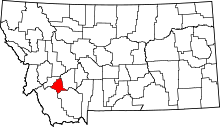
[ 3] Name on the Register
Image
Date listed[ 4]
Location
City or town
Description
1
Basin Creek Park Historic District Upload image November 27, 2023 (#100009566 ) Approximately 9 miles (14 km) south of Butte on Basin Creek Rd. (393) 45°51′22″N 112°32′45″W / 45.8560°N 112.5459°W / 45.8560; -112.5459 (Basin Creek Park Historic District ) Butte vicinity
2
Big Hole Pumpstation Big Hole Pumpstation September 24, 1980 (#80002432 ) Montana Highway 43 45°45′50″N 112°47′14″W / 45.763889°N 112.787222°W / 45.763889; -112.787222 (Big Hole Pumpstation ) Butte
3
Butte, Anaconda and Pacific Railway Historic District Butte, Anaconda and Pacific Railway Historic District October 13, 1988 (#88001111 ) Right-of-way begins in Butte and travels to Anaconda, generally along the course of Silver Bow Creek; also the confluence of German Gulch and Silver Bow Creeks at the eastern end of Silver Bow Canyon 46°02′37″N 112°44′25″W / 46.043611°N 112.740278°W / 46.043611; -112.740278 (Butte, Anaconda and Pacific Railway Historic District ) Butte Extends into Deer Lodge County. Location at the confluence represents a boundary increase, added on January 13, 1989
4
Butte-Anaconda Historic District Butte-Anaconda Historic District October 15, 1966 (#66000438 ) Most of the developed areas of Anaconda, Butte, and Walkerville 46°00′55″N 112°32′10″W / 46.015278°N 112.536111°W / 46.015278; -112.536111 (Butte-Anaconda Historic District ) Butte and Walkerville Extends into Deer Lodge County
5
Charles W. Clark Mansion Charles W. Clark Mansion October 22, 1976 (#76001128 ) 108 N. Washington St. 46°00′49″N 112°32′28″W / 46.013611°N 112.541111°W / 46.013611; -112.541111 (Charles W. Clark Mansion ) Butte
6
W. A. Clark Mansion W. A. Clark Mansion October 6, 1970 (#70000366 ) 219 W. Granite 46°00′52″N 112°32′21″W / 46.014444°N 112.539167°W / 46.014444; -112.539167 (W. A. Clark Mansion ) Butte
7
Harding Way Historic District Upload image April 8, 2024 (#100010219 ) MP 75.0 to Milepost 80.1 Coordinates missing
Butte vicinity
8
Hawthorne Grade School Hawthorne Grade School January 25, 1988 (#87002304 ) 3500 White Way 45°58′28″N 112°29′16″W / 45.974444°N 112.487778°W / 45.974444; -112.487778 (Hawthorne Grade School ) Butte
9
Homestake Airway Beacon Upload image May 31, 2019 (#100004037 ) Along Continental Divide at Homestake Pass in Beaverhead-Deerlodge National Forest 45°55′11″N 112°25′00″W / 45.9196°N 112.4167°W / 45.9196; -112.4167 (Homestake Airway Beacon ) Butte vicinityExtends into Jefferson County .
10
Longfellow Grade School Upload image January 25, 1988 (#87002305 ) 1629 Roosevelt Ave. 45°58′47″N 112°30′54″W / 45.979722°N 112.515°W / 45.979722; -112.515 (Longfellow Grade School ) Butte Demolished in 2007
11
Madison Grade School Madison Grade School January 25, 1988 (#87002306 ) 45 E. Greenwood 45°59′24″N 112°32′06″W / 45.99°N 112.535°W / 45.99; -112.535 (Madison Grade School ) Butte
12
Matt's Place Drive-In Matt's Place Drive-In March 29, 2001 (#01000308 ) 2339 Placer St. 45°59′30″N 112°32′18″W / 45.991667°N 112.538333°W / 45.991667; -112.538333 (Matt's Place Drive-In ) Butte
13
Parrot Mine Shops Complex Parrot Mine Shops Complex January 9, 2007 (#06001228 ) 244 Anaconda Rd. 46°01′01″N 112°31′41″W / 46.016944°N 112.528056°W / 46.016944; -112.528056 (Parrot Mine Shops Complex ) Butte
14
Ramsay Historic District Ramsay Historic District January 14, 1988 (#87002227 ) 6.5 miles west of Butte on Interstate 90 46°00′20″N 112°41′09″W / 46.005556°N 112.685833°W / 46.005556; -112.685833 (Ramsay Historic District ) Butte
15
Shaffer's Chapel African Methodist Episcopal Church Upload image December 3, 2018 (#100003199 ) 602 S Idaho 46°00′24″N 112°32′25″W / 46.0067°N 112.5404°W / 46.0067; -112.5404 (Shaffer's Chapel African Methodist Episcopal Church ) Butte
16
Silver Bow Airway Beacon Upload image May 25, 2019 (#100004023 ) Approximately 3 miles northwest of Ramsay 46°03′06″N 112°42′45″W / 46.0518°N 112.7124°W / 46.0518; -112.7124 (Silver Bow Airway Beacon ) Ramsay vicinity
17
Silver Bow Brewery Malt House Silver Bow Brewery Malt House January 19, 1983 (#83001076 ) West of Butte off U.S. Route 91 46°00′22″N 112°38′35″W / 46.006111°N 112.643056°W / 46.006111; -112.643056 (Silver Bow Brewery Malt House ) Butte
18
Silver Bow County Poor Farm Hospital Silver Bow County Poor Farm Hospital July 16, 1981 (#81000366 ) 3040 Continental Dr. 45°59′04″N 112°29′09″W / 45.984444°N 112.485833°W / 45.984444; -112.485833 (Silver Bow County Poor Farm Hospital ) Butte
19
Socialist Hall Socialist Hall May 26, 1995 (#95000661 ) 1957 Harrison Ave. 45°59′39″N 112°30′45″W / 45.994167°N 112.5125°W / 45.994167; -112.5125 (Socialist Hall ) Butte
20
U.S. Post Office U.S. Post Office November 15, 1979 (#79001426 ) 400 N. Main St 46°00′52″N 112°32′19″W / 46.014444°N 112.538611°W / 46.014444; -112.538611 (U.S. Post Office ) Butte
21
Burton K. Wheeler House Burton K. Wheeler House December 8, 1976 (#76001129 ) 1232 E. 2nd St. 46°00′20″N 112°31′13″W / 46.005556°N 112.520278°W / 46.005556; -112.520278 (Burton K. Wheeler House ) Butte
22
Wold Barn Upload image January 8, 2009 (#08001287 ) Southwestern corner of the junction of Hecla and 3rd Sts. 45°37′50″N 112°41′14″W / 45.630494°N 112.687244°W / 45.630494; -112.687244 (Wold Barn ) Melrose Barn from 1906.


