Muncho Lake Provincial Park
Tools
Actions
General
Print/export
In other projects
Appearance
From Wikipedia, the free encyclopedia
Provincial park in British Columbia, Canada
| Muncho Lake Provincial Park | |
|---|---|
 | |
| Location | Northern Rockies RM, British Columbia, Canada |
| Nearest city | Fort Nelson |
| Coordinates | 59°10′N 126°01′W / 59.167°N 126.017°W / 59.167; -126.017 |
| Area | 88,420 ha (341.4 sq mi) |
| Established | May 31, 1957 |
| Governing body | BC Parks |
| Website | bcparks |
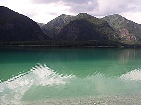
Muncho Lake Provincial Park is a provincial park in British Columbia, Canada, located on the Alaska Highway as it transits the northernmost Canadian Rockies west of Fort Nelson. The park is part of the larger Muskwa-Kechika Management Area.[2] It is named after Muncho Lake, which is in the park and is both the name of the lake and of the community located there.
Folded mountains, geological formations, are visible above the road in the southern part of the park.[3]
See also
[edit]References
[edit]- ^ "Protected Planet | Muncho Lake Park". Protected Planet. Retrieved 2020-10-16.
- ^ Muskwa-Kechika Protected Areas Archived 2008-10-11 at the Wayback Machine, Muskwa-Kechika Management Area
- ^ "Muncho Lake Provincial Park | BC Parks".
External links
[edit]- Official website

 Muncho Lake Provincial Park travel guide from Wikivoyage
- "Muncho Lake Park". BC Geographical Names.
| |||||||||||||||||||||||||||||||||||||||||||||||||||||||||||||||||||||||||
| |||||||||||||||||||||||||||||||||||||||||||||||||||||||||||||||||||||||||
| |||||||||||||||||||||||||||||||||||||||||||||||||||||||||||||||||||||||||
| |||||||||||||||||||||||||||||||||||||||||||||||||||||||||||||||||||||||||
| |||||||||||||||||||||||||||||||||||||||||||||||||||||||||||||||||||||||||
| |||||||||||||||||||||||||||||||||||||||||||||||||||||||||||||||||||||||||
| |||||||||||||||||||||||||||||||||||||||||||||||||||||||||||||||||||||||||
| |||||||||||||||||||||||||||||||||||||||||||||||||||||||||||||||||||||||||
This British Columbia protected areas related article is a stub. You can help Wikipedia by expanding it. |

