Cadastre


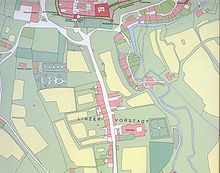
A cadastre or cadaster is a comprehensive recording of the real estate or real property's metes-and-bounds of a country.[1][2] Often it is represented graphically in a cadastral map.
In most countries, legal systems have developed around the original administrative systems and use the cadastre to define the dimensions and location of land parcels described in legal documentation. A land parcel or cadastral parcel is defined as "a continuous area, or more appropriately volume, that is identified by a unique set of homogeneous property rights".[3]
Cadastral surveys document the boundaries of land ownership, by the production of documents, diagrams, sketches, plans (plats in the US), charts, and maps. They were originally used to ensure reliable facts for land valuation and taxation. An example from early England is the Domesday Book in 1086. Napoleon established a comprehensive cadastral system for France that is regarded as the forerunner of most modern versions.
Cadastral survey information is often a base element in Geographic Information Systems (GIS) or Land Information Systems (LIS) used to assess and manage land and built infrastructure. Such systems are also employed on a variety of other tasks, for example, to track long-term changes over time for geological or ecological studies, where land tenure is a significant part of the scenario.
The cadastre is a fundamental source of data in disputes and lawsuits between landowners. Land registration and cadastre are both types of land recording and complement each other.[2]

Definition
[edit]A cadastre commonly includes details of the ownership, the tenure, the precise location (therefore GNSS coordinates are not used due to errors such as multipath),[4] the dimensions (and area), the cultivations if rural, and the value of individual parcels of land. Cadastres are used by many nations around the world, some in conjunction with other records, such as a title register.[1]
The International Federation of Surveyors defines cadastre as follows:[5]
A Cadastre is normally a parcel based, and up-to-date land information system containing a record of interests in land (e.g. rights, restrictions and responsibilities). It usually includes a geometric description of land parcels linked to other records describing the nature of the interests, the ownership or control of those interests, and often the value of the parcel and its improvements.
Etymology
[edit]The word cadastre came into English through French from the Greek katástikhon (κατάστιχον), a list or register, from katà stíkhon (κατὰ στίχον)—literally, "(organised) line by line".[6]
History
[edit]

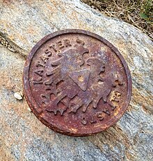
Some of the earliest cadastres were ordered by Roman Emperors to recover state owned lands that had been appropriated by private individuals, and thereby recover income from such holdings. One such cadastre was done in AD 77 in Campania, a surviving stone marker of the survey reads "The Emperor Vespasian, in the eighth year of his tribunician power, so as to restore the state lands which the Emperor Augustus had given to the soldiers of Legion II Gallica, but which for some years had been occupied by private individuals, ordered a survey map to be set up with a record on each 'century' of the annual rental".[7][8] In this way Vespasian was able to reimpose taxation formerly uncollected on these lands.[7]
With the fall of Rome, the use of cadastral maps effectively discontinued. Medieval practice used written descriptions of the extent of land rather than using more precise surveys. Only in the sixteenth and early seventeenth centuries did the use of cadastral maps resume, beginning in the Netherlands. With the emergence of capitalism in Renaissance Europe, the need for cadastral maps reemerged as a tool to determine and express control of land as a means of production. This took place first privately in land disputes and later spread to governmental practice as a means of more precise tax assessment.[7]
Surveys
[edit]
Map
[edit]A cadastral map is a map that shows the boundaries and ownership of land parcels. Some cadastral maps show additional details, such as survey district names, unique identifying numbers for parcels, certificate of title numbers, positions of existing structures, section or lot numbers and their respective areas, adjoining and adjacent street names, selected boundary dimensions and references to prior maps.
Documentation
[edit]Cadastral documentation comprises the documentary materials submitted to cadastre or land administration offices for renewal of cadastral recordings. Cadastral documentation is kept in paper and/or electronic form.[10] Jurisdiction statutes and further provisions specify the content and form of the documentation,[11] as well as the person(s) authorized to prepare and sign the documentation, including concerned parties (owner, etc.), licensed surveyors and legal advisors. The office concerned reviews the submitted information; if the documentation does not comply with stated provisions, the office may set a deadline for the applicant to submit complete documentation.[12][13]
The concept of cadastral documentation emerged late in the English language, as the institution of cadastre developed outside English-speaking countries. In a Danish textbook, one out of fifteen chapters regards the form and content of documents concerning subdivision and other land matters.[14] Early textbooks of international scope focused on recordings in terms of land registration and technical aspects of cadastral survey, yet note that 'cadastral surveying has been carried out within a tight framework of legislation'.[15][3] With the view of assessing transaction costs, a European project: Modelling real property transactions (2001–2005) charted procedures for the transfer of ownership and other rights in land and buildings.[16] Cadastral documentation is described, e.g. for Finland as follows '8. Surveyor draws up cadastral map and cadastral documents … 10. Surveyor sends cadastral documents to cadastral authority.' [17] In Australia, similar activities are referred to as 'lodgement of plans of subdivision at land titles offices' [18]
Management
[edit]Cadastre management has been used by the software industry since at least 2005.[19][20] It mainly refers to the use of technology for management of cadastre and land information in geographic information systems, spatial data infrastructures and software architecture, rather than to general management issues of cadastral and other land information agencies.[15]
Cadastres in different jurisdictions
[edit]United Kingdom
[edit]In 1836, Colonel Robert Dawson of the Royal Engineers proposed that a cadastre be implemented in light of his experiences as on secondment to the Tithe Commission.
United States
[edit]In the United States, Cadastral Survey within the Bureau of Land Management (BLM) maintains records of all public lands. Such surveys often require detailed investigation of the history of land use, legal accounts, and other documents.
The Public Lands Survey System is a cadastral survey of the United States originating in legislation from 1785, after international recognition of the United States. The Dominion Land Survey is a similar cadastral survey conducted in Western Canada, begun in 1871 after the creation of the Dominion of Canada in 1867. Both cadastral surveys are made relative to principal meridian and baselines. These cadastral surveys divided the surveyed areas into townships, square land areas of approximately 36 square miles (six miles by six miles; some very early surveys in Ohio created 25 square mile townships when the design of the system was being explored). These townships are divided into sections, each approximately one-mile square. Unlike in Europe, this cadastral survey largely preceded settlement and as a result greatly influenced settlement patterns. Properties are generally rectangular, boundary lines often run on cardinal bearings, and parcel dimensions are often in fractions or multiples of chains. Land descriptions in Western North America are principally based on these land surveys.
See also
[edit]- Assessor's parcel number
- Boundary (real estate)
- Cadastral community
- Cadastral divisions of Australia
- Defter (Ottoman Empire)
- Estate (house)
- Geographic information system (GIS)
- Kadaster (Netherlands)
- Land administration
- Land (economics)
- Land grant
- Land tenure and registration
- Real property
- Recorder of deeds
- Surveying
- Web mapping
- Land registry of Bertier de Sauvigny
- Napoleonic Cadastre
References
[edit]- ^ a b "Cadastral Template - Field Data C4" (lists nations), CadastralTemplate.org, January 2008, webpage: CT-C4 Archived 2012-07-30 at the Wayback Machine: also has term "cadastral survey" and other land records.
- ^ a b Jo Henssen, Basic Principles of the Main Cadastral Systems in the World, [1]
- ^ a b Dale, Peter; McLaughlin, John (2000). Land Administration. Oxford University Press. doi:10.1093/oso/9780198233909.001.0001. ISBN 9780198233909.
- ^ Wormley, Samuel J. "Sam Wormley's GPS Errors & Estimating Your Receiver's Accuracy". Archived from the original on 2016-03-10.
- ^ FIG (1995) "The FIG Statement on the Cadastre", FIG Policy Statement, The International Federation of Surveyors (FIG), FIG PUBLICATION No 11, 1995,OCLC 38375638 fig.net
- ^ "Lexico powered by Oxford". Lexico. Dictionary.com and Oxford University Press. Archived from the original on December 30, 2019. Retrieved 30 December 2019.
- ^ a b c Roger J. P. Kain and Elizabeth Baigent (1992). The Cadastral Map in the Service of the State: A History of Property Mapping. The University of Chicago Press.
- ^ Le_cadastre_d'Orange
- ^ Land.Vic (2020-12-18). "Cadastral survey". Land.Vic. Retrieved 2022-04-29.
- ^ "Slovak Geoportal, retrieved 2016-08-02".
- ^ "ČÚZK - Registration into the Cadastre of Real Estate".
- ^ Shala, X., Meha, M. and Ahmedi, S. (2015) Case Study of the Reforms on Laws for the Cadaster in the Republic of Kosovo. FIG Working Week 2015, Sofia, Bulgaria, 17-21 May 2015; retrieved 2016-08-04
- ^ Roşu D. C., Ciolac Valeria, Colţan O. N. (2016) Some aspects of cadastral documentation necessary registration agricultural land in land book Journal of Horticulture, Forestry and Biotechnology 20 (2) 231-233
- ^ Pedersen, V. E. (1951) Matrikelvæsen. København, Den kgl. Veterinær- og Landbohøjskole (Cadastral Service. Copenhagen. Royal Veterinary and Agricultural University)
- ^ a b Dale. P. F. & McLaughlin, J. D. (1988) Land Information Management. - An introduction with special reference to cadastral problems in Third World countries, Oxford University Press (p. 28)
- ^ "COST G9: Modelling Real Property Transactions".
- ^ Vitikainen, A. (2007) Transaction costs concerning real property - The case of Finland. Pp 101 - 118 in Zevenbergen, J., Frank, A., Stubkjær, E. (Eds) Real property transactions: procedures, transaction costs and models. Amsterdam, IOS Press. Page 109
- ^ "Australia - CSDILA icon". Archived from the original on 2016-08-27.
- ^ "GIS for Cadastre Management, ESRI® GIS Technology in Europe" (PDF).
- ^ Streamline Cadastral Data Management, Thomson Reuters, Aumentum Cadastre
- This article incorporates text from a publication now in the public domain: Chisholm, Hugh, ed. (1911). "Cadastre". Encyclopædia Britannica (11th ed.). Cambridge University Press.
Further reading
[edit]- National Research Council (1983). Procedures and Standards for a Multipurpose Cadastre. The National Academies Press. doi:10.17226/11803. ISBN 978-0-309-03343-5. Retrieved 2022-01-15.
External links
[edit]- Cadastral Template Project, linking to descriptions of national cadastres
- EuroGeographics, representing National Mapping and Cadastral Agencies
- Permanent Committee on Cadastre in the European Union
- http://www.icisociety.ca/
- Surveyor General Branch http://sgb.nrcan.gc.ca/ Archived 2022-04-26 at the Wayback Machine
- Cadastre in Romania Archived 2017-08-13 at the Wayback Machine
