Mertzig
Appearance
Mertzig
Mäerzeg (Luxembourgish) | |
|---|---|
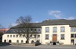
 Mertzig town hall | |
 Map of Luxembourg with Mertzig highlighted in orange, and the canton in dark red | |
| Coordinates: 49°49′52″N 6°00′13″E / 49.83109°N 6.00366°E | |
| Country | |
| Canton | Diekirch |
| Area | |
| • Total | 11.1 km2 (4.3 sq mi) |
| • Rank | 92nd of 100 |
| Highest elevation | 409 m (1,342 ft) |
| • Rank | 42nd of 100 |
| Lowest elevation | 302 m (991 ft) |
| • Rank | 94th of 100 |
| Population (2023) | |
| • Total | 2,370 |
| • Rank | 66th of 100 |
| • Density | 210/km2 (550/sq mi) |
| • Rank | 37th of 100 |
| Time zone | UTC+1 (CET) |
| • Summer (DST) | UTC+2 (CEST) |
| LAU 2 | LU0000607 |
| Website | mertzig.lu |
Mertzig (Luxembourgish: Mäerzeg) is a commune and town in central Luxembourg. It is part of Diekirch Canton.
Mertzig was formed on 30 December 1874, when it was detached from the commune of Feulen. The law forming Mertzig was passed on 20 November 1874.[1]
Population
[edit]Graphs are unavailable due to technical issues. There is more info on Phabricator and on MediaWiki.org. |
References
[edit]- ^ (in French and German) "Mémorial A, 1874, No. 34" (PDF). Service central de législation. Retrieved 2006-08-15.[permanent dead link]
- ^ "Population par canton et commune". statistiques.public.lu. Retrieved 11 January 2022.
External links
[edit] Media related to Mertzig at Wikimedia Commons

