Districts and neighbourhoods of Rotterdam
Appearance
This article needs additional citations for verification. (July 2019) |
The Dutch municipality Rotterdam is divided into districts and neighbourhoods for statistical purposes. The municipality is divided into the following statistical districts:
- District 01 Stadscentrum (CBS-districtcode:059901)
- District 03 Delfshaven (CBS-districtcode:059903)
- District 04 Overschie (CBS-districtcode:059904)
- District 05 Noord (CBS-districtcode:059905)
- District 06 Hillegersberg-Schiebroek (CBS-districtcode:059906)
- District 08 Kralingen-Crooswijk (CBS-districtcode:059908)
- District 10 Feijenoord (CBS-districtcode:059910)
- District 12 IJsselmonde (CBS-districtcode:059912)
- District 13 Pernis (CBS-districtcode:059913)
- District 14 Prins Alexander (CBS-districtcode:059914)
- District 15 Charlois (CBS-districtcode:059915)
- District 16 Hoogvliet (CBS-districtcode:059916)
- District 17 Hook of Holland (CBS-districtcode:059917)
- District 18 Spaanse Polder (CBS-districtcode:059918)
- District 19 Nieuw Mathenesse (CBS-districtcode:059919)
- District 21 Waalhaven-Eemhaven (CBS-districtcode:059921)
- District 22 Vondelingenplaat (CBS-districtcode:059922)
- District 23 Botlek-Europoort-Maasvlakte (CBS-districtcode:059923)
- District 24 Rotterdam-Noord-West (CBS-districtcode:059924)
- District 25 Rivium (CBS-districtcode:059925)
- District 26 Bedrijventerrein Schieveen (CBS-districtcode:059926)
- District 27 Rozenburg (CBS-districtcode:059927)
A statistical district may consist of several neighbourhoods. The table below shows the neighbourhood division with characteristic values according to the Statistics Netherlands (CBS, 2008):[1]
| CBS-neighbourhood code | Neighbourhood name | Population | Area total (ha) | Area land (ha) | Position |
|---|---|---|---|---|---|
| BU05990110 | Stadsdriehoek | 12060 | 172 | 134 | 
|
| BU05990111 | Oude Westen | 9500 | 59 | 59 | 
|
| BU05990112 | Cool | 4210 | 61 | 61 | 
|
| BU05990113 | C.S. kwartier | 970 | 39 | 39 | 
|
| BU05990117 | Kop van Zuid; number and map are dated, since 3 March 2010 part of Feijenoord | 1050 | 75 | 26 | 
|
| BU05990118 | Nieuwe Werk | 1660 | 99 | 70 | 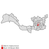
|
| BU05990119 | Dijkzigt | 640 | 51 | 49 | 
|
| BU05990320 | Delfshaven | 6280 | 53 | 41 | 
|
| BU05990321 | Bospolder | 6890 | 38 | 38 | 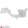
|
| BU05990322 | Tussendijken | 6290 | 40 | 37 | 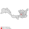
|
| BU05990323 | Spangen | 9520 | 64 | 59 | 
|
| BU05990324 | Nieuwe Westen | 18600 | 122 | 122 | 
|
| BU05990325 | Middelland | 11050 | 70 | 70 | 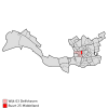
|
| BU05990327 | Oud-Mathenesse | 6400 | 82 | 82 | 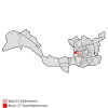
|
| BU05990328 | Witte Dorp | 580 | 4 | 4 | 
|
| BU05990329 | Schiemond | 4290 | 106 | 51 | 
|
| BU05990451 | Kleinpolder | 7290 | 131 | 125 | 
|
| BU05990452 | Noord-Kethel | 70 | 253 | 241 | 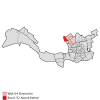
|
| BU05990454 | Schieveen | 420 | 429 | 422 | 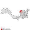
|
| BU05990455 | Zestienhoven | 880 | 590 | 573 | 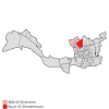
|
| BU05990456 | Overschie | 6700 | 169 | 147 | 
|
| BU05990457 | Landzicht | 400 | 8 | 8 | 
|
| BU05990515 | Agniesebuurt | 4080 | 36 | 36 | 
|
| BU05990516 | Provenierswijk | 4420 | 30 | 30 | 
|
| BU05990531 | Bergpolder | 7450 | 46 | 45 | 
|
| BU05990532 | Blijdorp | 9300 | 168 | 162 | 
|
| BU05990534 | Liskwartier | 7340 | 59 | 57 | 
|
| BU05990535 | Oude Noorden | 16600 | 106 | 101 | 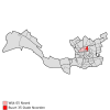
|
| BU05990558 | Blijdorpse polder | 100 | 91 | 85 | 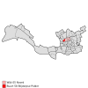
|
| BU05990660 | Schiebroek | 15160 | 493 | 487 | 
|
| BU05990661 | Hillegersberg-Zuid | 7620 | 127 | 119 | 
|
| BU05990662 | Hillegersberg-Noord | 7040 | 306 | 188 | 
|
| BU05990664 | Terbregge | 3470 | 188 | 179 | 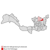
|
| BU05990665 | Molenlaankwartier | 7560 | 214 | 203 | 
|
| BU05990814 | Rubroek | 7820 | 53 | 52 | 
|
| BU05990836 | Nieuw-Crooswijk | 2770 | 111 | 104 | 
|
| BU05990837 | Oud-Crooswijk | 7820 | 54 | 49 | 
|
| BU05990841 | Kralingen-West | 15370 | 105 | 105 | 
|
| BU05990842 | Kralingen-Oost | 6690 | 204 | 202 | 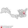
|
| BU05990843 | Kralingse Bos | 120 | 446 | 327 | 
|
| BU05990845 | De Esch | 4350 | 243 | 169 | 
|
| BU05990847 | Struisenburg | 4400 | 61 | 38 | 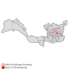
|
| BU05991079 | Kop van Zuid-Entrepot | 7640 | 82 | 74 | 
|
| BU05991080 | Vreewijk | 13950 | 204 | 203 | 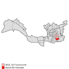
|
| BU05991081 | Bloemhof | 13180 | 80 | 80 | 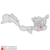
|
| BU05991082 | Hillesluis | 10660 | 90 | 90 | 
|
| BU05991085 | Katendrecht | 3660 | 119 | 56 | 
|
| BU05991086 | Afrikaanderwijk | 9300 | 48 | 48 | 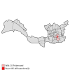
|
| BU05991087 | Feijenoord | 7420 | 100 | 63 | 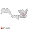
|
| BU05991088 | Noordereiland | 3280 | 67 | 25 | 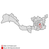
|
| BU05991283 | Oud-IJsselmonde | 5790 | 315 | 196 | 
|
| BU05991284 | Lombardijen | 13110 | 261 | 260 | 
|
| BU05991289 | Groot-IJsselmonde | 26960 | 583 | 578 | 
|
| BU05991290 | Beverwaard | 12140 | 152 | 149 | 
|
| BU05991391 | Pernis | 4740 | 160 | 160 | 
|
| BU05991444 | 's-Gravenland | 8520 | 223 | 208 | 
|
| BU05991446 | Kralingse Veer | 1710 | 64 | 50 | 
|
| BU05991448 | Prinsenland | 10160 | 179 | 171 | 
|
| BU05991449 | Het Lage Land | 9630 | 216 | 214 | 
|
| BU05991463 | Ommoord | 24260 | 448 | 438 | 
|
| BU05991466 | Zevenkamp | 16980 | 216 | 213 | 
|
| BU05991467 | Oosterflank | 10630 | 164 | 161 | 
|
| BU05991468 | Nesselande | 7340 | 513 | 398 | 
|
| BU05991571 | Tarwewijk | 10800 | 113 | 84 | 
|
| BU05991572 | Carnisse | 9960 | 62 | 62 | 
|
| BU05991573 | Zuidwijk | 12160 | 153 | 153 | 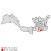
|
| BU05991574 | Oud-Charlois | 12590 | 149 | 135 | 
|
| BU05991575 | Wielewaal | 960 | 21 | 21 | 
|
| BU05991576 | Zuidplein | 880 | 26 | 26 | 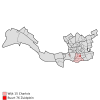
|
| BU05991577 | Pendrecht | 11890 | 123 | 123 | 
|
| BU05991578 | Zuiderpark | 1250 | 521 | 499 | 
|
| BU05991593 | Heijplaat | 1610 | 41 | 41 | 
|
| BU05991692 | Hoogvliet-Noord | 13260 | 532 | 502 | 
|
| BU05991699 | Hoogvliet-Zuid | 21640 | 541 | 480 | 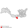
|
| BU05991701 | Strand en Duin | 1150 | 468 | 370 | 
|
| BU05991702 | Dorp | 8180 | 381 | 326 | 
|
| BU05991703 | Rijnpoort | 70 | 896 | 704 | 
|
| BU05991853 | Spaanse Polder | 160 | 204 | 185 | 
|
| BU05991926 | Nieuw-Mathenesse | 20 | 218 | 134 | 
|
| BU05992194 | Waalhaven | 10 | 618 | 257 | 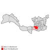
|
| BU05992196 | Eemhaven | 30 | 680 | 452 | 
|
| BU05992198 | Waalhaven-Zuid | 0 | 187 | 186 | 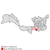
|
| BU05992295 | Vondelingenplaat | 0 | 911 | 683 | 
|
| BU05992306 | Botlek | 0 | 2474 | 1630 | 
|
| BU05992307 | Europoort | 0 | 3405 | 1844 | 
|
| BU05992308 | Maasvlakte | 0 | 3941 | 2385 | 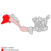
|
| BU05992459 | Bedrijventerrein Rotterdam Noord-West | 10 | 117 | 111 | 
|
| BU05992540 | Rivium | 0 | 11 | 11 | 
|
| BU05992650 | Bedrijventerrein Schieveen | 0 | 152 | 152 | 
|
| BU05992704 | Rozenburg | 12380 | xxx | xxx | {{{map}}} |
| BU05992705 | Noordzeeweg | 0 | xxx | xxx | {{{map}}} |
References
[edit]- ^ "Centraal Bureau voor de Statistiek". 6 June 2015. Archived from Digitale publicatie wijk- en buurtkaart, 2008 the original on 20 May 2015. Retrieved 6 June 2015.
{{cite web}}: Check|url=value (help)
