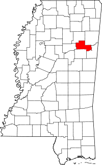
[ 3] Name on the Register[ 4]
Image
Date listed[ 5]
Location
City or town
Description
1
Dewitt Anderson House Dewitt Anderson House August 31, 1990 (#90001279 ) 104 W. Broad St. 33°36′15″N 88°39′02″W / 33.604167°N 88.650556°W / 33.604167; -88.650556 (Dewitt Anderson House ) West Point
2
Brandtown Gin Historic District Upload image November 15, 1991 (#91001634 ) Mississippi Highway 47 at Brandtown, west of Prairie33°48′03″N 88°51′10″W / 33.800833°N 88.852778°W / 33.800833; -88.852778 (Brandtown Gin Historic District ) Prairie
3
Brogan Mound and Village Site Discontiguous District Upload image May 24, 1991 (#91000607 ) Address restricted[ 6] West Point
4
Clay County Agricultural High School Clay County Agricultural High School November 15, 1991 (#91001645 ) 160 College 33°35′06″N 88°56′48″W / 33.585°N 88.946667°W / 33.585; -88.946667 (Clay County Agricultural High School ) Pheba
5
Colbert and Barton Townsites Colbert and Barton Townsites June 20, 1977 (#77000785 ) Western bank of the Tombigbee River , northeast of West Point (Colbert);[ 7] 33°37′50″N 88°30′15″W / 33.6306°N 88.5042°W / 33.6306; -88.5042 (Colbert and Barton Townsites ) West Point
6
Commerce Street Historic District Commerce Street Historic District August 31, 1990 (#90001283 ) 508-731 Commerce St. 33°36′06″N 88°38′44″W / 33.601667°N 88.645556°W / 33.601667; -88.645556 (Commerce Street Historic District ) West Point
7
Court Street Historic District Upload image August 12, 1982 (#82004835 ) Court Street between Travis and E. Broad Streets 33°36′08″N 88°38′56″W / 33.602222°N 88.648889°W / 33.602222; -88.648889 (Court Street Historic District ) West Point
8
East Main Street Historic District Upload image August 31, 1990 (#90001282 ) 510-1030 E. Main St. 33°36′26″N 88°38′29″W / 33.607222°N 88.641389°W / 33.607222; -88.641389 (East Main Street Historic District ) West Point
9
Mary Holmes Junior College Historic District Mary Holmes Junior College Historic District November 15, 1991 (#91001637 ) Mississippi Highway 50 , west of its junction with U.S. Highway 45A 33°36′29″N 88°39′55″W / 33.608056°N 88.665278°W / 33.608056; -88.665278 (Mary Holmes Junior College Historic District ) West Point
10
Charles R. Jordan House Charles R. Jordan House November 15, 1991 (#91001636 ) 82 Matthew Rd. 33°31′47″N 88°37′53″W / 33.529722°N 88.631389°W / 33.529722; -88.631389 (Charles R. Jordan House ) West Point
11
Moses Jordan House Moses Jordan House August 31, 1990 (#90001278 ) 940 E. Broad St. 33°36′11″N 88°38′33″W / 33.603056°N 88.6425°W / 33.603056; -88.6425 (Moses Jordan House ) West Point
12
Nathan Mathews House and Mathews Cotton Gin Nathan Mathews House and Mathews Cotton Gin November 15, 1991 (#91001638 ) 629 Mathews Gin Rd. 33°35′19″N 88°33′43″W / 33.588611°N 88.561944°W / 33.588611; -88.561944 (Nathan Mathews House and Mathews Cotton Gin ) West Point
13
Montpelier Historic District Upload image November 15, 1991 (#91001639 ) Junction of Mississippi Highways 46 and 389 33°43′02″N 88°56′52″W / 33.717222°N 88.947778°W / 33.717222; -88.947778 (Montpelier Historic District ) Montpelier
14
Kenneth G. Neigh Dormitory Complex Kenneth G. Neigh Dormitory Complex January 28, 2021 (#100006106 ) 276 Mary Holmes Row 33°36′33″N 88°40′05″W / 33.6091°N 88.6681°W / 33.6091; -88.6681 (Kenneth G. Neigh Dormitory Complex ) West Point
15
Pheba Historic District Upload image November 15, 1991 (#91001640 ) Pheba St. No. 2, just west of Mississippi Highway 389 33°34′52″N 88°57′00″W / 33.581111°N 88.95°W / 33.581111; -88.95 (Pheba Historic District ) Pheba
16
Powell-Vail House Upload image November 15, 1991 (#91001641 ) Eastern side of Vail Rd., 1.2 miles north of Mississippi Highway 50 33°36′16″N 88°55′43″W / 33.604444°N 88.928611°W / 33.604444; -88.928611 (Powell-Vail House ) Pheba
17
South Division Street Historic District Upload image August 31, 1990 (#90001281 ) 447-646 S. Division St. 33°36′11″N 88°32′32″W / 33.603056°N 88.542222°W / 33.603056; -88.542222 (South Division Street Historic District ) West Point
18
Tibbee Bridge Tibbee Bridge November 16, 1988 (#88002411 ) Spans Tibbee Creek on Old Tibbee Rd. 33°32′17″N 88°38′00″W / 33.538056°N 88.633333°W / 33.538056; -88.633333 (Tibbee Bridge ) West Point
19
Tibbee School Upload image November 15, 1991 (#91001642 ) Tibbee-Columbus Rd., at Tibbee 33°31′33″N 88°37′43″W / 33.525833°N 88.628611°W / 33.525833; -88.628611 (Tibbee School ) West Point
20
Town of Palo Alto Upload image August 20, 1987 (#87000473 ) Mississippi Highway 47 , northwest of West Point[ 8] 33°40′50″N 88°48′00″W / 33.6806°N 88.8°W / 33.6806; -88.8 (Town of Palo Alto ) Palo Alto
21
Turnage House Turnage House November 15, 1991 (#91001643 ) 1080 Turnage Rd. 33°43′18″N 88°54′41″W / 33.721667°N 88.911389°W / 33.721667; -88.911389 (Turnage House ) Montpelier
22
Una Consolidated School Una Consolidated School November 15, 1991 (#91001644 ) 3825 Brand-Una Rd. 33°47′45″N 88°47′10″W / 33.795833°N 88.786111°W / 33.795833; -88.786111 (Una Consolidated School ) Cedar Bluff
23
Waide Archeological Site Upload image July 27, 1999 (#99000842 ) Address restricted[ 6] Palo Alto
24
Waverley Waverley September 20, 1973 (#73001004 ) 10 miles east of West Point 33°34′09″N 88°30′13″W / 33.569167°N 88.503611°W / 33.569167; -88.503611 (Waverley ) West Point
25
Waverly Bridge Waverly Bridge March 20, 1989 (#88002412 ) Spans the Tombigbee River on the Columbus and Greenville railroad line 33°33′54″N 88°29′48″W / 33.565°N 88.496667°W / 33.565; -88.496667 (Waverly Bridge ) Waverly Extends into Lowndes County
26
West Point Central City Historic District Upload image June 1, 1982 (#82003099 ) Mississippi Highway 50 33°36′25″N 88°38′59″W / 33.606944°N 88.649722°W / 33.606944; -88.649722 (West Point Central City Historic District ) West Point
27
West Point School Historic District Upload image August 31, 1990 (#90001280 ) Roughly bounded by E. Westbrook, Calhoun, Travis and East Sts. 33°36′04″N 88°38′37″W / 33.601111°N 88.643611°W / 33.601111; -88.643611 (West Point School Historic District ) West Point
28
West Point Unified Historic District Upload image December 1, 2009 (#09000784 ) Roughly bounded by the rear property lines of resources along E. Main St. to the north, McCord St. to the west, and Forest St.July 25, 2012 , refnum 12000561): 117, 123, 133 West Broad St. 33°36′26″N 88°38′05″W / 33.607092°N 88.634694°W / 33.607092; -88.634694 (West Point Unified Historic District ) West Point


