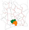
Gagnoa
Gagnoa | |
|---|---|
City, sub-prefecture, and commune | |
| Coordinates: 6°8′N 5°56′W / 6.133°N 5.933°W[1] | |
| Country | Ivory Coast |
| District | Gôh-Djiboua District |
| Region | Gôh |
| Department | Gagnoa |
| Area | |
| • Total | 890 km2 (340 sq mi) |
| Population (2021 census)[3] | |
| • Total | 277,044 |
| • Density | 310/km2 (810/sq mi) |
| • City | 160,465[2] |
| (2014 census) | |
| Time zone | UTC+0 (GMT) |
Gagnoa is a city in south-central Ivory Coast. It is the seat of both Gôh-Djiboua District and Gôh Region. It is also the seat of and a sub-prefecture of Gagnoa Department. Gagnoa is also a commune. In the 2014 census, the city had a population of 160,465,[2] making it the seventh-largest city in the country.
Gagnoa is the seat of the Roman Catholic Archdiocese of Gagnoa, and contains its cathedral.
Notable people
[edit]French rapper Vegedream's father as well as fellow performer and uncle Ziké are from Gagnoa, and Vegedream, famously the artist in the song Ramenez la coupe à la maison, says the French phrase Et ça c'est Vegedream de Gagnoa, meaning "And that is Vegedream of Gagnoa", in each song. He got that phrase when he visited Gagnoa as a child. He is therefore also named Vegedream de Gagnoa.
Climate
[edit]Gagnoa has a tropical savanna climate (Köppen Aw) with a lengthy although not particularly intense wet season from February/March to November, and a short dry season centred upon December and January.
| Climate data for Gagnoa | |||||||||||||
|---|---|---|---|---|---|---|---|---|---|---|---|---|---|
| Month | Jan | Feb | Mar | Apr | May | Jun | Jul | Aug | Sep | Oct | Nov | Dec | Year |
| Mean daily maximum °C (°F) | 32.3 (90.1) |
33.6 (92.5) |
33.0 (91.4) |
32.5 (90.5) |
31.6 (88.9) |
29.8 (85.6) |
28.6 (83.5) |
28.6 (83.5) |
29.8 (85.6) |
30.9 (87.6) |
31.1 (88.0) |
30.7 (87.3) |
31.0 (87.8) |
| Daily mean °C (°F) | 26.1 (79.0) |
26.8 (80.2) |
27.5 (81.5) |
27.3 (81.1) |
26.8 (80.2) |
25.7 (78.3) |
24.9 (76.8) |
24.7 (76.5) |
25.5 (77.9) |
26.2 (79.2) |
26.5 (79.7) |
25.7 (78.3) |
26.1 (79.0) |
| Mean daily minimum °C (°F) | 20.1 (68.2) |
21.8 (71.2) |
22.2 (72.0) |
22.3 (72.1) |
22.3 (72.1) |
21.9 (71.4) |
21.4 (70.5) |
21.4 (70.5) |
21.7 (71.1) |
22.0 (71.6) |
22.0 (71.6) |
20.9 (69.6) |
21.7 (71.1) |
| Average rainfall mm (inches) | 23.5 (0.93) |
63.4 (2.50) |
123.1 (4.85) |
162.8 (6.41) |
177.5 (6.99) |
205.8 (8.10) |
89.4 (3.52) |
95.4 (3.76) |
172.0 (6.77) |
159.2 (6.27) |
96.4 (3.80) |
37.5 (1.48) |
1,406 (55.38) |
| Mean monthly sunshine hours | 195.7 | 184.5 | 189.0 | 204.9 | 210.4 | 122.0 | 120.8 | 97.5 | 127.1 | 176.4 | 180.2 | 166.0 | 1,974.5 |
| Source: NOAA[4] | |||||||||||||
References
[edit]- ^ "Ivory Coast Cities Longitude & Latitude". sphereinfo.com. Archived from the original on 13 September 2012. Retrieved 19 November 2010.
- ^ a b Population.de Population of cities & localities in Ivory Coast
- ^ Citypopulation.de Population of regions and sub-prefectures of Ivory Coast
- ^ "Gagnoa Climate Normals 1961–1990". National Oceanic and Atmospheric Administration. Retrieved December 21, 2015.


