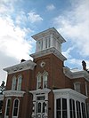
[ 3] Name on the Register
Image
Date listed[ 4]
Location
City or town
Description
1
Zenas Aplington House Zenas Aplington House September 5, 2017 (#100001565 ) 123 N. Franklin Ave. 41°59′14″N 89°34′40″W / 41.987133°N 89.577834°W / 41.987133; -89.577834 (Zenas Aplington House ) Polo
2
Bryant H. and Lucie Barber House Bryant H. and Lucie Barber House February 10, 1993 (#92001849 ) 103 North Barber Avenue 41°59′11″N 89°34′54″W / 41.986389°N 89.581667°W / 41.986389; -89.581667 (Bryant H. and Lucie Barber House ) Polo
3
Henry D. Barber House Henry D. Barber House March 28, 1974 (#74000770 ) 410 West Mason Street 41°59′11″N 89°34′56″W / 41.986482°N 89.58236°W / 41.986482; -89.58236 (Henry D. Barber House ) Polo
4
Buffalo Grove Lime Kiln Buffalo Grove Lime Kiln November 20, 2002 (#02001348 ) Galena Trail Road 41°59′10″N 89°36′37″W / 41.986111°N 89.610278°W / 41.986111; -89.610278 (Buffalo Grove Lime Kiln ) Polo
5
Buffalo Township Public Library Buffalo Township Public Library November 7, 1995 (#95001236 ) 302 West Mason Street 41°59′11″N 89°34′50″W / 41.986389°N 89.580556°W / 41.986389; -89.580556 (Buffalo Township Public Library ) Polo
6
Dr. William Burns House Dr. William Burns House August 27, 2018 (#100002824 ) 201 N Franklin Ave. 41°59′15″N 89°34′39″W / 41.9874°N 89.5775°W / 41.9874; -89.5775 (Dr. William Burns House ) Polo
7
Chana School Chana School December 6, 2005 (#05001369 ) 201 North River Road 42°00′50″N 89°20′00″W / 42.013958°N 89.333258°W / 42.013958; -89.333258 (Chana School ) Oregon
8
Chicago, Burlington, and Quincy Railroad Depot Chicago, Burlington, and Quincy Railroad Depot July 25, 1997 (#97000817 ) 400 Collins Street 42°00′06″N 89°19′59″W / 42.001604°N 89.333016°W / 42.001604; -89.333016 (Chicago, Burlington, and Quincy Railroad Depot ) Oregon
9
City and Town Hall City and Town Hall August 18, 1992 (#92001006 ) Junction of Fourth Avenue and Sixth Street 41°55′21″N 89°04′02″W / 41.9225°N 89.067222°W / 41.9225; -89.067222 (City and Town Hall ) Rochelle
10
John Deere House and Shop John Deere House and Shop October 15, 1966 (#66000327 ) Illinois and Clinton Streets 41°53′46″N 89°24′57″W / 41.896111°N 89.415833°W / 41.896111; -89.415833 (John Deere House and Shop ) Grand Detour
11
Flagg Township Public Library Flagg Township Public Library October 25, 1973 (#73000713 ) Northeast corner of 7th Street at 4th Avenue 41°55′24″N 89°04′05″W / 41.923333°N 89.068056°W / 41.923333; -89.068056 (Flagg Township Public Library ) Rochelle
12
Samuel M. Hitt House Samuel M. Hitt House November 14, 1985 (#85002841 ) 7782 Illinois Route 64 West 42°03′21″N 89°29′12″W / 42.055833°N 89.486667°W / 42.055833; -89.486667 (Samuel M. Hitt House ) Mount Morris
13
William H. Holcomb House William H. Holcomb House October 25, 1973 (#73000714 ) 526 North 7th Street 41°55′23″N 89°04′19″W / 41.923056°N 89.071944°W / 41.923056; -89.071944 (William H. Holcomb House ) Rochelle
14
Indian Statue Indian Statue November 5, 2009 (#09000871 ) Lowden Memorial State Park, 1411 N. River Rd. 42°00′50″N 89°20′00″W / 42.013958°N 89.333258°W / 42.013958; -89.333258 (Indian Statue ) Oregon
15
John McGrath House John McGrath House May 2, 1996 (#96000513 ) 403 West Mason Street 41°59′10″N 89°34′54″W / 41.986111°N 89.581667°W / 41.986111; -89.581667 (John McGrath House ) Polo
16
William Moats Farm William Moats Farm February 12, 1987 (#86003724 ) Wood Road 41°54′05″N 89°14′50″W / 41.901389°N 89.247222°W / 41.901389; -89.247222 (William Moats Farm ) Ashton
17
Mount Morris Downtown Historic District Upload image August 10, 2022 (#100007993 ) Wesley Ave., West Main St., South Seminary Ave., Center St. 42°02′51″N 89°26′03″W / 42.0476°N 89.4342°W / 42.0476; -89.4342 (Mount Morris Downtown Historic District ) Mount Morris
18
Ogle County Courthouse Ogle County Courthouse September 10, 1981 (#81000222 ) Courthouse Square 42°00′50″N 89°20′00″W / 42.013958°N 89.333258°W / 42.013958; -89.333258 (Ogle County Courthouse ) Oregon
19
Oregon Commercial Historic District Oregon Commercial Historic District August 16, 2006 (#06000713 ) Roughly bounded by Jefferson, Franklin, 5th and 3rd Streets 42°00′53″N 89°19′56″W / 42.014722°N 89.332222°W / 42.014722; -89.332222 (Oregon Commercial Historic District ) Oregon
20
Oregon Public Library Oregon Public Library May 9, 2003 (#03000352 ) 300 Jefferson Street 42°00′48″N 89°19′48″W / 42.013333°N 89.33°W / 42.013333; -89.33 (Oregon Public Library ) Oregon
21
Pinehill Pinehill July 24, 1978 (#78001179 ) 400 Mix Street 42°01′05″N 89°20′26″W / 42.018056°N 89.340556°W / 42.018056; -89.340556 (Pinehill ) Oregon
22
Polo Independent Order of Odd Fellows Lodge No. 197 Polo Independent Order of Odd Fellows Lodge No. 197 December 6, 2004 (#04001302 ) 117 West Mason Street 41°59′09″N 89°34′43″W / 41.985948°N 89.578519°W / 41.985948; -89.578519 (Polo Independent Order of Odd Fellows Lodge No. 197 ) Polo
23
Rochelle Downtown Historic District Rochelle Downtown Historic District December 31, 2018 (#100003265 ) Primarily 300-400 blks. Lincoln Hwy, 400 blk. Cherry & 400-500 blks. W. 4th Aves., 400 blk. Dewey & 300 blk. N. 6th Sts. 41°55′20″N 89°03′59″W / 41.922132°N 89.066347°W / 41.922132; -89.066347 (Rochelle Downtown Historic District ) Rochelle
24
Soldier's Monument Soldier's Monument February 14, 1985 (#85000268 ) Chestnut and 2nd Streets 42°07′36″N 89°15′16″W / 42.1267°N 89.254384°W / 42.1267; -89.254384 (Soldier's Monument ) Byron
25
Stillman's Run Battle Site Stillman's Run Battle Site December 8, 1983 (#83003587 ) Roosevelt and Spruce Streets 42°06′24″N 89°10′34″W / 42.106667°N 89.176111°W / 42.106667; -89.176111 (Stillman's Run Battle Site ) Stillman Valley
26
Village of Davis Junction Town Hall Village of Davis Junction Town Hall June 10, 2008 (#08000504 ) 202 Pacific Ave. 42°06′00″N 89°05′50″W / 42.10009°N 89.097175°W / 42.10009; -89.097175 (Village of Davis Junction Town Hall ) Davis Junction [ 5]
27
David and Julia Watson House David and Julia Watson House May 8, 2017 (#100000963 ) 103 N. Maple Ave. 41°59′12″N 89°35′07″W / 41.986566°N 89.585226°W / 41.986566; -89.585226 (David and Julia Watson House ) Polo
28
White Pines State Park Lodge and Cabins White Pines State Park Lodge and Cabins March 4, 1985 (#85002404 ) RR #1 41°59′40″N 89°27′53″W / 41.994444°N 89.464722°W / 41.994444; -89.464722 (White Pines State Park Lodge and Cabins ) Mount Morris


