Rabat
Rabat
الرباط | |
|---|---|
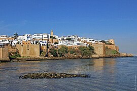
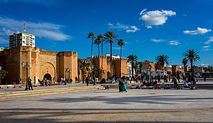
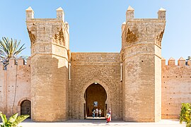
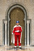
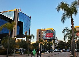
Clockwise from top: River Bou Regreg and the Kasbah of the Udayas, Royal Palace, Hassan Tower, Mohammed VI Tower, Avenue Mohammed V in downtown Rabat, Chellah Necropolis, Mausoleum of Mohammed V. | |
| Coordinates: 34°02′N 6°50′W / 34.033°N 6.833°W[1] | |
| Country | Morocco |
| Region | Rabat-Salé-Kénitra |
| Government | |
| • Mayor | Fatiha El Moudni |
| Area | |
| • City | 117 km2 (45.17 sq mi) |
| Highest elevation | 160 m (520 ft) |
| Lowest elevation | 0 m (0 ft) |
| Population (2014)[2] | |
| • City | 577,827 |
| • Rank | 7th in Morocco |
| • Density | 4,900/km2 (13,000/sq mi) |
| • Metro | 2,120,192 |
| Time zone | UTC+1 (CET) |
| Website | mairiederabat |
| Official name | Rabat, Modern Capital and Historic City: a Shared Heritage |
| Type | Cultural |
| Criteria | ii, iv |
| Designated | 2012 (36th session) |
| Reference no. | 1401 |
| Region | Arab States |
Rabat (/rəˈbɑːt/, also UK: /rəˈbæt/, US: /rɑːˈbɑːt/;[3][4][5] Arabic: الرباط, romanized: ar-Ribāṭ) is the capital city of Morocco and the country's seventh-largest city with an urban population of approximately 580,000 (2014)[2] and a metropolitan population of over 1.2 million. It is also the capital city of the Rabat-Salé-Kénitra administrative region.[6] Rabat is located on the Atlantic Ocean at the mouth of the river Bou Regreg, opposite Salé, the city's main commuter town.
Rabat was founded in the 12th century by the Almohads. The city grew at first but went into an extended period of decline following the collapse of the Almohads. In the 17th century, Rabat became a haven for Barbary pirates. When the French established a protectorate over Morocco in 1912 they made Rabat its administrative center. When Morocco achieved independence in 1955 Rabat became its capital.
Rabat, Temara, and Salé form a conurbation of over 1.8 million people. Silt-related problems have diminished Rabat's role as a port; however, Rabat and Salé still maintain important textile, food processing and construction industries. In addition, tourism and the city hosting all foreign embassies in Morocco makes Rabat one of the most important cities in the country. The Moroccan capital was ranked at second place by CNN in its "Top Travel Destinations of 2013".[7] It is one of four Imperial cities of Morocco, and the medina of Rabat is listed as a World Heritage Site. Rabat is accessible by train through the ONCF system and by plane through the nearby Rabat–Salé Airport.
Etymology
[edit]The name Rabat comes from the Arabic word الرباط (a-Ribāṭ) meaning the ribat, an Islamic base or fortification. This name is short for رباط الفتح (Ribāṭu al-Fatḥ) meaning the ribat of conquest or stronghold of victory—a title given by the Almohads when they established the city as a naval base in 1170.[8][9]
History
[edit]Ancient Sala
[edit]In the first millennium BC the Phoenicians founded several trading colonies along the Atlantic coast of what is now Morocco, but the existence of a Phoenician settlement in the area, called Sala or Shallat, has been debated by archeologists.[10][11] By the first century BC the local inhabitants were still writing in the neo-Punic language, but the region came under the influence of Rome.[12] It was controlled by the ancient Berber Mauretanian Kingdom until it was formally annexed by Rome in the first century BC.[13] On the site now known as Chellah, just south of the walled city today, the Romans built a city named Sala Colonia. Excavations have revealed that older Mauretanian structures existed on the site before Roman structures were built over them.[13] Along with Lixus, Sala Colonia was one of the two main naval outposts held by the Romans on the Atlantic coast of the Mauretania Tingitana province. The port of Sala (now disappeared) was used by commercial Roman ships as a way station on their southwestward passages to Anfa and the Insula Purpuraria (Mogador island).[14]
Archaeological objects of Visigothic and Byzantine origin found in the area attest to the persistence of commercial or political contacts between Sala and Roman Europe, up to the establishment of a Byzantine presence in North Africa during the 7th century.[15] However, Sala began to be abandoned in the 5th century and was mostly in ruins when the Muslim Arabs arrived in the 7th century and established Islamic influence in the region.[16]
Medieval Islamic period
[edit]
In the 10th century the Umayyads of Cordoba, or their Zenata Berber allies in the region, founded a ribat or fortified monastery/outpost in this area, to defend against the Barghawata Berbers who had established a Kharijite state to the south.[17] This ribat was most likely on the same site as the current Kasbah of the Udayas, but its location has not been confirmed by historians.[17] Around 1030, a new town called Salā (the present Salé) was founded on the opposite side of the river (the north side) by the Banu 'Ashara family.[18][19]
One of the last Almoravid emirs, Tashfin ibn Ali (r. 1143–1145) built a new ribat on the site of the current kasbah as part of his efforts to hold back the Almohads.[17][20] Almohads nonetheless defeated the Almoravids and destroyed the ribat shortly after.[21] In 1150 or 1151 the Almohad caliph Abd al-Mu'min built a new kasbah (citadel) to replace the former ribat, within which he included a palace and a mosque.[21][22][20] This Almohad kasbah corresponds to the current Kasbah of the Udayas (which was expanded in later periods).[20] Abd al-Mu'min also had an underground canal dug to divert a water source to this location, allowing for future settlement and urbanization in the area.[20] The site became a military staging ground for Almohad armies setting out on campaigns to Al-Andalus.[21]
The Almohad caliph Abu Yusuf Ya'qub al-Mansur (r. 1184–1199) embarked on an ambitious project to construct a new fortified imperial capital, called al-Mahdiyya or Ribat al-Fath, on the site of what is now the medina (old city) of Rabat, with new walls extending over a vast area beyond the kasbah.[20][23] This project also included the construction of an enormous mosque (the remains of which include the Hassan Tower) and of new grand gateways such as Bab er-Rouah and the main gate of the kasbah, now known as Bab Udaya or Bab al-Kbir. After al-Mansur's death in 1199 the mosque and the capital remained unfinished and his successors lacked the resources or the will to finish it.[20] The new city was never fully inhabited and the site was practically abandoned.[24][21]
During the Marinid dynasty period (13th to 15th centuries), the town of Salé across the river grew more important than the settlements of the south bank.[21][17][24] In 1515 Leo Africanus reported that Rabat had declined so much that only 100 inhabited houses remained.[citation needed] The Marinids did build a Great Mosque in what is now the medina of Rabat and on the nearby site of Chellah (ancient Sala) they built a royal necropolis for their dynasty.[24]
Corsair republic
[edit]In 1609, Philip III decreed the expulsion of all Moriscos (people of Muslim or Moorish descent) from Spain. About 2000 of these refugees, originally from the town of Hornachos near Badajoz, Spain, settled around Salé and occupied the kasbah, attracting between 5000 and 14,000 other Moriscos to join them.[21] Rabat and neighboring Salé united to form the Republic of Bou Regreg in 1627.[25] This autonomous republic became a base for corsairs: pirates, also known as the "Salé Rovers", who preyed on merchant ships around the shores of Western Europe.[21][26]

During this time, the area below the kasbah on the south bank became more heavily populated, thanks to the Morisco and Andalusi refugees. A new "Andalusian Wall" was built to delimit this area in the northern part of the former Almohad walled city. What is now known as the Street of the Consuls became an important road artery even at this time.[24][21] The name "Rabat" was not yet in use; the city of the south bank was known as "New Salé" while the city of the north bank was known as "Old Salé". Corsair activities were based in New Salé, whereas the inhabitants of Old Salé generally did not participate in piracy.[24]
'Alawi rule
[edit]The pirates did not have to contend with any central authority until al-Rashid, the founder of the 'Alawi dynasty, conquered the area in 1666 and united most of Morocco under his rule.[24][21] Nonetheless, the 'Alawi sultans allowed the piracy to continue up until the reign of Moulay Slimane in the early 19th century.[24] This led to the shelling of the city by Austria in 1829 after an Austrian ship had been lost to a pirate attack.[citation needed]

During the early part of the 'Alawi period (17th–18th centuries), the sultans took some interest in the city of the south bank and carried out constructions and repairs to the kasbah.[24] Moulay Isma'il (r. 1672–1727) expanded the kasbah southward and built a royal residence within it towards the end of the 17th century (it serves as a museum today).[17][21] Moulay Isma'il was also responsible for settling a part of the Udayas (or Oudayas), a guich tribe (military tribe serving the sultan's army), in the kasbah to serve as a counterbalancing force against other unruly tribes in the region.[21][26]: 230 Under Sidi Muhammad ibn 'Abdallah (r. 1757–1790), a new royal palace, the Dar al-Makhzen, was established in the southwest part of the Almohad walled area towards the end of the 18th century.[24] These additions began to give the city the character and function of a royal residence used by the ruling dynasty outside their main capitals.[24]
Moulay Slimane (r. 1792–1822) built another palace along the seaside called Dar al-Bahr and built new mosques such as the Moulay Slimane Mosque. He also ordered the creation of a Jewish quarter, the Mellah, in the eastern part of the Andalusian medina, in an formerly occupied by orchards.[24] It was also towards the beginning of the 19th century that the city walls, formerly limited to the Almohad-era perimeter, were extended significantly to the southwest, thus expanding the city to cover around 840 hectares.[24] The old Almohad walls and gates were still retained and the Almohad-era enclosure remained a more privileged district containing the city's major monuments and its imperial residence. Most of the population remained concentrated in the medina behind the Andalusian Wall in the northern section. In the 1850s, Moulay Abd ar-Rahman (r. 1822–1859) further developed and completed the Dar al-Makhzen palace in the southwest corner of this enclosure.[24] At the end of the 19th century or beginning of the 20th century, the city had some 20,000 to 25,000 inhabitants.[27]: 114
20th century
[edit]French colonial rule
[edit]
The French invasion of Morocco began in the east with General Hubert Lyautey's occupation of Oujda in March 1907 and in the west with the Bombardment of Casablanca in August 1907.[29] The Treaty of Fes established the protectorate in March 1912.[30] Acting as French administrator of Morocco, Lyautey decided to relocate the country's capital from Fes to Rabat after the riots of 1912 following the Treaty of Fes.[31] Lyautey appears to have had a personal affinity for Rabat. He argued that its coastal location was more pleasant and more accessible, and that its proximity to Casablanca, which he estimated would become the major economic center, would be advantageous.[27]: 138–139 In 1913, Lyautey hired Henri Prost to design the Ville Nouvelle (Rabat's modern quarter) as an administrative sector, as he did in other major Moroccan cities.[27]: 145–146
The colonial period resulted in major economic changes as well as accelerated urbanization. Prior to this period, the major cities of Morocco had always been Fez and Marrakesh, while the coastal cities were relatively small. Census figures are not available for the early years of the Protectorate, but in 1912 Rabat and nearby Salé can be estimated to have had about 35,000 to 40,000 inhabitants at most, according to Janet Abu-Lughod.[27]: 152 One early French survey, based on the number of houses rather than a formal census, estimated the population of Rabat to be 25,642. A formal census in 1921 counted the population as 33,714.[27]: 152–153 Some of this growth was due to the immigration of foreigners. In 1921, 59% of the population were Moroccan Muslims and 10% were Moroccan Jews, while 21.4% were French nationals and another 10% were foreigners of other origin. Nearby Salé, however, remained more homogenously Moroccan.[27]: 154 Rabat's population grew to approximately 83,000 in 1936 and to approximately 156,000 in 1952.[27]: 248
Post World War II and independence
[edit]When Morocco achieved independence in 1956, Mohammed V, the then King of Morocco, chose to have the capital remain at Rabat. Rabat's growth continued unabated. The most important demographic shift after independence was the exodus of foreign nationals and their replacement by Moroccans, who gradually took over the jobs and functions that the foreigners had occupied. In the census of 1971, the population of Rabat had grown to around 368,000, of which only 3.5% were foreigners.[27]: 152–153
Following World War II, the United States had established a military presence in Rabat at the former French air base. By the early 1950s, Rabat Salé Air Base was a U.S. Air Force installation hosting the 17th Air Force and the 5th Air Division, which oversaw forward basing for Strategic Air Command (SAC) B-47 Stratojet aircraft in the country. With the destabilization of French government in Morocco, and Moroccan independence in 1956, the government of Mohammed V wanted the U.S. Air Force to pull out of the SAC bases in Morocco, insisting on such action after American intervention in Lebanon in 1958.[32][verification needed] The United States agreed to leave as of December 1959, and was fully out of Morocco by 1963. SAC felt the Moroccan bases were much less critical with the long range capability of the B-52 Stratofortresses that were replacing the B-47s and with the completion of the USAF installations in Spain in 1959.[citation needed] With the USAF withdrawal from Rabat-Salé in the 1960s, the facility became a primary facility for the Royal Moroccan Air Force known as Air Base Nº 1, a status it continues to hold.
The fifth Arab League summit took place in Rabat in 1969 to discuss the arson of Al-Aqsa Mosque by Australian citizen Denis Michael Rohan.[33][34][35] In the same year, the Organisation of Islamic Cooperation, an organization that aims to protect the interests of the Muslim world, was founded at a summit in Rabat.[36][37][38] The 1974 Arab League summit was also held in Rabat. The summit recognized the Palestine Liberation Organization as the sole legitimate representative of the Palestinian people.[39][40] In 1985, the sixth edition of the Pan Arab Games was held in Rabat.[41]
In 2015, the city became part of the Rabat-Salé-Kénitra administrative region.[42] On 28 February 2024, Asmaa Rhlalou declared her resignation, months after she sparked a controversy that called into doubt her authority and validity within the City Council.[43][44]
Geography
[edit]Neighbourhoods of Rabat
[edit]Rabat is an administrative city. It has many shopping districts and residential neighbourhoods. The geographically spread out neighbourhoods are as follows:
The heart of the city consists of three parts: the Medina (old town); the Oudayas and Hassan both located to meet the Bou Regreg; and the Atlantic Ocean.[45][46]
To the west, and along the waterfront, there is a succession of neighbourhoods.
First, around the ramparts, there is the old neighbourhoods, Quartier l'Océan and Quartier les Orangers. Beyond that, a succession of mostly working-class districts: Diour Jamaa, Akkari, Yacoub El Mansour, Massira and Hay el Fath are the main parts of this axis.[47] Hay el Fath, which ends this sequence, evolves into a middle-class neighbourhood.[48]
To the east, along the Bouregreg, the Youssoufia region (working and middle class) : Mabella; Taqaddoum; Hay Nahda (mostly middle class); Aviation (middle and upper middle class); and Rommani.
Between the two axes, from north to south, there are three main neighbourhoods (middle class to affluent): Agdal (Ward Building; a lively mix of residential and commercial buildings. The residents are predominantly upper middle class); Hay Riad (affluent villas; this neighbourhood has experienced a surge of momentum since the 2000s); and Souissi (lavish villas, embassies, well-off residential neighborhood).
On the outskirts of Souissi, are a number of less-dense regions mainly comprising large private houses to areas that seem out of the city.
-
Riad District
-
Pietri Square
-
Rabat Hassan
Subdivisions
[edit]The prefecture is divided administratively into the following:[2]
| Name | Geographic code | Type | Households | Population (2014) | Foreign population | Moroccan population | Notes |
|---|---|---|---|---|---|---|---|
| Agdal Riyad | 421.01.01. | Arrondissement | 22,399 | 77,257 | 4,572 | 72,685 | |
| El Youssoufia | 421.01.03. | Arrondissement | 42,312 | 170,561 | 2,858 | 167,703 | |
| Hassan | 421.01.05. | Arrondissement | 32,848 | 108,179 | 2,151 | 106,025 | |
| Souissi | 421.01.06. | Arrondissement | 5,924 | 23,366 | 1,203 | 22,163 | |
| Touarga | 421.01.07. | Municipality | 812 | 3,932 | 8 | 3,924 | |
| Yacoub El Mansour | 421.01.09. | Arrondissement | 47,375 | 194,532 | 2,099 | 192,433 |
Climate
[edit]Rabat features a Mediterranean climate (Csa) with warm to hot, dry summers and mild, damp winters. Located along the Atlantic Ocean, Rabat has a mild, temperate climate, shifting from cool in winter to warm days in the summer months. The nights are always cool (or cold in winter, it can reach sub 0 °C (32 °F) sometimes), with daytime temperatures generally rising about 7–8 °C (13–14 °F). The winter highs typically reach only 17.2 °C (63.0 °F) in December–February. Summer daytime highs usually hover around 27 °C (80.6 °F), but may occasionally exceed 40 °C (104.0 °F) during heat waves. Summer nights are usually pleasant and cool, ranging between 11 and 19 °C (51.8 and 66.2 °F) and rarely exceeding 20 °C (68.0 °F). Rabat belongs to the sub-humid bioclimatic zone with an average annual precipitation of 560 mm (22 in). The airport station is located about 5 kilometres (3.1 mi) from the coastline, which will somewhat warm afternoons and cool nights down compared to a seaside location.
| Climate data for Rabat (Rabat–Salé Airport) 1991–2020, extremes 1943–present | |||||||||||||
|---|---|---|---|---|---|---|---|---|---|---|---|---|---|
| Month | Jan | Feb | Mar | Apr | May | Jun | Jul | Aug | Sep | Oct | Nov | Dec | Year |
| Record high °C (°F) | 30.0 (86.0) |
31.0 (87.8) |
35.8 (96.4) |
37.6 (99.7) |
43.0 (109.4) |
46.3 (115.3) |
47.2 (117.0) |
45.8 (114.4) |
43.6 (110.5) |
38.7 (101.7) |
35.1 (95.2) |
30.4 (86.7) |
47.2 (117.0) |
| Mean maximum °C (°F) | 22.7 (72.9) |
23.8 (74.8) |
28.6 (83.5) |
29.6 (85.3) |
33.8 (92.8) |
34.5 (94.1) |
36.3 (97.3) |
35.2 (95.4) |
33.7 (92.7) |
31.6 (88.9) |
27.8 (82.0) |
23.7 (74.7) |
40.5 (104.9) |
| Mean daily maximum °C (°F) | 17.4 (63.3) |
18.2 (64.8) |
20.2 (68.4) |
21.2 (70.2) |
23.6 (74.5) |
25.6 (78.1) |
27.2 (81.0) |
27.8 (82.0) |
26.6 (79.9) |
24.8 (76.6) |
21.1 (70.0) |
18.6 (65.5) |
22.7 (72.9) |
| Daily mean °C (°F) | 12.3 (54.1) |
13.0 (55.4) |
14.8 (58.6) |
16.0 (60.8) |
18.5 (65.3) |
20.8 (69.4) |
22.6 (72.7) |
23.1 (73.6) |
21.7 (71.1) |
19.6 (67.3) |
15.9 (60.6) |
13.7 (56.7) |
17.7 (63.9) |
| Mean daily minimum °C (°F) | 7.2 (45.0) |
7.8 (46.0) |
9.5 (49.1) |
10.9 (51.6) |
13.3 (55.9) |
15.9 (60.6) |
17.9 (64.2) |
18.3 (64.9) |
16.8 (62.2) |
14.4 (57.9) |
10.8 (51.4) |
8.8 (47.8) |
12.6 (54.7) |
| Mean minimum °C (°F) | 2.7 (36.9) |
3.1 (37.6) |
4.4 (39.9) |
6.5 (43.7) |
8.5 (47.3) |
11.5 (52.7) |
13.6 (56.5) |
14.2 (57.6) |
12.8 (55.0) |
10.1 (50.2) |
5.7 (42.3) |
3.9 (39.0) |
1.5 (34.7) |
| Record low °C (°F) | −3.2 (26.2) |
−2.6 (27.3) |
−1.0 (30.2) |
3.8 (38.8) |
5.3 (41.5) |
8.2 (46.8) |
10.0 (50.0) |
11.0 (51.8) |
10.0 (50.0) |
5.8 (42.4) |
0.3 (32.5) |
−0.6 (30.9) |
−3.2 (26.2) |
| Average precipitation mm (inches) | 80.9 (3.19) |
60.5 (2.38) |
62.6 (2.46) |
42.3 (1.67) |
17.9 (0.70) |
3.6 (0.14) |
0.4 (0.02) |
0.6 (0.02) |
13.7 (0.54) |
54.9 (2.16) |
94.3 (3.71) |
90.2 (3.55) |
521.9 (20.55) |
| Average precipitation days (≥ 1.0 mm) | 7.6 | 6.4 | 6.4 | 5.3 | 2.7 | 0.8 | 0.2 | 0.3 | 1.9 | 5.2 | 7.4 | 7.6 | 51.8 |
| Average relative humidity (%) | 82 | 82 | 80 | 78 | 77 | 78 | 78 | 79 | 80 | 79 | 80 | 83 | 80 |
| Mean monthly sunshine hours | 179.9 | 182.3 | 232.0 | 254.5 | 290.5 | 287.6 | 314.7 | 307.0 | 261.1 | 235.1 | 190.5 | 180.9 | 2,916.1 |
| Source 1: NOAA (sun 1961–1990)[49][50] | |||||||||||||
| Source 2: Deutscher Wetterdienst (humidity 1973–1993, record highs and lows),[51] Meteo Climat (record highs and lows)[52] Infoclimat[53] | |||||||||||||
Culture
[edit]The biggest place for theatre is the Mohammed V Theatre in the centre of the town, which was opened in 1962.[54][55] Construction on a new performing arts center, the Grand Theatre of Rabat, began in 2014.[56] Designed by Zaha Hadid, it will reportedly be the largest theater in the Arab world and in Africa. It was scheduled to open in 2021.[57][58]
Many organizations are active in cultural and social issues. Orient-Occident Foundation and ONA Foundation are the biggest of these. An independent art scene is active in the city. L'appartement 22, which is the first independent space for visual arts created by Abdellah Karroum, opened in 2002 and introduced international and local artists. Other independent spaces opened few years after, such as Le Cube, also set up in a private space.
Mawazine
[edit]Mawazine is a music festival in Rabat organized under the auspices of King Mohammed VI of Morocco, that started in 2001 where music groups, fans and spectators come together in a week-long celebration of culture and music both locally and internationally. Musicians such as Scorpions,[59] The Weeknd,[60] Jennifer Lopez,[61] Kanye West,[62] Pitbull,[63] Rihanna,[64] Elton John,[65] Stromae[66] and many others have performed at the festival.
Mawazine was host to more than 2,500,000 in 2013. Workshops are available for teaching dances and other arts. The festival is free. However, while most areas are free, there are those that require payment, specifically the smaller stages being the historical site of Chellah, the Mohammed V National Theater, and the Renaissance Cultural Center.[67]
Places of worship
[edit]The places of worship are predominantly Muslim mosques.[68] The oldest mosque in the city is the "Old Mosque" (Jama' al-'Atiqa) in the Kasbah of the Udayas. It was originally founded during Abd al-Mu'min's construction of the kasbah in 1150, though its current form mostly dates from an 18th-century restoration.[21][17][69] Other important mosques include the Great Mosque in the old medina, also known as the el-Kharrazin Mosque, and the As-Sunna Mosque in central Rabat, originally completed in 1785 by Sultan Muhammad ibn Abdallah.[70][71][21]
The last remaining synagogues in Rabat are the Rabbi Shalom Zawi Synagogue and the Talmud Torah Synagogue.[72][73] There are also Christian churches and temples, including an Evangelical church and St. Peter's Cathedral (Cathédrale de Saint-Pierre), which hosts the Roman Catholic Archdiocese of Rabat.
Museums and parks
[edit]
The Oudayas Museum (also formerly known as the National Museum of Jewellery) is housed in a pavilion residence built by Sultan Moulay Isma'il (r. 1672–1727) inside the Kasbah of the Udayas. It was first opened in 1915, making it one of the oldest public museums in Morocco. Its collections, augmented by private donations, feature diverse objects from throughout Morocco, mostly from the 18th to 20th centuries.[75][76] In 2006 it became the National Museum of Jewellery, with exhibits focusing on the history of Moroccan jewellery.[75] As of 2019 it was under renovations to be transformed into a new museum to be called Musée du caftan et de la parure ('Museum of the caftan and adornment').[77]
The Museum of History and Civilizations (formerly the National Archeological Museum) showcases the history of Morocco through a collection of archeological artifacts from the Punic, Mauretanian, Roman, and Islamic periods. This includes a collection of ancient Roman bronze and marble statuary from sites such as Lixus, Volubilis, and Chellah, as well as coins, ceramics, and architectural fragments from the Islamic period.[78][79][80]
The Rabat Zoo (officially called the Zoological Garden of Rabat) was opened in 1973, in part to house the lions that were previously kept at the Royal Palace.[81] The lions are descended from the now-extinct Barbary lions.[82][83] Since then the zoo has expanded to house some 1800 animals and has engaged in conservation efforts.[84]
The Bank al-Maghrib Museum was inaugurated in 2002 and is housed at the Bank al-Maghrib building downtown. Its main exhibits include a collection of coins and currency from ancient times to the modern era, as well as a gallery of Orientialist art.[85][86] The Mohammed VI Museum of Modern and Contemporary Art was inaugurated in 2014.[87]
Historic monuments
[edit]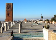
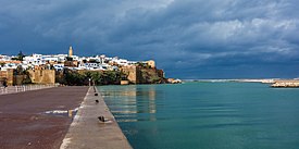
The Kasbah of the Udayas (also spelled "Kasbah of the Oudaias") is the oldest part of the present-day city, built by the Almohads in the 12th century. It was later refortified and expanded by the corsairs and the 'Alawi dynasty in the 17th and 18th centuries.[21][17][20][88]: 171 The kasbah is now a residential district with traditional houses painted white and blue on the outside. Its southern section includes the "Andalusian Garden", landscaped in the 20th century.[21][89][90]
The city's historic walls were first built by the Almohad caliph Ya'qub al-Mansur and completed in 1197, with later additions in the 17th and 19th centuries.[24][21] A number of monumental gates are found along the walls, the most notable being Bab er-Rouah. The other Almohad-era gates are Bab el-Had, Bab al-Alou, Bab Zaers, and Bab al-Hadid, though many of them were modified in more recent periods.[21] The 17th-century Andalusian Wall, which divides the zone inside the Almohad walls, has five more gates: Bab Jdid (formerly Bab Teben, mostly demolished), Bab al-Bouiba, Bab Chellah, Bab Mellah, and Bab Diouana.[21]
The old medina, located below the kasbah and above the line of the Andalusian Wall, contains many historic mosques and traditional houses. The rest of the area within the Almohad walls but south of the Andalusian Wall was largely built up in the 20th century when Rabat became the capital during the French Protectorate.[27] These districts contain numerous public buildings and apartment blocs built in contemporary styles of that period, such as neo-Moorish (known as néo-Mauresque or arabisant in French), Art Nouveau, Art Deco, and modern architecture.[88]: 38–42 Examples of these include the Bank al-Maghrib building (built in the 1920s), the Central Post Office building (circa 1921, expanded in 1930s), the Parliament building (built in the 1920s), St.-Peter's Cathedral (inaugurated in 1921, with later additions), the Rabat-Ville train station (early 1920s), and some of the apartment blocs on Rue Gaza (built or begun in the 1930s), among others.[88]: 44–55 [91][92][27]: 199 [93]
Overlooking the shores of the river is the Hassan Tower, a monumental unfinished minaret constructed by Ya'qub al-Mansur in the late 12th century. It was built for an enormous mosque planned as part of the larger city al-Mansur was constructing. Across from the tower today, at the southern end of the mosque's remains, is the Mausoleum of Mohammed V (d. 1961), which houses the remains of King Mohammed V and King Hassan II. The mausoleum, completed in 1971, was designed in a neo-Moorish or Moroccan revivalist style by Vietnamese architect Cong Vo Toan.[94][95]
A short distance south of the historic city walls is the archeological site of Chellah, a walled enclosure containing a 13th to 14th-century Marinid funerary and religious complex as well as the ruins of the Roman city of Sala Colonia.[21] Across the river is the city of Salé, which also preserves a historic medina. The medina of Salé includes monuments from the Marinid period such as Bab Mrissa and the Madrasa of Abu al-Hasan as well as landmarks from later periods.[96]
- Historic sites and landmarks
-
The Kasbah of the Udayas, seen from the river
-
Typical street and houses inside the Kasbah
-
Rue des Consuls, one of the main streets of the medina
-
City walls, including Bab al-Had (left)
-
Central Post Office
-
Gates of Chellah
-
Honor guard at Mausoleum of Mohammed V
Education
[edit]Colleges and universities
[edit]Public:
- Mohammed V University was founded in 1957[97][98]
- National Institute of Statistics and Applied Economics was founded 1961
- National School of Architecture (1980)[99]
Private:
- HEM Business School, founded 1993
Transport
[edit]
Air
[edit]Rabat's main airport is Rabat–Salé Airport.
Trains
[edit]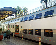
Rabat is served by two principal railway stations run by the national rail service ONCF.
Rabat-Ville and Rabat Agdal are the two main inter-city stations, from which trains run south to Casablanca, Marrakech and El Jadida, north to Tangier, or east to Meknes, Fez, Taza and Oujda.
ONCF operates the Le Bouregreg urban rail for Rabat-Salé agglomeration. Marrakesh is a 4 hr journey, Fez 21⁄2 hr on an express train and 31⁄2 hr on other trains and Casablanca 1 hr.[100]
Tram
[edit]
The Rabat–Salé tramway was the first tramway network in Morocco and connects Rabat with Salé across the river. It was opened on 11 May 2011 after a construction cost of 3.6 billion MAD.[101][102] The network was constructed by Alstom Citadis and is operated by Transdev.[103][104] As of February 2022, the network had two lines with a total length of 26.9 km (17 miles) and 43 stations.[102][105] In 2023, an extension of the network was being planned and is due to be completed by 2028.[101]
City buses
[edit]After some years of neglect as investment was directed at the tramway, the existing operator, STAREO, was displaced in 2019. A contract was awarded to Alsa-City Bus, a joint venture between Moroccan company City Bus and Spanish company Alsa, a subsidiary of the Mobico Group. The new operator took over in July 2019 with a commitment to three hundred and fifty new buses. These will comprise 102 Mercedes-Benz and 248 Scania vehicles. The contract covers a 15-year period, renewable for seven years, and promises approximately 10 billion MAD investment into the bus transport system in the region.[106]
Sports
[edit]Prince Moulay Abdellah Stadium (Arabic: استاد الأمير مولاي عبد لله) is a multi-purpose stadium in Rabat, Morocco. It is named after Prince Moulay Abdellah. It was built in 1983 and is the home ground of ASFAR (football club). It is used mostly for football matches, and it can also stage athletics. The stadium holds 52,000. Since 2008 it is host of the Meeting International Mohammed VI d'Athlétisme de Rabat.
Rabat hosted the 2019 African Games after Malabo, Equatorial Guinea was stripped of hosting due to economic matters. It was the first time the African Games were hosted by Morocco. It is one of the potential host cities for the 2030 FIFA World Cup.
Football
[edit]Rabat's most popular sport club is the association football clubs ASFAR and FUS de Rabat. Well known in the continental competitions. AS FAR have won 2 major African titles, including 1 CAF Champions League and 1 CAF Confederation Cup.[107][108] While Fus de Rabat has only managed to win one major African title, 1 CAF Confederation Cup.[109]
The local football teams are:
- ASFAR (football club)
- ASFAR (women)
- FUS de Rabat
- Stade Marocain
- Hilal de Rabat
- Union de Touarga
- Youssoufia Club de Rabat
Handball
[edit]- ASFAR
- FUS de Rabat
- Le Stade Marocain
Basketball
[edit]The local basketball teams are:
- ASFAR
- FUS de Rabat
- Moghreb de Rabat
- FAR
Volleyball
[edit]- ASFAR
- FUS de Rabat
- Crédit agricole Rabat
Notable people
[edit]Politicians:
- Reuven Abergel, Israeli social and political activist
- Marc Perrin de Brichambaut, French judge and diplomat
- Dominique de Villepin, former Prime Minister of France
- Richard Dell'Agnola, French politician
- Omar El Bahraoui, former mayor of Rabat
- David Levy, Israeli politician
- Maxim Levy, Israeli politician
- Bernard Squarcini, French counter-terrorism director
- Asmaa Rhlalou, mayor of Rabat
Scientists, writers and philosophers:
- Abdellah Taïa, writer
- Mehdi Elmanjra, scholar
- Robert Assaraf, historian
- Alain Badiou, French philosopher
- Mohammed Suerte Bennani, Moroccan novelist
- Mohammed Berrada, Moroccan novelist, literary critic, and translator
- Helene Hagan, Franco-American writer anthropologist
- Abdelfattah Kilito, Moroccan writer
- Bahaa Trabelsi, Moroccan novelist
- Mohammad Naciri, Regional Director for the Arab States and Asia Pacific for the UN Women
Artists:
- Samira Said, Moroccan singer
- Saad Lamjarred, Moroccan singer
- Hajib, Moroccan Chaabi singer
- Shlomo Bar, Israeli musician
- Fabienne Égal, French announcer and television host
- Roland Giraud, French actor
- Macha Méril, French actress and writer
- Daniel Siboni, French photographer
- French Montana, American Hip-Hop Artist
- Bryce Hudson, American painter and photographer
Sports:
- Saïd Aït-Bahi, Moroccan footballer
- Rachid Benmahmoud, Former footballer
- Bouabid Bouden, Moroccan footballer
- Custodio Dos Reis, French road bicycle racer
- Younes El Aynaoui, Moroccan tennis player
- Adam Ennafati, footballer
- Younes Khattabi, Moroccan rugby league player
- Ait Hammi Miloud, Moroccan Olympic boxer
- Jean Patrick Lesobre, French Rugby Union player
- Younès Moudrik, Moroccan long jumper
- Youssef Rabeh, Former footballer
- Brahim Taleb, Moroccan long-distance runner
Royal descendants:
Twin towns – sister cities
[edit]References
[edit]- ^ "Hong Kong Observatory". Hong Kong Observatory. Retrieved 2009-08-17.
- ^ Jump up to: a b c "Population légale d'après les résultats du RGPH 2014 sur le Bulletin officiel N° 6354". Haut-Commissariat au Plan (in Arabic). Archived from the original (pdf) on 2018-12-26. Retrieved 2015-07-11.
- ^ "Rabat". The American Heritage Dictionary of the English Language (5th ed.). HarperCollins. Retrieved 7 May 2019.
- ^ "Rabat". Collins English Dictionary. HarperCollins. Retrieved 7 May 2019.
- ^ "Rabat" (US) and "Rabat". Lexico UK English Dictionary. Oxford University Press. Archived from the original on 2020-03-22.
- ^ "Décret fixant le nom des régions" (PDF). Portail National des Collectivités Territoriales (in French). Archived from the original (PDF) on 2015-05-18. Retrieved 2015-07-11.
- ^ "Top travel destinations for 2013 – CNN.com". Edition.cnn.com. 2013-01-02. Retrieved 2013-03-12.
- ^ تاريخ رباط الفتح - عبد الله السويسي (in Arabic).
- ^ "دعوة الحق - رباط الفتح". www.habous.gov.ma. Retrieved 2021-04-06.
- ^ Janet L. Abu-Lughod (1980). Rabat: Urban Apartheid in Morocco. Princeton University Press. pp. 35, 37–38 (note 2). ISBN 978-1-4008-5303-8.
- ^ Martín, Alfredo Mederos (2019). "North Africa: from the Atlantic to Algeria". In Doak, Brian R.; López-Ruiz, Carolina (eds.). The Oxford Handbook of the Phoenician and Punic Mediterranean. Oxford University Press. p. 630. ISBN 978-0-19-049934-1.
- ^ Anna Gallina Zevi; Rita Turchetti (2004). Méditerranée occidentale antique: les échanges. Atti del seminario (Marsiglia, 14–15 maggio 2004). Ediz. francese, italiana e spagnola. Rubbettino Editore. p. 224. ISBN 978-88-498-1116-2.
- ^ Jump up to: a b Mugnai, Niccolò (2016). Architectural Decoration and Urban History in Mauretania Tingitana (Morocco) (PhD thesis). School of Archaeology and Ancient History, University of Leicester. pp. 156–183.
- ^ "Le province romane d'Africa in "Il Mondo dell'Archeologia"". www.treccani.it (in Italian). Retrieved 2018-02-24.
- ^ Boube, J. "Éléments de ceinturon wisigothiques et byzantins trouvés au Maroc".Bulletin d'archéologie marocaine, volume=XV, 1983–84.pages=281–297
- ^ Salmon, Xavier (2021). Fès mérinide: Une capitale pour les arts, 1276-1465. Lienart. pp. 268–271. ISBN 9782359063356.
- ^ Jump up to: a b c d e f g Parker, Richard (1981). A practical guide to Islamic Monuments in Morocco. Charlottesville, VA: The Baraka Press. pp. 75–85.
- ^ Rachid El Hour (1 January 2000). "The Andalusian Qāḍī in the Almoravid Period: Political and Judicial Authority". Studia Islamica (90). Maisonneuve & Larose: 80. doi:10.2307/1596165. JSTOR 1596165.
With regard to the judicial administration in the Maghreb, the Almoravids gave the judicial functions to local families. For example in Sale, the Banu 'Ashara family, a very rich family...
- ^ Oleg Grabar (1990). Muqarnas: An Annual on Islamic Art and Architecture. Brill. p. 65. ISBN 90-04-09347-8.
- ^ Jump up to: a b c d e f g Bennison, Amira K. (2016). The Almoravid and Almohad Empires. Edinburgh University Press. pp. 309–10, 322–25.
- ^ Jump up to: a b c d e f g h i j k l m n o p q r s Touri, Abdelaziz; Benaboud, Mhammad; Boujibar El-Khatib, Naïma; Lakhdar, Kamal; Mezzine, Mohamed (2010). "VIII.1 Rabat". Le Maroc andalou : à la découverte d'un art de vivre (2 ed.). Ministère des Affaires Culturelles du Royaume du Maroc & Museum With No Frontiers. ISBN 978-3902782311.
- ^ Lintz, Yannick; Déléry, Claire; Tuil Leonetti, Bulle (2014). Le Maroc médiéval: Un empire de l'Afrique à l'Espagne. Paris: Louvre éditions. pp. 306–308. ISBN 9782350314907.
- ^ History of Morocco, Henri Terrasse, 1952
- ^ Jump up to: a b c d e f g h i j k l m n Mouline, Saïd (2008). "Rabat, Salé – Holy Cities of the Two Banks". In Jayyusi, Salma K. (ed.). The City in the Islamic World. Brill. pp. 643–662. ISBN 9789047442653.
- ^ Levant, Yves; Maziane, Leïla (2017-01-02). "The Republic of Salé (1627–1641/1666); an alternative pirate organization model?". Management & Organizational History. 12 (1): 1–29. doi:10.1080/17449359.2017.1296773. ISSN 1744-9359. S2CID 157363174.
- ^ Jump up to: a b Abun-Nasr, Jamil (1987). A history of the Maghrib in the Islamic period. Cambridge: Cambridge University Press. ISBN 0521337674.
- ^ Jump up to: a b c d e f g h i j Janet L. Abu-Lughod (1980). Rabat: Urban Apartheid in Morocco. Princeton University Press. ISBN 978-1-4008-5303-8.
- ^ "Bank al-Maghrib, Agence Centrale". Archnet. Retrieved 2020-06-09.
- ^ Miller, Susan Gilson. (2013). A history of modern Morocco. New York: Cambridge University Press. p. 75. ISBN 9781139624695. OCLC 855022840.
- ^ "History of Morocco". Encyclopedia Britannica. Retrieved 2017-12-22.
- ^ "Fez Riots (1912)". Encyclopedia of Jews in the Islamic World. doi:10.1163/1878-9781_ejiw_sim_0007730. Retrieved 2021-10-28.
- ^ Roman Adrian Cybriwsky, Capital Cities around the World: An Encyclopedia of Geography, History, and Culture, ABC-CLIO, USA, 2013, p. 253
- ^ Akhtar, Shameem (1969). "The Rabat Summit Conference". Pakistan Horizon. 22 (4): 336–340. ISSN 0030-980X. JSTOR 41394681.
- ^ "Arab League Summit Conferences, 1964–2000". The Washington Institute. Retrieved 2023-04-19.
- ^ "Human Right Centre - Università di Padova | Pins :: The League of Arab States, not to be confounded with the Organization of Islamic Cooperation". unipd-centrodirittiumani.it. Retrieved 2023-04-19.
- ^ "History". www.oic-oci.org. Retrieved 2023-04-19.
- ^ "Organization of Islamic Cooperation". www.mofa.gov.bh. Retrieved 2023-04-19.
- ^ Johansson-Nogués, Elisabeth (2020-03-26). The Organization of Islamic Cooperation and the Arab League. Brill Nijhoff. ISBN 978-90-04-38444-6.
- ^ "Text of Arab Resolution at Rabat". The New York Times. 1974-10-30. ISSN 0362-4331. Retrieved 2023-04-19.
- ^ "Jordan - THE RABAT SUMMIT CONFERENCE". countrystudies.us. Retrieved 2023-04-19.
- ^ "6th Pan Arab Games, 1985 (Morocco)". www.rsssf.org. Retrieved 2023-04-19.
- ^ "Décret fixant le nom des régions" (PDF). Portail National des Collectivités Territoriales (in French). Archived from the original (PDF) on 18 May 2015. Retrieved 11 July 2015.
- ^ "Rabat mayor steps down amidst accusations and mounting pressure". HESPRESS English - Morocco News. 2024-02-28. Retrieved 2024-03-01.
- ^ Kasraoui, Safaa. "Asmaa Rhlalou Resigns as Mayor of Rabat". Morocco World News. Retrieved 2024-03-01.
- ^ videos, All the. "Rabat - Culture, heritage and festivals | Moroccan National Tourist Office". www.visitmorocco.com. Retrieved 2023-04-20.
- ^ "Medina of Rabat". Morocco.com. Retrieved 2023-04-20.
- ^ Elsheshtawy, Yasser (2008-05-27). The Evolving Arab City: Tradition, Modernity and Urban Development. Routledge. ISBN 978-1-134-12821-1.
- ^ Team, Kurby (2023-06-29). "The 10 Best Neighborhoods In Rabat, Morocco". Kurby Real Estate AI. Retrieved 2024-03-01.
- ^ "Rabat Sale Climate Normals for 1991–2020". National Oceanic and Atmospheric Administration. Archived from the original on 8 October 2023. Retrieved 8 October 2023.
- ^ "Rabat Climate Normals 1961–1990". National Oceanic and Atmospheric Administration. Archived from the original on 8 October 2023. Retrieved 8 October 2023.
- ^ "Klimatafel von Rabat-Salé (Int. Flugh.) / Marokko" (PDF). Baseline climate means (1961–1990) from stations all over the world (in German). Deutscher Wetterdienst. Retrieved October 14, 2016.
- ^ "Station Rabat" (in French). Météo Climat. Retrieved October 14, 2016.
- ^ "Climatologie de l'année à Rabat-Sale" (in French). Infoclimat. Retrieved 10 October 2023.
- ^ V, Théâtre Mohammed. "Théâtre National Mohammed V | Théâtre Mohammed V". Retrieved 2022-04-21.
- ^ "Theatre National Mohammed V, Rabat, Maroc, Concert, Musique, Humour". www.babelfan.ma (in French). Archived from the original on 2022-05-22. Retrieved 2022-04-21.
- ^ "Archnet". www.archnet.org. Retrieved 2022-04-21.
- ^ "Grand Théâtre de Rabat | Rabat, Morocco Attractions". Lonely Planet. Retrieved 2022-04-21.
- ^ "Grand Theatre of Rabat soon to open as the largest in Arab world, Africa |". AW. 18 August 2020. Retrieved 2022-04-21.
- ^ "Morocco hosts musicians — and imprisons its own". NBC News. 26 May 2012. Retrieved 2023-04-21.
- ^ Senoussi, Zoubida (14 May 2018). "The Weeknd to Perform at Morocco's Mawazine Festival". Morocco World News. Retrieved 2023-04-21.
- ^ "Jennifer Lopez Moroccan concert sparks calls for minister's resignation". BBC News. 2015-06-02. Retrieved 2023-04-21.
- ^ "Kanye West performs at Mawazine Festival". ajc. Retrieved 2023-04-21.
- ^ "Pitbull At Mawazine Festival…. Again". Morocco World News. 23 May 2016. Retrieved 2023-04-21.
- ^ "Rihanna Kicks Off Morocco's Mawazine Global Music Fest". MTV. Archived from the original on April 21, 2023. Retrieved 2023-04-21.
- ^ "Elton John performs in Morocco despite protest". BBC News. 2010-05-27. Retrieved 2023-04-21.
- ^ "Maroc: Stromae explose le record d'affluence de Mawazine – Jeune Afrique". JeuneAfrique.com (in French). Retrieved 2023-04-21.
- ^ Bill K. Anderson, Mawazine — The binding of cultures, the channeling of acceptance, http://digitaljournal.com/, 5 June 2014
- ^ J. Gordon Melton, Martin Baumann, ‘‘Religions of the World: A Comprehensive Encyclopedia of Beliefs and Practices’’, ABC-CLIO, USA, 2010, p. 1959
- ^ France, PASS Technologie, 26, rue Louis Braille, 75012 Paris. "Al masjid al-Atiq (Kasbah des Oudaïa)". www.idpc.ma (in French). Archived from the original on 2020-01-02. Retrieved 2020-01-02.
{{cite web}}: CS1 maint: multiple names: authors list (link) CS1 maint: numeric names: authors list (link) - ^ Marçais, Georges (1954). L'architecture musulmane d'Occident. Paris: Arts et métiers graphiques. p. 391.
- ^ El Mghari, Mina (2017). "Tendances architecturales de la mosquée marocaine (XVIIème-XIXème siècles)". Hespéris-Tamuda. LII (3): 229–254.
- ^ Yabiladi.com. "Les 10 plus belles synagogues du Maroc". www.yabiladi.com (in French). Retrieved 2019-10-11.
- ^ Gross, Judah Ari. "Gantz meets with Moroccan Jews at Rabat synagogue". www.timesofisrael.com. Retrieved 2022-04-22.
- ^ "جامع السنة". www.habous.gov.ma. Retrieved 2019-10-11.
- ^ Jump up to: a b "MUSÉE DES OUDAYAS – FNM" (in French). Retrieved 2022-04-21.
- ^ "Udayas Museum (National Museum of Jewellery)". MWNF - Museum With No Frontiers. Retrieved 2022-04-21.
- ^ "Rénovation des musées : Le chantier démarre en juillet". LesEco.ma (in French). 2016-05-17. Retrieved 2022-04-21.
- ^ "Rabat Archaeological Museum". Discover Islamic Art - Virtual Museum. Retrieved 2022-04-21.
- ^ "Museum of History & Civilisation | Rabat, Morocco Attractions". Lonely Planet. Retrieved 2022-04-21.
- ^ "Welcome to the Moroccan History and Civilizations Museum". Morocco World News. 14 April 2017. Retrieved 2022-04-21.
- ^ MATIN, LE (September 2007). "Un nouveau parc zoologique à Rabat". Le Matin (in French). Retrieved 2022-04-21.
- ^ Burger, J.; Hemmer, H. (2006). "Urgent call for further breeding of the relic zoo population of the critically endangered Barbary lion (Panthera leo leo Linnaeus 1758)" (PDF). European Journal of Wildlife Research. 52: 54–58. doi:10.1007/s10344-005-0009-z. S2CID 30407194. Archived from the original (PDF) on 3 July 2007.
- ^ Black, S.; Yamaguchi, N.; Harland, A.; Groombridge, J. (2010). "Maintaining the genetic health of putative Barbary lions in captivity: an analysis of Moroccan Royal Lions". European Journal of Wildlife Research. 56: 21–31. doi:10.1007/s10344-009-0280-5. S2CID 44941372.
- ^ "Jardin Zoologique de Rabat : immersion dans le monde animal… - La Vie éco". La Vie Éco (in French). 15 November 2017. Retrieved 2022-04-21.
- ^ "Sharing the history of an institution and the heritage of a country". Bank al-Maghrib. Retrieved 2022-05-04.
- ^ "Bank Al Maghrib Museum". Visit Rabat. Conseil Régional du Tourisme - Rabat-Salé-Kenitra. Retrieved 2022-05-04.
- ^ "MUSÉE MOHAMMED VI D'ART MODERNE ET CONTEMPORAIN, RABAT – FNM" (in French). Retrieved 2022-04-21.
- ^ Jump up to: a b c Rabat, capitale moderne et ville historique: un patrimoine en partage. Royaume du Maroc (state submission to UNESCO for World Heritage Site nomination). 2011. (see "Nomination text" at linked page).
- ^ "Jardin Andalou des Oudayas – 2ème partie". Rabat-Maroc.net (in French). 2018-02-05. Retrieved 2019-12-24.
- ^ "Kasbah des Oudaias | Rabat, Morocco Attractions". Lonely Planet. Retrieved 2022-04-21.
- ^ "Archnet". www.archnet.org. Retrieved 2022-04-22.
- ^ "Archnet". www.archnet.org. Retrieved 2022-04-22.
- ^ M. Bloom, Jonathan; S. Blair, Sheila, eds. (2009). "Morocco, Kingdom of". The Grove Encyclopedia of Islamic Art and Architecture. Oxford University Press. ISBN 9780195309911.
- ^ Bloom, Jonathan M. (2020). Architecture of the Islamic West: North Africa and the Iberian Peninsula, 700–1800. Yale University Press. pp. 275–276. ISBN 978-0300218701.
- ^ Dardar, Wissal. "5 Historical Mausoleums You Should Visit in Morocco". moroccoworldnews. Retrieved 2023-04-20.
- ^ Touri, Abdelaziz; Benaboud, Mhammad; Boujibar El-Khatib, Naïma; Lakhdar, Kamal; Mezzine, Mohamed (2010). "VIII.2. Salé". Le Maroc andalou : à la découverte d'un art de vivre (2 ed.). Ministère des Affaires Culturelles du Royaume du Maroc & Museum With No Frontiers. ISBN 978-3902782311.
- ^ Brooms, Derrick (2015-02-24). "Rabat, Morocco (10th century- ) •". Retrieved 2023-04-19.
- ^ "Mohammed V University". www.unipage.net. Retrieved 2023-04-19.
- ^ "ENA Maroc - École Nationale d'Architecture" (in French). 2021-04-07. Retrieved 2023-11-08.
- ^ "Visit Africa's Rabat City, Morocco". visitafrica.site. Retrieved 2021-04-20.
- ^ Jump up to: a b El Masaiti, Amira (2023-07-20). "Rabat Tramway network extends in the directions of Temara and Sale". HESPRESS English - Morocco News. Retrieved 2023-09-07.
- ^ Jump up to: a b L'Opinion. "Tramway / Rabat-Salé : 7,8 MDH pour la 3ème phase de développement". L'Opinion Maroc (in French). Retrieved 2023-09-07.
- ^ "Morocco: Inauguration of tramway line between Rabat and Salé". ICA. Retrieved 2023-09-07.
- ^ "Qui sommes-nous ?". Tramway Rabat Salé (in French). Retrieved 2023-09-07.
- ^ "MISE EN SERVICE COMMERCIALE DE L'EXTENSION DE LA LIGNE 2 DU RESEAU DU TRAMWAY DE RABAT SALE LE MERCREDI 16 FERVIER 2022". Tramway Rabat Salé (in French). Retrieved 2023-09-07.
- ^ Buses Worldwide October 2019, ISSN 0961-2122
- ^ "African Club Competitions 1985". www.rsssf.org. Retrieved 2023-04-18.
- ^ "African Club Competitions 2005". www.rsssf.org. Retrieved 2023-04-18.
- ^ "African Club Competitions 2010". www.rsssf.org. Retrieved 2023-04-18.
- ^ "Jumelage Rabat". toutrabat.com. Tout Rabat. Retrieved 2020-10-20.
- ^ "Sister Cities". eguangzhou.gov.cn. Guangzhou. Retrieved 2020-10-20.
- ^ "Acordos de geminação". lisboa.pt (in Portuguese). Lisboa. Archived from the original on 2020-02-03. Retrieved 2020-10-20.
- ^ "Jumelage". economie.grandlyon.com (in French). Grand Lyon économie. Retrieved 2020-10-20.
- ^ "The twinning between Dundee and Nablus". dundee-nablus.org.uk. Dundee–Nablus Twinning Association. Archived from the original on 2023-02-25. Retrieved 2020-10-20.
Bibliography
[edit]External links
[edit]- Rabat Tourist Portal
- Entry in Lexicorient Archived 2005-02-06 at the Wayback Machine
- "Rabat". Islamic Cultural Heritage Database. Istanbul: Organisation of Islamic Cooperation, Research Centre for Islamic History, Art and Culture. Archived from the original on 2013-04-27.
- ArchNet.org. "Rabat". Cambridge, Massachusetts, US: MIT School of Architecture and Planning. Archived from the original on 2013-12-02.






![Sunnah Mosque, built in 1785 under Sultan Muhammad III[74]](http://upload.wikimedia.org/wikipedia/commons/thumb/d/d3/Sunna_Mosque%2C_Rabat_%284316777665%29.jpg/268px-Sunna_Mosque%2C_Rabat_%284316777665%29.jpg)


