[ 3] Name on the Register[ 4]
Image
Date listed[ 5]
Location
City or town
Description
1
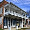
Arkansas City Commercial District Arkansas City Commercial District February 18, 1999 (#99000227 ) Roughly along the junction of Desoto Ave. and Sprague St. 33°36′19″N 91°12′13″W / 33.605278°N 91.203611°W / 33.605278; -91.203611 (Arkansas City Commercial District ) Arkansas City
2
Arkansas City High School Arkansas City High School October 4, 1984 (#84000005 ) Robert S. Moore and President Sts. 33°36′36″N 91°12′05″W / 33.61°N 91.201389°W / 33.61; -91.201389 (Arkansas City High School ) Arkansas City
3
Dante House Upload image January 23, 2020 (#100004905 ) 501 Court St. 33°52′56″N 91°29′18″W / 33.8821°N 91.4884°W / 33.8821; -91.4884 (Dante House ) Dumas
4
Desha County Courthouse Desha County Courthouse July 12, 1976 (#76000403 ) Robert S. Moore Ave. 33°36′33″N 91°12′08″W / 33.609167°N 91.202222°W / 33.609167; -91.202222 (Desha County Courthouse ) Arkansas City
5
Dickinson-Moore House Dickinson-Moore House February 1, 2011 (#10001192 ) 707 Robert S. Moore Ave. 33°36′31″N 91°12′10″W / 33.608611°N 91.202778°W / 33.608611; -91.202778 (Dickinson-Moore House ) Arkansas City
6
Dumas Commercial Historic District Dumas Commercial Historic District May 22, 2007 (#07000446 ) S. Main St. between Choctaw and Waterman Sts. 33°53′22″N 91°29′32″W / 33.889444°N 91.492222°W / 33.889444; -91.492222 (Dumas Commercial Historic District ) Dumas
7
Hubert & Ionia Furr House Hubert & Ionia Furr House February 4, 2011 (#10001197 ) 702 Desoto Ave. 33°36′24″N 91°12′04″W / 33.606667°N 91.201111°W / 33.606667; -91.201111 (Hubert & Ionia Furr House ) Arkansas City
8
Kemp Cotton Gin Historic District Kemp Cotton Gin Historic District June 1, 2005 (#05000491 ) County Road 227 west of Highway 1 33°45′48″N 91°16′36″W / 33.763333°N 91.276667°W / 33.763333; -91.276667 (Kemp Cotton Gin Historic District ) Rohwer
9
Jay Lewis House Jay Lewis House January 20, 2005 (#04001501 ) 12 Fairview Dr. 33°38′13″N 91°24′33″W / 33.636944°N 91.409167°W / 33.636944; -91.409167 (Jay Lewis House ) McGehee
10
McGehee City Jail McGehee City Jail January 21, 2011 (#10001149 ) Southwest corner of S. First St. and Pine St. 33°37′37″N 91°23′45″W / 33.626944°N 91.395833°W / 33.626944; -91.395833 (McGehee City Jail ) McGehee
11
McGehee National Guard Armory McGehee National Guard Armory May 31, 2006 (#06000441 ) 1610 S. 1st St. 33°36′48″N 91°23′04″W / 33.613333°N 91.384444°W / 33.613333; -91.384444 (McGehee National Guard Armory ) McGehee
12
McGehee Post Office McGehee Post Office January 19, 2010 (#09001245 ) 201 N. Second St. 33°37′44″N 91°23′50″W / 33.628858°N 91.397089°W / 33.628858; -91.397089 (McGehee Post Office ) McGehee
13
McKennon-Shea House McKennon-Shea House June 8, 1993 (#93000485 ) 206 Waterman St. 33°53′13″N 91°29′39″W / 33.886944°N 91.494167°W / 33.886944; -91.494167 (McKennon-Shea House ) Dumas
14
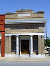
Merchants & Farmers Bank Merchants & Farmers Bank December 22, 1982 (#82000809 ) Waterman and Main Sts. 33°53′15″N 91°29′29″W / 33.8875°N 91.491389°W / 33.8875; -91.491389 (Merchants & Farmers Bank ) Dumas
15
Missouri Pacific Railroad Depot-McGehee Missouri Pacific Railroad Depot-McGehee June 11, 1992 (#92000616 ) Railroad St. 33°37′42″N 91°23′42″W / 33.628333°N 91.395°W / 33.628333; -91.395 (Missouri Pacific Railroad Depot-McGehee ) McGehee
16
Missouri Pacific Railway Van Noy Eating House Missouri Pacific Railway Van Noy Eating House January 24, 2011 (#10001154 ) Southeast of the Seamans Dr. and Railroad St. intersection 33°37′41″N 91°23′42″W / 33.628056°N 91.395°W / 33.628056; -91.395 (Missouri Pacific Railway Van Noy Eating House ) McGehee
17
Mound Cemetery Mound Cemetery January 24, 2008 (#07001426 ) 0.5 miles north of Arkansas City on County Road 351 33°37′13″N 91°12′03″W / 33.620278°N 91.200833°W / 33.620278; -91.200833 (Mound Cemetery ) Arkansas City
18
Old Piney Cemetery Upload image October 11, 2022 (#100008278 ) US 278 , approx. 2.7 miles (4.3 km) west of jct. with Cty. Rd. 74, 1/8 mi. north of US 287 Coordinates missing
Monticello
19
Parnell-Sharpe House Parnell-Sharpe House September 28, 1989 (#89001594 ) 302 N. 2nd St. 33°37′51″N 91°23′52″W / 33.630833°N 91.397778°W / 33.630833; -91.397778 (Parnell-Sharpe House ) McGehee
20
R.A. Pickens II House Upload image May 29, 2019 (#100003992 ) 1 Pickens Pl. 33°50′38″N 91°28′53″W / 33.843889°N 91.481389°W / 33.843889; -91.481389 (R.A. Pickens II House ) Pickens
21
Xenophon Overton Pindall Law Office Xenophon Overton Pindall Law Office May 10, 1999 (#98000832 ) Junction of Capitol and Kate Adams Sts. 33°36′22″N 91°12′11″W / 33.606111°N 91.203056°W / 33.606111; -91.203056 (Xenophon Overton Pindall Law Office ) Arkansas City
22
Rohwer Relocation Center Memorial Cemetery Rohwer Relocation Center Memorial Cemetery July 6, 1992 (#92001882 ) Highway 1 33°45′59″N 91°16′49″W / 33.766389°N 91.280278°W / 33.766389; -91.280278 (Rohwer Relocation Center Memorial Cemetery ) Rohwer
23
Rohwer Relocation Center Site Rohwer Relocation Center Site July 30, 1974 (#74000474 ) Highway 1 33°45′58″N 91°16′34″W / 33.766127°N 91.276156°W / 33.766127; -91.276156 (Rohwer Relocation Center Site ) Rohwer
24
Temple Meir Chayim Temple Meir Chayim April 22, 1999 (#99000470 ) Junction of 4th and Holly Sts. 33°37′43″N 91°23′59″W / 33.628611°N 91.399722°W / 33.628611; -91.399722 (Temple Meir Chayim ) McGehee
25
Thane House Thane House December 22, 1982 (#82000810 ) Levy and 1st Sts. 33°36′26″N 91°11′59″W / 33.607222°N 91.199722°W / 33.607222; -91.199722 (Thane House ) Arkansas City
26
Trippe Holly Grove Cemetery Trippe Holly Grove Cemetery June 25, 1999 (#99000729 ) Highway 4 or Crooked Bayou Rd., approximately 2 miles south of McGehee33°36′07″N 91°20′53″W / 33.601944°N 91.348056°W / 33.601944; -91.348056 (Trippe Holly Grove Cemetery ) McGehee
27
Dr. J.D. Watts House Dr. J.D. Watts House December 9, 1994 (#94001460 ) 205 W. Choctaw 33°53′17″N 91°29′39″W / 33.888056°N 91.494167°W / 33.888056; -91.494167 (Dr. J.D. Watts House ) Dumas


