[ 3] Name on the Register[ 4]
Image
Date listed[ 5]
Location
City or town
Description
1
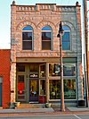
Bowers and McDonald Office Building Bowers and McDonald Office Building December 20, 1990 (#90001849 ) 816 Commercial St. 41°44′33″N 92°43′29″W / 41.7425°N 92.724722°W / 41.7425; -92.724722 (Bowers and McDonald Office Building ) Grinnell
2
Brooklyn Hotel Brooklyn Hotel October 1, 1979 (#79000933 ) 154 Front St. 41°43′42″N 92°26′51″W / 41.728333°N 92.4475°W / 41.728333; -92.4475 (Brooklyn Hotel ) Brooklyn
3
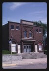
Brooklyn Opera House–Broadway Theatre Brooklyn Opera House–Broadway Theatre May 17, 2021 (#100006522 ) 115 Jackson St. 41°43′44″N 92°26′42″W / 41.729020°N 92.445091°W / 41.729020; -92.445091 (Brooklyn Opera House–Broadway Theatre ) Brooklyn Footlights in Farm Country: Iowa Opera Houses MPS
4
Chicago, Rock Island and Pacific Railroad-Grinnell Passenger Station Chicago, Rock Island and Pacific Railroad-Grinnell Passenger Station December 12, 1976 (#76000805 ) Park and State Sts. 41°44′36″N 92°43′20″W / 41.743333°N 92.722222°W / 41.743333; -92.722222 (Chicago, Rock Island and Pacific Railroad-Grinnell Passenger Station ) Grinnell
5
Farmers Mutual Reinsurance Company Building Farmers Mutual Reinsurance Company Building March 13, 2013 (#13000069 ) 821 5th Ave. 41°44′42″N 92°43′29″W / 41.744933°N 92.724699°W / 41.744933; -92.724699 (Farmers Mutual Reinsurance Company Building ) Grinnell
6
Goodnow Hall Goodnow Hall April 26, 1979 (#79000934 ) Grinnell College campus41°44′49″N 92°43′19″W / 41.746944°N 92.721944°W / 41.746944; -92.721944 (Goodnow Hall ) Grinnell
7
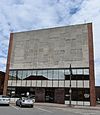
Grinnell Herald Building Grinnell Herald Building January 17, 1991 (#90002131 ) 813 5th Ave. 41°44′41″N 92°43′29″W / 41.744722°N 92.724722°W / 41.744722; -92.724722 (Grinnell Herald Building ) Grinnell See Grinnell Herald-Register
8
Grinnell Historic Commercial District Grinnell Historic Commercial District April 9, 1991 (#91000384 ) Roughly bounded by Main, Broad, and Commercial Sts. and 5th Ave. 41°44′37″N 92°43′30″W / 41.743611°N 92.725°W / 41.743611; -92.725 (Grinnell Historic Commercial District ) Grinnell
9
Levi P. Grinnell House Levi P. Grinnell House October 1, 1979 (#79000935 ) 1002 Park St. 41°44′42″N 92°43′33″W / 41.745°N 92.725833°W / 41.745; -92.725833 (Levi P. Grinnell House ) Grinnell
10
Interior Telephone Company Building Interior Telephone Company Building December 20, 1990 (#90001850 ) 815 5th Ave. 41°44′42″N 92°43′29″W / 41.745°N 92.724722°W / 41.745; -92.724722 (Interior Telephone Company Building ) Grinnell
11
Kent Union Chapel and Cemetery Kent Union Chapel and Cemetery September 16, 2009 (#09000715 ) 3386 V18 Rd. 41°48′22″N 92°26′35″W / 41.806214°N 92.44305°W / 41.806214; -92.44305 (Kent Union Chapel and Cemetery ) Brooklyn
12
William Manatt House William Manatt House October 30, 1997 (#97001288 ) 304 Jackson St. 41°43′50″N 92°26′44″W / 41.730556°N 92.445556°W / 41.730556; -92.445556 (William Manatt House ) Brooklyn
13
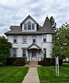
E.A. and Rebecca (Johnson) Marsh House E.A. and Rebecca (Johnson) Marsh House April 15, 1999 (#99000454 ) 833 East St. 41°44′17″N 92°43′27″W / 41.738056°N 92.724167°W / 41.738056; -92.724167 (E.A. and Rebecca (Johnson) Marsh House ) Grinnell
14
Mears Hall Mears Hall April 26, 1979 (#79000936 ) Grinnell College campus41°44′49″N 92°43′07″W / 41.746944°N 92.718611°W / 41.746944; -92.718611 (Mears Hall ) Grinnell
15
Merchants' National Bank Merchants' National Bank January 7, 1976 (#76000804 ) Northwestern corner of 4th Ave. and Broad St. 41°44′39″N 92°43′33″W / 41.744167°N 92.725833°W / 41.744167; -92.725833 (Merchants' National Bank ) Grinnell
16
Montezuma Downtown Historic District Montezuma Downtown Historic District May 30, 2012 (#12000131 ) Roughly along 3rd, 4th, Main & Liberty Sts. around courthouse square 41°35′06″N 92°31′27″W / 41.584907°N 92.524272°W / 41.584907; -92.524272 (Montezuma Downtown Historic District ) Montezuma part of the Iowa's Main Street Commercial Architecture Multiple Property Submission
17
New Carroll House Hotel Upload image October 1, 1979 (#79000938 ) E. Main and 5th Sts. 41°35′00″N 92°31′21″W / 41.583333°N 92.5225°W / 41.583333; -92.5225 (New Carroll House Hotel ) Montezuma
18
North Grinnell Historic District North Grinnell Historic District December 10, 2008 (#08001164 ) Park to W. 6th Ave. to 11th Ave. 41°44′59″N 92°43′21″W / 41.749808°N 92.722533°W / 41.749808; -92.722533 (North Grinnell Historic District ) Grinnell
19
Pioneer Oil Company Filling Station Pioneer Oil Company Filling Station March 13, 2013 (#13000070 ) 831 West St. 41°44′32″N 92°43′39″W / 41.742339°N 92.727381°W / 41.742339; -92.727381 (Pioneer Oil Company Filling Station ) Grinnell
20
Poweshiek County Courthouse Poweshiek County Courthouse July 2, 1981 (#81000266 ) 302 E. Main St. 41°35′07″N 92°31′30″W / 41.58537°N 92.52487°W / 41.58537; -92.52487 (Poweshiek County Courthouse ) Montezuma
21
P.P. Raymond House P.P. Raymond House April 24, 1985 (#85000873 ) 4th St. 41°42′30″N 92°33′22″W / 41.708333°N 92.556111°W / 41.708333; -92.556111 (P.P. Raymond House ) Malcom
22
B.J. Ricker House B.J. Ricker House December 25, 1979 (#79000937 ) 1510 Broad St. 41°45′05″N 92°43′33″W / 41.751389°N 92.725833°W / 41.751389; -92.725833 (B.J. Ricker House ) Grinnell
23
Spaulding Manufacturing Company Spaulding Manufacturing Company December 21, 1978 (#78001257 ) 500-610 4th Ave., 827-829 Spring St. 41°44′36″N 92°43′33″W / 41.743333°N 92.725833°W / 41.743333; -92.725833 (Spaulding Manufacturing Company ) Grinnell
24
Charles H. Spencer House Charles H. Spencer House January 25, 1980 (#80001458 ) 611 6th Ave. 41°44′52″N 92°43′50″W / 41.747778°N 92.730556°W / 41.747778; -92.730556 (Charles H. Spencer House ) Grinnell
25
Stewart Library Stewart Library November 21, 1976 (#76000806 ) 926 Broad St. 41°44′42″N 92°43′24″W / 41.745°N 92.723333°W / 41.745; -92.723333 (Stewart Library ) Grinnell


