Porto Novo, Cape Verde

Porto Novo | |
|---|---|
Settlement | |
 | |
 Porto Novo | |
| Coordinates: 17°01′08″N 25°03′50″W / 17.019°N 25.064°W | |
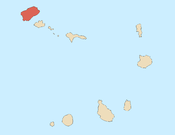
| Country | Cape Verde |
| Island | Santo Antão |
| Municipality | Porto Novo |
| Civil parish | São João Baptista |
| Elevation | 8 m (26 ft) |
| Population (2010)[1] | |
| • Total | 9,310 |
| Postal code | 1310 |
| ID | 13122 |
Porto Novo is a city[2] in the island of Santo Antão, in Cape Verde. It is the seat of the Porto Novo municipality. At the 2010 census, the town had 9,310 inhabitants, which makes it the most populous settlement of the island.[1]
Geography
[edit]Porto Novo is situated on the southeastern coast of Santo Antão, opposite the island São Vicente.
The city is divided into the following sections:[1]
- Abufador
- Alto de Peixinho
- Alto de São Tomé
- Armazém
- Bairro
- Berlim
- Branquinho
- Chã de Camoca
- Chã de Galinheira
- Chã de Itália
- Chã de Matinho
- Covoada
- Lombo Branco
- Lombo de Meio
- Praia de Topo
- Ribeira Corujinho
- São Tomé
Demography
[edit]| Population of the town of Porto Novo (1990–2010) | |||
|---|---|---|---|
| 1990[3] | 2000[3] | 2010[1] | |
| 4867 | 7685 | 9310 | |
History
[edit]
Due to the aridity of the south coast of Santo Antão, settlement began relatively late. The city was initially a fishing village called Porto dos Carvoeiros. From only 30 dispersed buildings in 1901, it started growing in the 1910s.[4]: 21 The port was inaugurated in 1962, and modernized in 2012-14.[5] Before 1962, ships had to anchor in the bay of Alto Peixinho, and goods and passengers had to be brought ashore with small boats.[4]: 24 The seat of the Porto Novo municipality created in 1962,[4]: 29 it gradually became the largest urban settlement of the island. In 2005 the town of Porto Novo became a city.[4]: 40
Climate
[edit]Porto Novo has a hot arid climate (Köppen BWh). Its annual precipitation is 191 millimetres or 7.52 inches. The average annual temperature is 23.8 °C (74.8 °F).[6]
| Climate data for Porto Novo, 17 metres ASL | |||||||||||||
|---|---|---|---|---|---|---|---|---|---|---|---|---|---|
| Month | Jan | Feb | Mar | Apr | May | Jun | Jul | Aug | Sep | Oct | Nov | Dec | Year |
| Mean daily maximum °C (°F) | 24.0 (75.2) | 23.4 (74.1) | 24.1 (75.4) | 24.6 (76.3) | 25.3 (77.5) | 26.2 (79.2) | 27.3 (81.1) | 27.9 (82.2) | 27.6 (81.7) | 27.5 (81.5) | 27.0 (80.6) | 25.2 (77.4) | 25.8 (78.4) |
| Daily mean °C (°F) | 22.0 (71.6) | 21.6 (70.9) | 22.0 (71.6) | 22.3 (72.1) | 23.0 (73.4) | 24.1 (75.4) | 25.0 (77.0) | 25.9 (78.6) | 26.0 (78.8) | 25.8 (78.4) | 25.0 (77.0) | 23.4 (74.1) | 23.8 (74.8) |
| Mean daily minimum °C (°F) | 20.1 (68.2) | 19.8 (67.6) | 19.9 (67.8) | 20.1 (68.2) | 20.8 (69.4) | 22.1 (71.8) | 22.7 (72.9) | 23.9 (75.0) | 24.4 (75.9) | 24.2 (75.6) | 23.0 (73.4) | 21.6 (70.9) | 21.9 (71.4) |
| Average rainfall mm (inches) | 7 (0.3) | 2 (0.1) | 1 (0.0) | 0 (0) | 0 (0) | 0 (0) | 4 (0.2) | 28 (1.1) | 86 (3.4) | 31 (1.2) | 17 (0.7) | 15 (0.6) | 191 (7.5) |
| Source: [6] | |||||||||||||
Transport
[edit]Since the latest modernization in 2014, the port of Porto Novo has 3 quays, 1 container park, 2 roll-on/roll-off ramps and a boat ramp. The total length of the quays is 268 m, and the maximum depth is 8 m.[5] In 2017 134,141 metric tonnes of cargo and 301,813 passengers were handled (2017).[7] There are 4 daily ferry connections from Porto Novo to Mindelo on São Vicente island.[8]
The national road EN1-SA01 connects Porto Novo with Ribeira Grande, passing through the mountainous interior. The EN1-SA03 leads to Pombas along the east coast. The EN1-SA04 leads west to Ponte Sul. Since the closing of Agostinho Neto Airport, located in Ponta do Sol, there is no functioning airport on the island.
See also
[edit]References
[edit]- ^ Jump up to: a b c d "2010 Census results". Instituto Nacional de Estatística Cabo Verde (in Portuguese). 24 November 2016.
- ^ Cabo Verde, Statistical Yearbook 2015, Instituto Nacional de Estatística, p. 32-33
- ^ Jump up to: a b Source: City Population, citing the Instituto Nacional de Estatística
- ^ Jump up to: a b c d Evolução histórica do concelho do Porto Novo, Andreza Costa Dias, 2006
- ^ Jump up to: a b "Porto Novo" (in Portuguese). ENAPOR. Retrieved 6 September 2018.
- ^ Jump up to: a b "Porto Novo Climate (Cape Verde)". Climate-Data.ORG.
- ^ Statistics Porto Novo, ENAPOR, December 2017
- ^ Ferry to Santo Antão
Subdivisions of the island of Santo Antão |
|---|