Арни

Арни | |
|---|---|
 | |
 Арни | |
| Coordinates: 59°27′59″N 18°7′48″E / 59.46639°N 18.13000°E | |
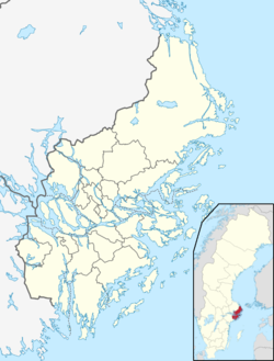
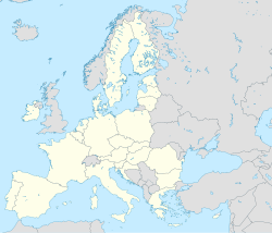
| Country | Sweden |
| Province | Uppland |
| County | Stockholm County |
| Municipality | Täby Municipality |
| Area | |
| • Total | 0.163 km2 (0.063 sq mi) |
| Population (2020)[1] | |
| • Total | 1,978 |
| Time zone | UTC+1 (CET) |
| • Summer (DST) | UTC+2 (CEST) |

Arnge - это местность , расположенная в муниципалитете Таби , округ Стокгольм , Швеция. Район граничит с муниципалитетом Эстеракера на Востоке, Vågsjö и Löttingelund на севере и Реннинге на юге. Arnge - это в первую очередь коммерческая и промышленная зона.
История
[ редактировать ]История Арнинга простирается далеко до железного века, когда уровень моря был значительно выше, чем сегодня, и Арни был внутренним морем с архипелаго, подобной природе. Даже сегодня за вновь построенным строительным магазином Flink и Lekland все еще есть следы, например, несколько погребений и небольшая оборонительная стена (древний замок) все еще видны. Некоторые могилы, однако, раскопаны. Есть еще следы морских бухты с голыми породами и растениями на берегу озера (тростники).
In the 1930s and 1940s, the military built bunkers here as part of the defense, the so-called sausage line. On the hill opposite K-Rauta there is a preserved one. In the mid-1940s, Arninge was an alternative to a new location for the Roslagen Anti-Aircraft Corps.[2]
Residential construction began in the 2010s in the area. Ullna strand and Hägerneholm are called two emerging residential areas. From 2015 onwards, Statistics Sweden has defined a new urban area for these settlements with the name Arninge.[3]
References
[edit]- ^ Jump up to: a b "Statistiska tätorter 2020, befolkning, landareal, befolkningstäthet per tätort" (in Swedish). Statistics Sweden. 24 November 2021.
- ^ "Regeringens proposition 1945:189". riksdagen.se. Retrieved 14 April 2020.
- ^ "Förändringar i antalet småorter 2010-2015". Statistics Sweden. 19 December 2016.