Торгилсбу

Торгилсбу | |
|---|---|
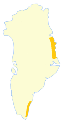
 Торгилсбу Место в Гренландии | |
| Координаты: 60 ° 32′23,6 ″ с.ш. 43 ° 13′14 ″ со / 60,539889 ° с.ш. 43,22056 ° С | |
| Состояние | Дания |
| Constituent country | Greenland |
| Municipality | Kujalleq |
| Built | 1932 |
| Population (2019) | |
| • Total | 0 |
| Time zone | UTC-01 |
Torgilsbu был норвежской охотой , метеорологической и радиостанцией (Radio/LMQ Torgilsbu) [ 1 ] Расположенный на побережье короля Фредерика VI , Юго -Восточная Гренландия . [ 2 ]
Административно область была хижина, которая теперь принадлежит муниципалитету Куджальлека .
Станция была расположена на северном берегу главы Nanuuseq Fjord , ранее известного как Ойфьорд . У фьорда была якорная стоянка возле станции. [ 3 ]
История
[ редактировать ]In 1931 Norway sent two expeditions to establish hunting and radio stations in Southeast Greenland. Led by Ole Mortensen, one of the expeditions went to Storfjord (Kangerlussuaq Fjord) on ship Signalhorn and built a hut there. Since hunting there was poor, Mortensen moved with his men to Lindenow Fjord, where a Norwegian radio and meteorological station named Moreton was built 7 km (4.3 mi) from the mouth of the fjord in 1932. Meanwhile another Norwegian station was built in Thorland and named Finnsbu.[4]
In the same year Norway staked sovereignty claims in Southeast Greenland between 60°30'N —just north of Nanuuseq, and 63°40'N —just south of Odinland.[5] As a result, another expedition was sent by the Norwegian government led by Gunnar Horn on ship Veslemari and the Storfjord Station was reestablished.[4] The Lindenow Fjord station was moved to a better location further north to Nanuuseq Fjord.[2]
The meteorological station in the new location was named "Torgilsbu", after Torgils Orrabeinfostre, a legendary Norseman who was shipwrecked in 1001 and spent four years trying to reach the Western Settlement. Subsequently seven smaller stations were established in the area near Torgilsbu.[5]
Together with Finnsbu and Storfjord further north, Torgilsbu became part of the Norwegian contribution to the International Polar Year 1932–33.[6]
Gino Watkins and his two companions, Percy Lemon and Augustine Courtauld, stopped at Torgilsbu during their open boat journey of 600 nautical miles (1,111 km) around the King Frederick VI Coast in the south of Greenland.[7] The Norwegians gave them hospitality and helped them to repair their boats.[5]
Mortensen died by drowning in the waters of the fjord while fishing on the ice. After the 1933 resolution of the Permanent Court of International Justice rejecting Norway's claims in Greenland, the stations further north at Storfjord and Finnsbu were closed, but Torgilsbu continued operation, being manned by a staff of three that were relieved each year by a Norwegian ship. The station was closed in 1940, following the German occupation of Norway.[5]
After the Nanuuseq Fjord station was abandoned, the name "Torgilsbu" was transferred to one of the Bluie WWII weather stations, Bluie East One, a little further south on Prince Christian Sound.[8]
Bibliography
[edit]- Spencer Apollonio, Lands That Hold One Spellbound: A Story of East Greenland, 2008
- Frode Skarstein, “A cursed affair”—how a Norwegian expedition to Greenland became the USA’s first maritime capture in World War II. Norwegian Polar Institute,
See also
[edit]References
[edit]- ^ 'Jan S. Krogh.Nęrmere beskrivelse av kystradiostasjonene
- ^ Jump up to: a b "Torgilsbu". Mapcarta. Retrieved 20 August 2019.
- ^ Prostar Sailing Directions 2005 Greenland and Iceland Enroute, p. 124
- ^ Jump up to: а беременный Норвежская экспедиция в юго-восточной Гренландии, 1932
- ^ Jump up to: а беременный в дюймовый Спенсер Аполлонио, земли, которые держат одну зачатую: история Восточной Гренландии, 2008, с. 188-189
- ^ Уильям Джеймс Миллс, Изучение полярных границ: историческая энциклопедия , с. 321
- ^ Морский каноэистский информационный бюллетень - Киви Ассоциация морских каякеров (Каск)
- ^ Сэмюэль Элиот Морисон (1975). История военно -морских операций Соединенных Штатов во Второй мировой войне, том 1: Битва за Атлантику в сентябре 1939 г. - май 1943 года. Бостон: Литтл, Браун и Компания. С. 62
Внешние ссылки
[ редактировать ]- Норвежский полярный год и радиостанции в Восточной Гренландии, 1932–33
- Андерс Кристиан Фейлинг, Торгильсбу, 1933-34: дневник во главе с менеджером радиостанции
- Мир на войне - Гренландия 1721 - 1953
Эта статья о местоположении Гренландии является заглушкой . Вы можете помочь Википедии, расширив ее . |