Dota (canton)

Dota | |
|---|---|
 Santa María de Dota Church | |
 Flag  Seal | |
 Dota canton | |
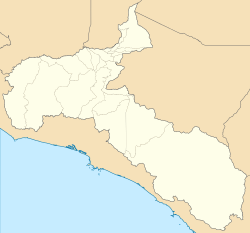 Dota Dota canton location in San José Province | |
| Coordinates: 9°35′05″N 83°52′25″W / 9.5847517°N 83.8736707°W | |
| Country | |
| Province | San José |
| Creation | 23 July 1925[1] |
| Head city | Santa María |
| Districts | Districts |
| Government | |
| • Type | Municipality |
| • Body | Municipalidad de Dota |
| Area | |
| • Total | 400.22 km2 (154.53 sq mi) |
| Elevation | 1,874 m (6,148 ft) |
| Population (2011) | |
| • Total | 6,948 |
| • Density | 17/km2 (45/sq mi) |
| Time zone | UTC−06:00 |
| Canton code | 117 |
| Website | www |

Dota is a canton in the San José province of Costa Rica.[2][3] The head city of the canton is Santa María.
It is part of Los Santos Zone, together with Tarrazú and León Cortés Castro.
History
[edit]Dota was created on 23 July 1925 by decree 80.[3]
Geography
[edit]Dota has an area of 400.22 km2[4] and a mean elevation of 1,874 metres.[2]
The canton is delineated by the Savegre River on the south and southeast, the Naranjo River on the west and the Cordillera de Talamanca on the north and northeast.
Districts
[edit]The canton of Dota is subdivided into the following districts:
Demographics
[edit]| Census | Pop. | ±% p.a. |
|---|---|---|
| 1927 | 4,712 | — |
| 1950 | 2,801 | −2.24% |
| 1963 | 3,718 | +2.20% |
| 1973 | 4,375 | +1.64% |
| 1984 | 4,934 | +1.10% |
| 2000 | 6,519 | +1.76% |
| 2011 | 6,948 | +0.58% |
| 2022 | 8,041 | +1.34% |
| Source: Instituto Nacional de Estadística y Censos[5] Centro Centroamericano de Población[6] | ||
For the 2011 census, Dota had a population of 6,948 inhabitants. [7]
Transportation
[edit]Road transportation
[edit]The canton is covered by the following road routes:
References
[edit]- ^ Hernández, Hermógenes (1985). Costa Rica: evolución territorial y principales censos de población 1502 - 1984 (in Spanish) (1 ed.). San José: Editorial Universidad Estatal a Distancia. pp. 164–173. ISBN 9977-64-243-5. Retrieved 5 October 2020.
- ^ Jump up to: a b "Declara oficial para efectos administrativos, la aprobación de la División Territorial Administrativa de la República N°41548-MGP". Sistema Costarricense de Información Jurídica (in Spanish). 19 March 2019. Retrieved 26 September 2020.
- ^ Jump up to: a b División Territorial Administrativa de la República de Costa Rica (PDF) (in Spanish). Editorial Digital de la Imprenta Nacional. 8 March 2017. ISBN 978-9977-58-477-5.
- ^ "Área en kilómetros cuadrados, según provincia, cantón y distrito administrativo". Instituto Nacional de Estadística y Censos (in Spanish). Archived from the original on 24 October 2020. Retrieved 26 September 2020.
- ^ "Instituto Nacional de Estadística y Censos" (in Spanish).
- ^ Centro Centroamericano de Población de la Universidad de Costa Rica. "Sistema de Consulta a Bases de Datos Estadísticas" (in Spanish).
- ^ "Censo. 2011. Población total por zona y sexo, según provincia, cantón y distrito". Instituto Nacional de Estadística y Censos (in Spanish). Retrieved 26 September 2020.
This Costa Rican location article is a stub. You can help Wikipedia by expanding it. |