Природный парк хижин Маркароло

| Хижины Маркароло Естественный региональный парк | |
|---|---|
| Природный парк хижин Маркароло | |
IUCN Категория IV (область управления средой обитания/видами) | |
Парк, как видно из Монте -Делле Финьи | |
 | |
| Расположение | Провинция Алессандрия , Италия |
| Ближайший город | Генуя |
| Область | 8 216 га (20 300 акров) [ 1 ] |
| Учредил | 1979 |
| Руководящий орган | Управление охраняемыми областями Пьемонтской Апеннины ( Босио ) |
| www.areeprotetteappenninopiemontese.it | |
Кэпэнн ди Маркароло Естественный региональный парк (в итальянском парке хижины Маркароло ) является природным парком в провинции Алессандрия ( Пьемонт , Италия ). Он получает название от небольшой деревни в охраняемой зоне, хижины Маркароло .
История
[ редактировать ]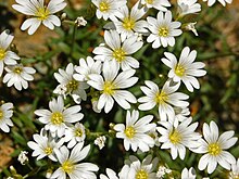
Некоторые искусственные озера, расположенные в парке, как Лагхи дель -Горзенте, были построены с конца 19 -го века, чтобы обеспечить город Генова и его окрестности электричеством хорошего качества и пресной водой . [ 2 ]
В весне в 1944 году группа итальянских партизан была окружена фашистскими и нацистскими войсками на Монте Тоббио . После боя некоторым из них удалось сломать блокаду , в то время как некоторые другие были захвачены, переведены возле аббатства Бенедикты и казнены отрядами стрельбы 7 апреля 1944 года. [ 3 ]
Природный парк был создан LR (региональным законом, в итальянском регионе Legge ) NR. 53 от 31 августа 1979 года в соответствии с изменением LR NR. 13 от 23 января 1989 года. [ 4 ] Парковая зона также включена в SIC ( участок важности сообщества ) под названием Capanne di Marcarolo (Code: IT1180026). [ 5 ] SIC больше парка, и достигает поверхности 9548,78 га. [ 6 ]
География
[ редактировать ]
Парк , расположенный во внутренней части итальянской Ривьеры, не далекая от Геновы , защищает живописную часть лигурийских апеннинов . Защищенная территория является административной частью Пьемонта и расположена недалеко от пограничной линии региона с Лигурией , к северу от апеннического водораздела, разделяющего Пиануру Падана (приток Адриатического моря ) от лигурийского моря . Он охватывает более 82 квадратных километров (32 кв. МИ). [ 7 ]
Парк охватывает некоторые приточные долины реки По :
- часть долины Лемме (к востоку от парка),
- Долины Горценте и Пиота (в центре),
- a small portion of Stura di Ovada valley (west of the park).
Concerned municipalities
[edit]The natural park is shared among seven different municipalities:
Main summits of the park
[edit]
Among the highest summits located in the park can be cited Monte Pracaban (946 m), Monte delle Figne (1172 m), Monte Taccone (1113 m) and Monte Leco (1072 m), located on its Southern borders of the park, and Monte Tobbio (1092 m), near the centre of the protected area.
Geology
[edit]Park geology is mostly tied to the Gruppo di Voltri.[8] In this area the collision between the African and the Eurasian Plates produced a huge amount of effusive rocks, now mostly represented by peridotites and serpentinites.[9] The peculiar soils formed by degradation of peridoties bedrock and a large variety of micro-habitats in the protected area allow the presence of rare endemic plants, as Viola bertolonii or Cerastium utriense.[7]
Some gold mines, now abandoned, have been exploited near Cascina Ferriere and in other surrounding locations.[10]
Wildlife
[edit]
Among animals is to be highlighted a wide reptiles' and amphibia's biodiversity: in the park have been found eight different species of snakes and in the obscurity of the old mines[5] dwells the endemic Speleomantes strinatii,[11] at first considered a subspecies of the Italian cave salamander and now a self-standing species.[12]
In the streams lives not only the brown trout but also the endangered white-clawed crayfish, observed in Lemme Valley. Park's forests offer a suitable habitat to wild boars, foxes, badgers, fat dormouses, bats, roe deer, fallow deer, European hedgehogs, beech martens and hares.
Located on a crowded migratory route the park offers nesting places to many bird species. Among birds of prey must be noted the short-toed snake eagle[5] (in Italian Biancone), a species very endangered in Italy which was chosen as the symbol of the park. Many common buzzards' couples also nest in the protected area.
Transport
[edit]Capanne di Marcarolo park can be reached by car via motorway (Autostrada A26 Voltri-Sempione or Autostrada A7 Genova-Milano). The closest railway stations are in Serravalle Scrivia and Arquata Scrivia.[13]
Hiking
[edit]
A large network of footpaths, mostly signposted by F.I.E. (Federazione Italiana Escursionismo, Hiking Italian Federation) is available within the park. Two mountain hut can be used by hikers:
- Maria Santissima di Caravaggio, on the top of Monte Tobbio: a room contiguous to the small church can be used as an emergence hut.[14]
- Rifugio Escursionistico Nido Del Biancone, owned by the park and located in Frazione Capanne di Marcarolo (Bosio).[15]
References
[edit]- ^ "Parco Naturale Delle Capanne Di Marcarolo in Italy". UN Environment Programme World Conservation Monitoring Centre. Retrieved 2020-01-31.
- ^ M.Turbi. "Le CENTRALI IDROELETTRICHE degli ACQUEDOTTI di GENOVA 1883–2008" (PDF). www.cai.it (in Italian). Club Alpino Italiano. Archived from the original (PDF) on 2016-03-04. Retrieved 2016-04-05.
- ^ "Il rastrellamento dell'aprile 1944". www.istitutoresistenza-ge.it (in Italian). ILSREC – Istituto ligure per la storia della Resistenza e dell’età contemporanea. Archived from the original on 2017-05-10. Retrieved 2016-04-05.
- ^ Ministero dell'ambiente e della tutela del territorio e del mare. "Elenco ufficiale delle aree protette (EUAP) – 5º Aggiornamento – Supplemento ordinario n. 144 alla Gazzetta Ufficiale n. 205 del 4 settembre 2003" (PDF). www.parks.it (in Italian). Federparchi. Retrieved 2016-04-07.
- ^ Jump up to: a b c Settore gestione proprietà regionali forestali e vivaistiche (2003). ALLEGATO IV – schede dei siti di interesse comunitario (PDF) (in Italian). Regione Piemonte. Retrieved 2016-04-05.
- ^ "Siti di Importanza Comunitaria (SIC)" (PDF). gis.csi.it (in Italian). Archived from the original (PDF) on 2016-03-03. Retrieved 2016-04-09.
- ^ Jump up to: a b "Parco Naturale delle Capanne di Marcarolo". www.parks.it (in Italian). Federparchi. Retrieved 2016-04-07.
- ^ "Una scelta di natura e di cultura". www.parks.it (in Italian). Federparchi. Retrieved 2016-04-03.
- ^ Settore Antincendi Boschivi and I.P.L.A. Studio di aree incendiate del Piemonte con riferimento all’erodibilità dei suoli, alla funzionalità protettiva dei soprassuoli ed alla pianificazione di interventi di ricostituzione boschiva (PDF) (in Italian). Regione Piemonte. Retrieved 2016-04-03.
- ^ Guglielmo Jervis (1874). I tesori sotterranei dell'Italia (in Italian). Loescher. p. 63. Retrieved 2016-04-08.
ferriere miniere oro.
- ^ Daniele Baroni and Andrea Costa (2016-02-02). "Appennino Piemontese, terra di anfibi". Piemonte Parchi (in Italian). Regione Piemonte. Archived from the original on 2016-04-14. Retrieved 2016-04-08.
- ^ "Speleomantes strinatii". IUCN Liste Rosse italiane. Retrieved 2016-04-10.
- ^ "Arrivare al parco". www.areeprotetteappenninopiemontese.it (in Italian). Retrieved 2016-04-05.
- ^ "Sul monte Tobbio". www.miapavia.it (in Italian). Buon Vento. 2015-11-17. Retrieved 2016-04-08.
- ^ "Rifugio Escursionistico Nido Del Biancone". www.parks.it (in Italian). Retrieved 2016-04-05.
Bibliography
[edit]- Stefano Ardito (2006). Guida al Parco naturale delle Capanne di Marcarolo (in Italian). Erredì Grafiche Editoriali. ISBN 88-95023-00-5.
External links
[edit]![]() Media related to Parco naturale delle Capanne di Marcarolo at Wikimedia Commons
Media related to Parco naturale delle Capanne di Marcarolo at Wikimedia Commons
- Appennino piemontese, on-line guidebook of the Regione Piemonte, available for free in .pdf on www.regione.piemonte.it (in Italian)
44°38′00″N 8°51′00″E / 44.6333°N 8.8500°E
| International | |
|---|---|
| National | |