Лангеберг
| Лангеберг | |
|---|---|
 Ландшафт линейки Лангиберга возле Робертсона | |
| Самая высокая точка | |
| Пик | Керомберг |
| Возвышение | 2 075 м (6808 футов) |
| Список | Список горных хребтов Южной Африки |
| Coordinates | 33°33′43″S 19°36′09″E / 33.56194°S 19.60250°E |
| Dimensions | |
| Length | 250 km (160 mi) NW/SE |
| Width | 20 km (12 mi) NE/SW |
| Geography | |
| Country | South Africa |
| Province | Western Cape |
| Parent range | Western Cape System |
| Geology | |
| Orogeny | Cape Fold Belt |
| Age of rock | Paleoproterozoic |
| Type of rock | Sandstone |
| Climbing | |
| Easiest route | From Montagu |
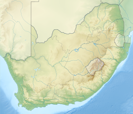
Диапазон Лангеберга - это горная хребта в провинции Западной Кейп в Южной Африке . Его самый высокий пик - Керомберг в 2075 м, который находится в 15 км к северо -востоку от города Вустер . Некоторые из самых высоких пиков диапазона расположены к северу от Свеглулендама , в подпадке, известном как пики часов, самая высокая точка которого - точка высотой 1710 м высотой . Местные знания могут определить время посредством тени, отбрасываемых семи вершинами пиков часов.
Этимология
[ редактировать ]Название голландское и означает «длинная гора» [ 1 ]
Физиография и геология
[ редактировать ]
Диапазон проходит примерно NW/SE в его западной части и в направлении восток-запад в его средней и восточной части и длиной около 250 км, от Вустера, мимо Робертсона, Монтагю, Свеллендама, Гейдельберга и Риверсдейла до ближней от Джорджа.
The Langeberg's most westerly point is located 5 km east of the town of Worcester; the range ends some 20 km North of Mossel Bay in the east.[2] The open plains of the Little Karoo border the north of the mountain range, while to the south lies the Agulhas Plain and the Overberg wheatbelt.
The Langeberg Range is composed mostly of Table Mountain Sandstone and the range is part of the Cape Fold Belt.[3]
Ecology
[edit]
On the southern slopes of the range mountain fynbos can be found, with Afromontane forest patches found in deep secluded gorges, while on the drier northern slopes karroid scrub is found.[4]
Protected areas
[edit]There are the following protected areas along the range:
- The Marloth Nature Reserve, in the area where the highest peaks are found
- The Boosmansbos Wilderness Area, which includes the Grootvadersbosch Nature Reserve near Barrydale
- The Garcia State Forest
Mountain passes
[edit]The range is traversed by four mountain passes, from west to east, they are:
- Cogmanskloof Pass, linking Montagu with Ashton.
- Tradouws Pass, linking Barrydale with Swellendam and Heidelberg
- Garcia's Pass, linking Riversdale and Ladismith, Western Cape
- Cloetes Pass, linking Mossel Bay with Ladismith, Western Cape
See also
[edit]References
[edit]- ^ [Dictionary of Southern African Place Names by Dr P.E. Raper]
- ^ [Dictionary of Southern African Place Names by Dr P.E. Raper]
- ^ The Cape Fold Belt
- ^ Swellendam Hiking Guide

