Dagda, Latvia

Dagda | |
|---|---|
Town | |
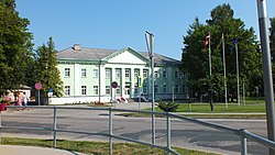 Town hall in Dagda | |
 Flag  Coat of arms | |
 Dagda Location in Latvia | |
| Coordinates: 56°5′N 27°32′E / 56.083°N 27.533°E | |
| Country | |
| Municipality | Krāslava Municipality |
| Town rights | 1992 |
| Government | |
| • Mayor | Viktors Stikuts |
| • City council | 9 members |
| Area | |
| • Total | 2.92 km2 (1.13 sq mi) |
| • Land | 2.86 km2 (1.10 sq mi) |
| • Water | 0.06 km2 (0.02 sq mi) |
| Population (2024)[2] | |
| • Total | 1,805 |
| • Density | 620/km2 (1,600/sq mi) |
| Time zone | UTC+2 (EET) |
| • Summer (DST) | UTC+3 (EEST) |
| Postal code | LV-5674 |
| Calling code | +371 656 |
| Climate | Dfb |
| Website | www |
Dagda () is a town in Dagda Parish, Krāslava Municipality in the Latgale region of Latvia, near the country's border with Belarus. It is the administrative center of Dagda Parish.
Climate
[edit]Dagda has a humid continental climate (Köppen Dfb). In March 1972, the deepest ground frost in Latvia was registered in Dagda - 150 cm (59 in).[3]
| Climate data for Dagda, Latvia (1991-2020 normals, extremes 1956-present) |
|---|
See also
[edit]References
[edit]- ^ "Reģionu, novadu, pilsētu un pagastu kopējā un sauszemes platība gada sākumā". Central Statistical Bureau of Latvia. Retrieved 30 July 2024.
- ^ "Iedzīvotāju skaits pēc tautības reģionos, pilsētās, novados, pagastos, apkaimēs un blīvi apdzīvotās teritorijās gada sākumā (pēc administratīvi teritoriālās reformas 2021. gadā)". Central Statistical Bureau of Latvia. Retrieved 19 June 2024.
- ^ Latvijas pagasti. Enciklopēdija. Rīga: A/S Preses nams. 2001–2002. ISBN 9984-00-412-0.
- ^ "Klimatisko normu dati". Latvian Environment, Geology and Meteorology Centre. Retrieved March 21, 2023.
- ^ "Gaisa temperatūras rekordi". Latvian Environment, Geology and Meteorology Centre. Retrieved March 21, 2023.
This Latgale location article is a stub. You can help Wikipedia by expanding it. |