Chok Chai district

Chok Chai
โชคชัย | |
|---|---|
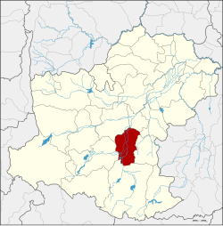 District location in Nakhon Ratchasima province | |
| Coordinates: 14°43′56″N 102°9′47″E / 14.73222°N 102.16306°E | |
| Country | Thailand |
| Province | Nakhon Ratchasima |
| Seat | Chok Chai |
| Area | |
| • Total | 503.9 km2 (194.6 sq mi) |
| Population (2015) | |
| • Total | 81,632 |
| • Density | 146.2/km2 (379/sq mi) |
| Time zone | UTC+7 (ICT) |
| Postal code | 30190 |
| Geocode | 3007 |
Chok Chai (Thai: โชคชัย, pronounced [t͡ɕʰôːk t͡ɕʰāj]) is a district (amphoe) in Nakhon Ratchasima province, northeastern Thailand.
History
[edit]The district was originally named Krathok (กระโทก). The government renamed it Chok Chai (meaning 'lucky victory') in 1945.[1] The name was chosen to commemorate the victory of King Taksin the Great over the warlord of Phimai after the fall of Ayutthaya.
Geography
[edit]Neighboring districts are (from the north clockwise): Mueang Nakhon Ratchasima, Chaloem Phra Kiat, Nong Bun Mak, Khon Buri and Pak Thong Chai.
Administration
[edit]Central administration
[edit]Chok Chai is divided into 10 sub-districts (tambons), which are further subdivided into 132 administrative villages (mubans).
| No. | Name | Thai | Villages | Pop.[2] |
|---|---|---|---|---|
| 1. | Krathok | กระโทก | 13 | 7,629 |
| 2. | Phlapphla | พลับพลา | 18 | 8,321 |
| 3. | Tha Ang | ท่าอ่าง | 10 | 8,311 |
| 4. | Thung Arun | ทุ่งอรุณ | 17 | 8,055 |
| 5. | Tha Lat Khao | ท่าลาดขาว | 11 | 4,038 |
| 6. | Tha Chalung | ท่าจะหลุง | 10 | 5,096 |
| 7. | Tha Yiam | ท่าเยี่ยม | 16 | 10,853 |
| 8. | Chok Chai | โชคชัย | 15 | 13,862 |
| 9. | Lalom Mai Phatthana | ละลมใหม่พัฒนา | 12 | 6,537 |
| 10. | Dan Kwian | ด่านเกวียน | 10 | 8,930 |
Local administration
[edit]There are three sub-district municipalities (thesaban tambons) in the district:
- Chok Chai (Thai: เทศบาลตำบลโชคชัย) consisting of parts of sub-districts Krathok and Chok Chai.
- Dan Kwian (Thai: เทศบาลตำบลด่านเกวียน) consisting of parts of sub-districts Tha Ang and Dan Kwian.
- Tha Yiam (Thai: เทศบาลตำบลท่าเยี่ยม) consisting of sub-district Tha Yiam.
There are nine sub-district administrative organizations (SAO) in the district:
- Krathok (Thai: องค์การบริหารส่วนตำบลกระโทก) consisting of parts of sub-district Krathok.
- Phlapphla (Thai: องค์การบริหารส่วนตำบลพลับพลา) consisting of sub-district Phlapphla.
- Tha Ang (Thai: องค์การบริหารส่วนตำบลท่าอ่าง) consisting of parts of sub-district Tha Ang.
- Thung Arun (Thai: องค์การบริหารส่วนตำบลทุ่งอรุณ) consisting of sub-district Thung Arun.
- Tha Lat Khao (Thai: องค์การบริหารส่วนตำบลท่าลาดขาว) consisting of sub-district Tha Lat Khao.
- Tha Chalung (Thai: องค์การบริหารส่วนตำบลท่าจะหลุง) consisting of sub-district Tha Chalung.
- Chok Chai (Thai: องค์การบริหารส่วนตำบลโชคชัย) consisting of parts of sub-district Chok Chai.
- Lalom Mai Phatthana (Thai: องค์การบริหารส่วนตำบลละลมใหม่พัฒนา) consisting of the sub-district Lalom Mai Phatthana.
- Dan Kwian (Thai: องค์การบริหารส่วนตำบลด่านเกวียน) consisting of parts of the sub-district Dan Kwian.
Climate
[edit]| Climate data for Chok Chai (1991–2020) |
|---|
References
[edit]- ^ พระราชกฤษฎีกาเปลี่ยนชื่ออำเภอกระโทก พุทธศักราช ๒๔๘๖ (PDF). Royal Gazette (in Thai). 60 (69 ก): 1800–1801. 28 December 1943. Archived from the original (PDF) on 9 June 2012.
- ^ "Population statistics 2015" (in Thai). Department of Provincial Administration. Retrieved 25 March 2016.
- ^ "World Meteorological Organization Climate Normals for 1991–2020". World Meteorological Organization. Retrieved 12 October 2023.
- ^ "Climatological Data for the Period 1981–2010". Thai Meteorological Department. Retrieved 4 August 2016.
External links
[edit]- amphoe.com (Thai)
This Nakhon Ratchasima Province location article is a stub. You can help Wikipedia by expanding it. |