Haddinnet

Haddinnet
Hadnet | |
|---|---|
Характер | |
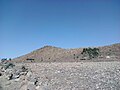
 Склоны хребта Цили в Haddinnet | |
 Haddinnet Location within Ethiopia | |
| Coordinates: 13°42′N 39°12′E / 13.700°N 39.200°E | |
| Country | Ethiopia |
| Region | Tigray |
| Zone | Debub Misraqawi (Southeastern) |
| Woreda | Dogu'a Tembien |
| Area | |
| • Total | 69.37 km2 (26.78 sq mi) |
| Elevation | 2,200 m (7,200 ft) |
| Population (2007) | |
| • Total | 7,310 |
| • Density | 105/km2 (270/sq mi) |
| Time zone | UTC+3 (EAT) |
Haddinnet , также транслитерированный как HADT , является табией или муниципалитетом в районе Dogu'a Temben в Тигрей в Эфиопии регионе Центр Табиа находится в деревне Адди Идога, расположенной примерно в 6,5 км к северо -восточному из Ворда города Хагере Селам
География
[ редактировать ]
Таблица Догуа расположена на южных и северных склонах хребта Цили в северной части Тембиена . Самый высокий пик - Dabba Selama (2630 м ASL) (не путайте с домонимным монастырем ) и самым низким местом вдоль реки Agefet (1720 м ASL).


Geology
[ редактировать ]

From the higher to the lower locations, the following geological formations are present:[1]
- Phonolite plugs
- Upper basalt
- Interbedded lacustrine deposits
- Lower basalt
- Amba Aradam Formation
- Agula Shale[2]
- Antalo Limestone
- Adigrat Sandstone
- Edaga Arbi Glacials
- Quaternary alluvium and freshwater tufa[3]
Climate
[edit]The rainfall pattern shows a very high seasonality with 70 to 80% of the annual rain falling in July and August. Mean temperature in Addi Idaga is 20.4 °C, oscillating between average daily minimum of 11.5 °C and maximum of 28.9 °C. The contrasts between day and night air temperatures are much larger than seasonal contrasts.[4]

Springs
[edit]As there is very poor baseflow in the permanent rivers, the presence of springs is of utmost importance for the local people. The main springs in the tabia are:[5]
- Ruba Weyni, fed by seepage from May Leiba reservoir
- May Damo in Atsa
- Abune Ayezgi in Debre Medhanit
Reservoirs
[edit]In this area with rains that last only for a couple of months per year, reservoirs of different sizes allow harvesting runoff from the rainy season for further use in the dry season. Overall they suffer from siltation.[6] Yet, they strongly contribute to greening the landscape, either through irrigation or seepage water. Main reservoirs are:
- May Leiba reservoir, in Ayninbirkekin tabia, constructed in 1998
- Traditional surface water harvesting ponds, particularly in places without permanent springs, called rahaya
- Horoyo, household ponds, recently constructed through campaigns[7]
Vegetation and exclosures
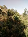
[edit]The tabia holds several exclosures, areas that are set aside for regreening.[8] Wood harvesting and livestock range are not allowed there. Besides effects on biodiversity,[9][10][11] water infiltration, protection from flooding, sediment deposition,[12] carbon sequestration,[13] people commonly have economic benefits from these exclosures through grass harvesting, beekeeping and other non-timber forest products.[14] The local inhabitants also consider it as “land set aside for future generations”.[15]


Settlements
[edit]The tabia centre Addi Idaga holds a few administrative offices, a health post, a primary school, and some small shops. Saturday is the market day.[5] There are a few more primary schools across the tabia. The main other populated places are:[16]
|
|

Agriculture and livelihood
[edit]The population lives essentially from crop farming, supplemented with off-season work in nearby towns. The land is dominated by farmlands which are clearly demarcated and are cropped every year. Hence the agricultural system is a permanent upland farming system.[17] The farmers have adapted their cropping systems to the spatio-temporal variability in rainfall.[18] Large irrigated lands have been established in Addi Idaga. The youngsters of the tabia have established wide grasslands on mountain ridges; the grass is mainly sold for thatching.
History and culture
[edit]
History
[edit]The history of the tabia is strongly confounded with the history of Tembien. In the 1930s, during the Italian invasion, Ksad Azef (13°44.2′N 39°13′E / 13.7367°N 39.217°E) was an important battlefield during the First Battle of Tembien. It is a place through which the Tembien highlands could relatively easily be accessed when coming from the Gheralta lowlands. The Italians called it Passo Abaro.[19] Italian Blackshirt soldiers left a memorial stone on top of the nearby Mount Dabba Selama.[20]

Religion and churches
[edit]Most inhabitants are Orthodox Christians. The following churches are located in the tabia:
|
|

Inda Siwa, the local beer houses
[edit]In the main villages, there are traditional beer houses (Inda Siwa), often in unique settings, which are a good place for resting and chatting with the local people. The most renown in the tabia are all located in the tabia centre Addi Idaga:[5]
- Yergalem Assefa
- Mulubrhan Hagos
- Mihret Abrha
Roads and communication
[edit]
The main road Mekelle – Hagere Selam – Abiy Addi runs 5–10 km south of the tabia. People need to walk long distances to catch a bus. Further, a rural access road links most villages to the main asphalt road.
Tourism
[edit]Its mountainous nature and proximity to Mekelle makes the tabia fit for tourism.[21]
Touristic attractions
[edit]- Tsili ridge
- Tinsehe waterfall
- Dabba Selama mountain, with Erica arborea forest, church, and a memorial stone of the 1930s, left by soldiers of the Italian army, a metres-wide phonolite with inscriptions.[20]
- Kidane Mihret rock church in Ab'aro, surrounded by tufa plugs, springs and a cluster of trees. The church was established in widened caves of the tufa plug.[20]
Geotouristic sites
[edit]The high variability of geological formations and the rugged topography invites for geological and geographic tourism or "geotourism".[22] Geosites in the tabia include:
|
|
Birdwatching
[edit]Birdwatching (for the species, see the main Dogu'a Tembien page) can be done particularly in exclosures and forests. The Wehabit Sillasie church forest bird-watching site is particularly interesting.[9][16]

Trekking routes
[edit]Trekking routes have been established in this tabia.[20] The tracks are not marked on the ground but can be followed using downloaded .GPX files.[23]
- Trek 21, along the northern side of Tsaliet gorge up to Addi Hamushenai, and further down to Addeha in Kola Tembien
- Trek 23 to the top of Dabba Selama mountain
- Trek 26, over the top of Tsili ridge
- Trek Gh2, from Addi Idaga, down to Gheralta, along the Ab'aro rock church
Accommodation and facilities
[edit]The facilities are very basic.[24] One may be invited to spend the night in a rural homestead or ask permission to pitch a tent. Hotels are available in Hagere Selam and Mekelle.
More detailed information
[edit]For more details on environment, agriculture, rural sociology, hydrology, ecology, culture, etc., see the overall page on the Dogu'a Tembien district.
Gallery
[edit]-
 View on Azef
 -
 Dabba Selama Mountain
 -
 Ksad Azef Mountain Pass
 -
 Erica arborea on Dabba Selama Mountain


References
[edit]- ^ Sembroni, A.; Molin, P.; Dramis, F. (2019). Regional geology of the Dogu'a Tembien massif. In: Geo-trekking in Ethiopia's Tropical Mountains - The Dogu'a Tembien District. SpringerNature. ISBN 978-3-030-04954-6.
- ^ Bosellini, A.; Russo, A.; Fantozzi, P.; Assefa, G.; Tadesse, S. (1997). "The Mesozoic succession of the Mekelle Outlier (Tigrai Province, Ethiopia)". Mem. Sci. Geol. 49: 95–116.
- ^ Moeyersons, J. and colleagues (2006). "Age and backfill/overfill stratigraphy of two tufa dams, Tigray Highlands, Ethiopia: Evidence for Late Pleistocene and Holocene wet conditions". Palaeogeography, Palaeoclimatology, Palaeoecology. 230 (1–2): 162–178. Bibcode:2006PPP...230..165M. doi:10.1016/j.palaeo.2005.07.013.
- ^ Jacob, M. and colleagues (2019). "Dogu'a Tembien's Tropical Mountain Climate". Geo-trekking in Ethiopia's Tropical Mountains. GeoGuide. SpringerNature. pp. 45–61. doi:10.1007/978-3-030-04955-3_3. ISBN 978-3-030-04954-6. S2CID 199105560.
- ^ Jump up to: a b c What do we hear from the farmers in Dogu'a Tembien? [in Tigrinya]. Hagere Selam, Ethiopia. 2016. p. 100.
{{cite book}}: CS1 maint: location missing publisher (link) - ^ Nigussie Haregeweyn, and colleagues (2006). "Reservoirs in Tigray: characteristics and sediment deposition problems". Land Degradation and Development. 17: 211–230. doi:10.1002/ldr.698. S2CID 129834993.
- ^ Developers and farmers intertwining interventions: the case of rainwater harvesting and food-for-work in Degua Temben, Tigray, Ethiopia
- ^ Aerts, R; Nyssen, J; Mitiku Haile (2009). "On the difference between "exclosures" and "enclosures" in ecology and the environment". Journal of Arid Environments. 73 (8): 762–763. Bibcode:2009JArEn..73..762A. doi:10.1016/j.jaridenv.2009.01.006.
- ^ Jump up to: a b Aerts, R.; Lerouge, F.; November, E. (2019). Birds of forests and open woodlands in the highlands of Dogu'a Tembien. In: Geo-trekking in Ethiopia's Tropical Mountains - The Dogu'a Tembien District. SpringerNature. ISBN 978-3-030-04954-6.
- ^ Mastewal Yami, and colleagues (2007). "Impact of Area Enclosures on Density and Diversity of Large Wild Mammals: The Case of May Ba'ati, Douga Tembien Woreda, Central Tigray, Ethiopia". East African Journal of Sciences. 1: 1–14.
- ^ Aerts, R; Lerouge, F; November, E; Lens, L; Hermy, M; Muys, B (2008). "Land rehabilitation and the conservation of birds in a degraded Afromontane landscape in northern Ethiopia". Biodiversity and Conservation. 17: 53–69. doi:10.1007/s10531-007-9230-2. S2CID 37489450.
- ^ Descheemaeker, K. and colleagues (2006). "Sediment deposition and pedogenesis in exclosures in the Tigray Highlands, Ethiopia". Geoderma. 132 (3–4): 291–314. Bibcode:2006Geode.132..291D. doi:10.1016/j.geoderma.2005.04.027.
- ^ Wolde Mekuria, and colleagues (2011). "Restoration of Ecosystem Carbon Stocks Following Exclosure Establishment in Communal Grazing Lands in Tigray, Ethiopia". Soil Science Society of America Journal. 75 (1): 246–256. Bibcode:2011SSASJ..75..246M. doi:10.2136/sssaj2010.0176.
- ^ Bedru Babulo, and colleagues (2006). "Economic valuation methods of forest rehabilitation in exclosures". Journal of the Drylands. 1: 165–170.
- ^ Jacob, M. and colleagues (2019). Exclosures as Primary Option for Reforestation in Dogu'a Tembien. In: Geo-trekking in Ethiopia's Tropical Mountains - The Dogu'a Tembien District. SpringerNature. ISBN 978-3-030-04954-6.
- ^ Jump up to: a b Jacob, M. and colleagues (2019). Geo-trekking map of Dogu'a Tembien (1:50,000). In: Geo-trekking in Ethiopia's Tropical Mountains - The Dogu'a Tembien District. SpringerNature. ISBN 978-3-030-04954-6.
- ^ Nyssen, J.; Naudts, J.; De Geyndt, K.; Haile, Mitiku; Poesen, J.; Moeyersons, J.; Deckers, J. (2008). "Soils and land use in the Tigray highlands (Northern Ethiopia)". Land Degradation and Development. 19 (3): 257–274. doi:10.1002/ldr.840. S2CID 128492271.
- ^ Frankl, A. and colleagues (2013). "The effect of rainfall on spatio‐temporal variability in cropping systems and duration of crop cover in the Northern Ethiopian Highlands". Soil Use and Management. 29 (3): 374–383. doi:10.1111/sum.12041. hdl:1854/LU-3123393. S2CID 95207289.
- ^ Итальянское туристическое консультирование. Гид Итальянской Восточной Африки . Милан. п. 246
- ^ Jump up to: а беременный в дюймовый Описание маршрутов треккинга в Dogu'a Tembien. В кн.: Гео -переезда в тропические горы Эфиопии - район Dogu'a Tembien . Весентранатура. 2019. ISBN 978-3-030-04954-6 .
- ^ Гео -переключение в тропические горы Эфиопии - район Dogu'a Temben Весентранатура. 2019. ISBN 978-3-030-04954-6 .
- ^ Miruts Hagos и коллеги (2019). «Геозиты, гео Прокладка, взаимодействие человека с окружающей средой и устойчивый геотуризм в Dogu'a Tembien» . Гео-переезда в тропические горы Эфиопии . Геогуид. Весентранатура. С. 3–27. doi : 10.1007/978-3-030-04955-3_1 . ISBN 978-3-030-04954-6 Полем S2CID 199095921 .
- ^ «Общественные GPS-следы с меткой Nyssen-Jacob-Frankl» .
- ^ Nyssen, Jan (2019). «Логистика для треккера в аурном горном районе Северной Эфиопии » Геокайра в тропические горы Эфиопии Геогуид. Пружина. Стр. 537–556. Doi : 10.1007/ 978-3-030-04955-3_3 ISBN 978-3-030-04954-6 Полем S2CID 199198251 .
Места примыкают к Haddinnet |
|---|