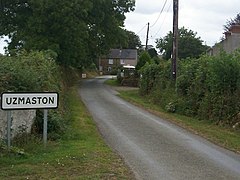
Uzmetway

| Uzmetway | |
|---|---|
 Uzmetway | |
 Uzmetway Расположение в Пембрукшире | |
| OS grid reference | SM969144 |
| Community |
|
| Principal area | |
| Country | Wales |
| Sovereign state | United Kingdom |
| Police | Dyfed-Powys |
| Fire | Mid and West Wales |
| Ambulance | Welsh |
Узмастон - маленький приход [ 1 ] В Пембрукшире , Уэльс, около 1 мили (1,6 км) к юго-востоку от Хаверфордвеста . Деревня, к северо -западу от Болстона , является частью общины Узмастона , Боулстона и Слбеха , и лежит недалеко от берега Западного Кеддау . [ 2 ] [ 3 ] Он содержит приходскую церковь Св. Исмаила , которая существует с момента, по крайней мере, с 1230 года, была тщательно восстановлена в 1870-73 годах и восстановлен в 1990-х годах.
История
[ редактировать ]Исторически, Узмастон и окружающий приход принадлежали сотню Dungleddy . [ 2 ] Его название - сложное слово, означающее «ферма Осмунда». [ 4 ] В 1993 году пять римских монет были обнаружены за церковью в Узмастоне. [ 5 ] Во время переписи 1851 года Узмастон принадлежал к приходу, содержащему площадь 2070 акров с населением 683 человек, 307 мужчин и 376 женщин. [ 6 ]
Первоначально фермерская деревня, жилища сидят между двумя фермами.
Landmarks
[edit]
Its parish church is dedicated to the 6th-century Breton prince and Welsh saint Isfael. In 1230 it was granted to Wizo the Fleming. It was extensively rebuilt in 1870-73 and renovated in 1991–92. It was further restored in 1999[7] by Hereford architect Lingen Barker.[8] It became a Grade II listed building on 16 July 2004.[9] There is a house on the edge of Uzmaston along the lane from Boulston named "The Cottage".[3] There are the ruins of a cottage between the main lane (known locally as "Nans Lane") and the Cleddau, just to the southwest of the village.[10]
The village is the start of the frolic, a public footpath that starts at the church gates, through the churchyard, across the field and then follows the River Cleddau into Haverfordwest. From the churchyard looking down river is white rock, a single chalk rock on the edge of the river.
Land
[edit]Samuel Lewis, writing in his A Topographical Dictionary of Wales, stated that Uzmaston "comprises a moderate extent of enclosed and cultivated land: the soil is generally fertile, and the inhabitants are chiefly employed in agriculture. The western part of it, containing the straggling extemity of a suburb of Haverfordwest, called Cartlett, is included within the new electoral limits of that borough.[2]
Geologically, the area is known for the yellow-grey[11] Uzmaston Beds, dated to the Silurian period,[12] which are unfossiliferous in the lower parts.[13]
References
[edit]- ^ "Uzmaston". Genuki.org.uk. Retrieved 16 February 2016.
- ^ Jump up to: a b c Lewis, Samuel (1840). A Topographical Dictionary of Wales. p. 480.
- ^ Jump up to: a b "Uzmaston" (Map). Google Maps. Retrieved 3 September 2019.
- ^ Mills, A. D. (2003). A Dictionary of British Place-Names. Oxford: Oxford University Press. ISBN 978-0-19-852758-9.
- ^ Peter Guest; Nicholas Wells; Nick Wells (2007). Iron age and Roman coins from Wales. Moneta. ISBN 978-90-77297-34-6.
- ^ Религиозная перепись 1851 года, календарь возвращений, касающихся Уэльса: Южный Уэльс . Общий регистр офис, Университет Уэльса Пресс. 1976. с. 425. ISBN 978-0-7083-0619-2 .
- ^ «Церковь Святого Ишмаила, Узмастон (414797)» . Кофляйн . Rcahmw . Получено 29 сентября 2021 года .
- ^ Торнхилл Тимминс, Х. (4 апреля 2018 г.). Уклаты и уголки Пембрукшира . Тел п. 185. ISBN 978-3-7326-3189-6 .
- ^ «Церковь святого Исмаэла» . Британцы перечислены зданиями . Получено 3 сентября 2019 года .
- ^ «Разбитый коттедж возле Узмастона» . География . Получено 3 сентября 2019 года .
- ^ Разбирательство . Ассоциация геолога. 1972. с. 151.
- ^ Европа Национальный центр научных исследований. 1956. P. 248
- ^ Special Papers, Issues 152-156 . Общество. 1974. с. 70. ISBN 978-0-8137-2152-1 .
{{cite book}}:|website=игнорируется ( помощь )