Список дорог на острове Мэн

(Перенаправлен с A22 Road (остров человека) )
Эта статья требует дополнительных цитат для проверки . ( декабрь 2018 г. ) |

Этот список, связанный с транспортом, является неполным ; Вы можете помочь, добавив недостающие предметы . ( Октябрь 2021 г. ) |
"А" дороги
[ редактировать ]| Дорога | От | К | Примечания | Координаты | Маршрутная карта |
|---|---|---|---|---|---|
| Дуглас | Чистить | В том числе A1 Peel Road, присоединяющаяся к A2 и A5 в четвертибридже и A3 в Ballacraine . Соединяет A8 и Дуглас на востоке острова с кожурой на западе. В Дугласе дорога известна как Пил -роуд и в Пил, как Дуглас -роуд . А1 проходит через Юнион Миллс , Кросби и Сент -Джонс . | 54 ° 11´32 ″ с.ш. 4 ° 35'11 ″ с 54,19232 ° С. 4,58637 ° С | 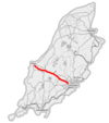 | |
| Douglas | Ramsey | Connects Douglas with Ramsey in the north. The road follows the east coast of the Island and passes through Laxey at the midpoint. | 54°14′44″N 4°22′22″W / 54.24542°N 4.3729°W |  | |
| Castletown | Ramsey | Connects Castletown in the south with Ramsey in the north. The A3 passes through Foxdale, St John's, Kirk Michael and Sulby. Between Ballacraine and Ramsey, the road forms part of the Snaefell Mountain Course over which the Isle of Man TT races are run each year. | 54°14′39″N 4°36′05″W / 54.24421°N 4.60147°W |  | |
| Peel | Kirk Michael | Connects Peel with Kirk Michael on the west coast. | 54°15′15″N 4°37′49″W / 54.25429°N 4.63039°W | ||
| Douglas | Port Erin | Also called New Castletown Road; connects Douglas with Port Erin in the south via Richmond Hill. The A5 passes through Santon, Ballasalla and Castletown before skirting Gansey Bay and passing the northern side of Port St Mary. Between Santon and Ballasalla, the road passes over the Fairy Bridge. | 54°07′13″N 4°35′01″W / 54.12015°N 4.58353°W |  | |
| Douglas | Cronk-ny-Mona, Onchan | The Old Castletown Road, Douglas from South Quay to the A25 Old Castletown Road at Kewaigue. Continuing west to the A5/A6 Cooil Road (Fort North)[1] roundabout and the (A6) Cooil Road, Braddan. Travelling eastwards, the A6 Vicarage Road/Saddle Road, Douglas joins the A1 Peel Road at Braddan Bridge. The A6 Braddan Bridge Road/Ballafletcher Road joins the A6 Johnny Watterson's Lane at Cronkbourne Village, continuing to the C10 Scollag Road junction with the A18 Snaefell Mountain Road at Cronk-ny-Mona, Onchan. | 54°07′25″N 4°32′55″W / 54.12372°N 4.5486°W | ||
| Ballasalla |
Port Erin | Connects Ballasalla with Port Erin in the south of the Island. The A7 crosses the A3 Castletown to Ramsey road and passes through Ballabeg and Colby. | 54°05′56″N 4°41′06″W / 54.09902°N 4.68506°W | ||
| Douglas Sea Terminal | Douglas Harbour Lifting Bridge | Connects the northern entrance to Douglas' Seaport with North Quay and the Douglas Harbour Lifting Bridge [2] | |||
| Ramsey | Andreas | Via Regaby | |||
| Ballaugh |
Ramsey | Branches off A9 on outskirts of Ramsey; runs north to Bride, then west to Jurby via The Lhen, then south to meet the A3 at Ballaugh. | |||
| Douglas | Balladromma Beg, Lonan | A11 King Edward VIII Road from Summerhill, Queen's Promenade to the Balladromma Beg Halt (Liverpool Arms) road junction on the A2 Douglas to Ramsey Coast Road. | |||
| Castletown | Derbyhaven | Starts at Janet's Corner, Castletown (junction with A5), runs east past Hango Hill to Derbyhaven where it turns north towards the airport runway. Formerly it continued on the other side of the airport runway to Ballasalla, but that section is now designated as the B53. | |||
| Ramsey | The Cronk, Ballaugh | A13 Jurby Road from the A9 Bowring Road junction, Ramsey to the A10 Jurby Coast Road and B9 Ballacrye Road junction at The Cronk, Ballaugh. | |||
| Jurby | Bungalow | From Jurby the road runs south, crossing the A13 at Sandygate and the A3 at Sulby. It continues up Sulby Glen, skirting Snaefell, and meets the A18 at the Bungalow. | |||
| Port Lewaigue (Belle Vue) | The Hibernian | Branches off A2 at Port Lewaigue and forms a loop through Maughold before rejoining the A2 at The Hibernian. | |||
| Bride | Point of Ayre | Cul-de-sac from Bride to the Point of Ayre | |||
| Bride | Sulby Bridge | Via Andreas and St Judes | |||
| Douglas | Ramsey | Snaefell Mountain Road. The entire road forms part of the Isle of Man TT Course and crosses the hilliest parts of the Island, reaching 422 m (1,385 ft). The road is closed for TT and Manx Grand Prix races and sometimes closed due to bad weather at other times. The majority of the road outside of developed areas has no speed limit. See A18 for more about this road. |  | ||
| Lhen Bridge | Andreas | Bayr Kione Droghad | |||
| Peel | Ballig | Also known as Poortown Road, after the small settlement of Poortown through which it passes. Connects Peel on the west coast of the Island with the A3 Castletown to Ramsey road at a point just north of St John's. | 54°12′58″N 4°39′48″W / 54.21607°N 4.66344°W | ||
| Union Mills | St Ninian's Crossroads | Loop via Strang, Nobles Hospital and Ballanard | |||
| Strang | Crosby | Loop via Mount Rule | |||
| Douglas | Foxdale | Connects the A3 Castletown to Ramsey road in Foxdale with the A5 Port Erin to Douglas road. Between Foxdale and Douglas, the road passes the Eairy Dam and Braaid. | 54°09′27″N 4°35′07″W / 54.15746°N 4.58524°W | ||
| Douglas | Blackboards | Also known as Old Castletown Road. Connects Douglas with Ballasalla, and historically with Castletown. The road is now bypassed by the A5 Douglas to Port Erin route which allows for faster traffic movement. | 54°07′44″N 4°32′28″W / 54.12875°N 4.54113°W | ||
| Ballasalla | Glen Vine | Connects Ballasalla with Glen Vine where it meets the A1 Douglas to Peel road. Between Ballasalla and Glen Vine, the road passes through St Mark's and Braaid. | 54°08′44″N 4°35′29″W / 54.14544°N 4.59142°W | ||
| Colby | Peel | Also known as Colby Glen Road. Connects Colby with Peel. Between its junction with the A7 road in Colby and its terminus in the centre of Peel, the road passes through Colby Glen, the Round Table, Dalby, Glenmaye and Patrick. | 54°09′21″N 4°42′32″W / 54.15595°N 4.70875°W | ||
| Ballakaighan, Castletown | Ballabeg, Arbory | Forms the W side of the Southern 100 Course | |||
| Port St Mary | Ballagawne | Connects the village of Ballagawne with Port St Mary via Four Roads | |||
| St John's | Patrick | Bayr Keill Pherick | 54°12′11″N 4°39′53″W / 54.20317°N 4.66481°W | ||
| Port St Mary | Calf Sound | The eastern part is known as Raad yn Cheyllys. Connects Port St Mary with the Calf Sound, passing the village of Cregneash. | 54°04′25″N 4°45′34″W / 54.07349°N 4.7594°W | ||
| Port Erin | Ballachurry, Port Erin | Loop via Bradda | |||
| Douglas Railway Station | Intersection with A6 and A41 | Connects A1 with A6 and A41 in Douglas[3] | |||
| Ballanank, Malew | Mount Rule, Malew | Also known as Phildraw Road; connects Ballasalla with the A3 Castletown to Ramsey road. | 54°06′35″N 4°37′48″W / 54.10959°N 4.63005°W | ||
| Onchan | Port Jack, Onchan | A35 Royal Avenue and Royal Avenue West, Onchan with the 'Port Jack'/Imperial Terrace/Royal Terrace junction with the A11 King Edward VIII road.[4] | |||
| Порт Эрин | Южный Баррел | Соединяет A7 Ballasalla с Порт -Эрин -роуд недалеко от Порт -Эрин с кастрюлем A3 до Ramsey Road к югу от Фоксдейла . Дорога известна как шоссе, когда она наклоняется через SLOC, проход на южной стороне Cronk NY Arrey Laa . Он также известен как плечевая дорога , когда проходит через северное плечо Южного Баррале . | 54°07′51″N 4°42′56″W / 54.13096°N 4.71545°W | ||
| B52 в Керистале | B23 в порторе Soderick | Также известен как Marine Drive . Используется для простирания вдоль берега в Дуглас, но должен был быть перенаправлен из-за плохих дорожных условий. Северная часть Морской Драйв сейчас B80. [ 5 ] | |||
| Королева набережная, Дуглас | Ончан (центр) | Summerhill, Queen's Promdade и Summerhill Road, Дуглас с перекресткой дороги губернатора A2, Ончан. (Длиной менее 1200 ярдов). | |||
| Надежда, Патрик. | Сент -Джонс | A40 Hope Road от перекрестка A3 Curragh Road и C33 Archallagan Road по адресу ( Нижний Фоксдейл ) с перекресткой A40 Station Road с A1 Douglas To Peel Road на Тинвальд -Хилл в Сент -Джонсе. Около 1000 ярдов в длину. | 54 ° 11´56 ″ с.ш. 4 ° 38´25 ″ с 54,19895 ° с.ш. 4,64018 ° С | ||
| A6 Old Castletown Road | Пирс батарея, Дуглас Харбор | Подключает A6 и A33 Bridge Road с South Quay, Douglas Head Road и пирсом из аккумулятора. [ 6 ] |
«Б» дороги
[ редактировать ]Примечание. Многие из этих дорог в сельской местности не приводят ни к нему отдаленно, в то время как многие дороги в городах и деревнях действительно очень короткие. Это делает проблематичным включать «к» или »из« направлений ».
| Нет. | Подробности | Приход и т. Д. |
|---|---|---|
| B1 | НИНДКА ХИЛЛ, Лакси | Вел |
| B2 | Leodest Road | Андреас |
| B3 | Андреас-Джурби | Андреас/Юрби |
| B4 | Ballaheaney Road, Jurby East | Юрби |
| B5 | Ballavarran Road, Jurby West | Юрби |
| B6 | СМАЛ -Роуд, Андреас | Андреас |
| B7 | Керроугарроу в Regaby | Андреас |
| B8 | Sulby Claddagh Road | Лезай |
| B9 | Ballacry Road, Cronk | Баллау |
| B10 | Гора-и-Питтл-роуд | Lezayre / Braddan / Michael |
| B11 | Ballaragh Road | Лонан |
| B12 | Creggle Back Grod (Ballasell-NY NY BAA) | Лаун / onn |
| B13 | Ист -Бретни -роуд, Юрби Ист | Юрби |
| B14 | Бернахара -роуд, Андреас | Андреас/Лезайр |
| B15 | Ричмонд -роуд | Рэмси |
| B16 | Глен Олдин | Лезай |
| B17 | Lezayre Church Road, Черчтаун | Лезай |
| B18 | Порт -Сент -Мэри | Порт -Сент -Мэри |
| B19 | Dreemskerry Road, Lewaigue-Ballajora | Могольд |
| Бедоптуш | Begoade Road | Лаун / onn |
| B21 | Восточная Болдуин -роуд | Брэди |
| B22 | Западная Болдуин -роуд | Брэди |
| B23 | Порт Содерик Роуд | Брэди |
| B24 | Овсянка -роуд | Мужчина |
| B25 | Глентро | Сантон |
| B26 | Ballavale Road | Сантон |
| B27 | Седл -роуд | Дуглас |
| B28 | Парк -роуд | Порт -Сент -Мэри |
| B29 | Ballachurry Road | Мужчина |
| B30 | Ballamodha до Star Marks Road (The Bayrauyr) | Мужчина |
| B31 | Harbour Road | Ончан |
| B32 | ЛЕРГИ КРИПЕРТИ | Брэди |
| B33 | Кали-Калле/Кентр измельченной Калле. | Торопиться |
| B34 | Blackberry Lane | Ончан |
| B35 | Гарт -роуд | Мале/Мараун |
| B36 | Tosaby Road | Мале/Мараун |
| B37 | КЛАННАГА ДОРОГА | Сантон |
| B38 | Оррисдейл Роуд | Мужчина |
| Nb не Оррисдейл в Майкл Шидинг | ||
| B39 | Ronague Road/Solomons Corn | Arbory/Malew |
| B40 | Ballamaddrell / Grenaby Road | Мале/Арбори |
| B41 | Grenaby to Kerrowkeill Road | Мужчина |
| B42 | RONAGUE ROAD | Арбори |
| B43 | Ballagawne Road | Арбори |
| B44 | Ballakilpheric Road | Торопиться |
| B45 | Гора Гавн -роуд | Торопиться |
| B46 | Казармы дорога | Торопиться |
| B47 | Плоть | Торопиться |
| B48 | Королевский проспект (часть) | Ончан |
| B49 | Лакси Пременда | Вел |
| B50 | Сильвердейл -роуд | Мужчина |
| B52 | Керистальная дорога | Брэди |
| B53 | Balthane, Ballasalla (см. A12) | Мужчина |
| B54 | Sunningdale Drive | Ончан |
| B55 | Фолкленд Драйв | Ончан |
| B61 | Александр Драйв | Дуглас |
| B61 до B82 (кроме B72 и B80) - различные городские улицы в Дугласе | ||
| B63 | Дерби -роуд | Дуглас |
| B74 | Уэстморленд -роуд | Дуглас |
| B80 | Морской диск | Дуглас / Брэдан |
Смотрите также
[ редактировать ]- Транспорт на острове человека
- Список названных углов курса горы Снаефелл
- Ограничения скорости на острове человека
Ссылки
[ редактировать ]- ^ Isle of Man Courier - Roieder Ellan Vannin Page 44 Департамент инфраструктурных дорожных служб общественных услуг по общественным уведомлениям Isle of Man Newspapers Ltd (2018). Пешеходное движение из Ричмонд -Хилла, Брэддан между его соединением с кольцевой развязкой Форт -Север и его соединением с Баллачаткель -роуд ..... »
- ^ «A8 (остров Мэн) - Дайджест Роджера: сабля вики» .
- ^ «A33 (остров Мэн) - Дайджест Роджера: сабля вики» . www.sabre-roads.org.uk . Получено 27 июня 2018 года .
- ^ «A35 (остров Мэн) - Дайджест Роджера: сабля вики» .
- ^ «A35 (остров Мэн) - Дайджест Роджера: сабля вики» . www.sabre-roads.org.uk . Получено 27 июня 2018 года .
- ^ «A41 (остров Мэн) - Дайджест Роджера: сабля вики» . www.sabre-roads.org.uk . Получено 27 июня 2018 года .
Внешние ссылки
[ редактировать ]Wikimedia Commons имеет средства массовой информации, связанные с дорогами на острове человека .